Evening Update: Wet snow, mix and rain arrive through 10 pm


Updated: 7:00 p.m. Jan. 18, 2023
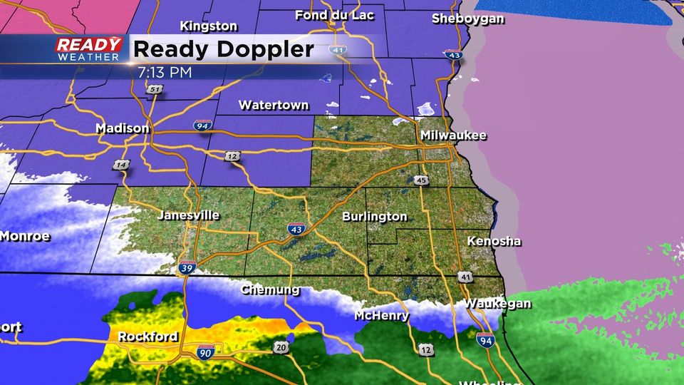
No changes to the going forecast. We've seen some light snow and a mix across portions of Milwaukee County this afternoon and evening; however, the push for heavier precipitation will occur through 10 pm. You can see the mix just across northern Illinois. The precipitation will be moving south to north. The Winter Weather Advisories go until Noon Thursday.
The majority of snow will fall overnight through Thursday morning. Slushy roads are expected within the advisory for the Thursday morning commute.
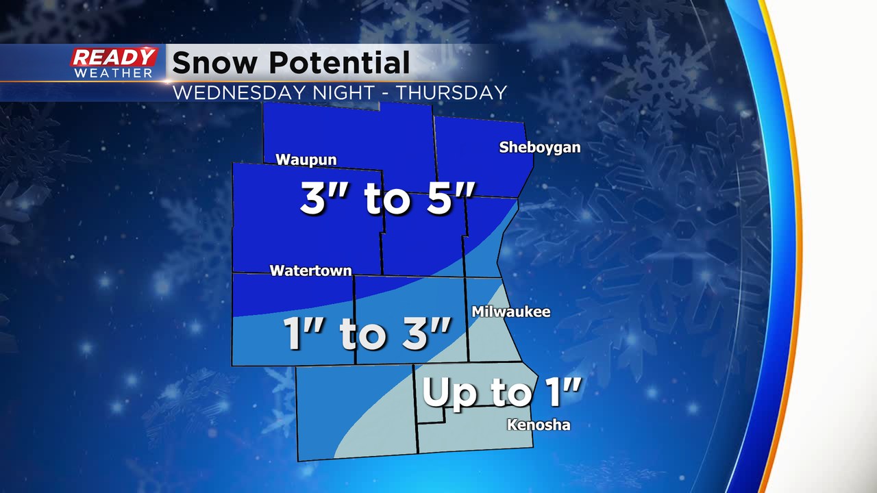
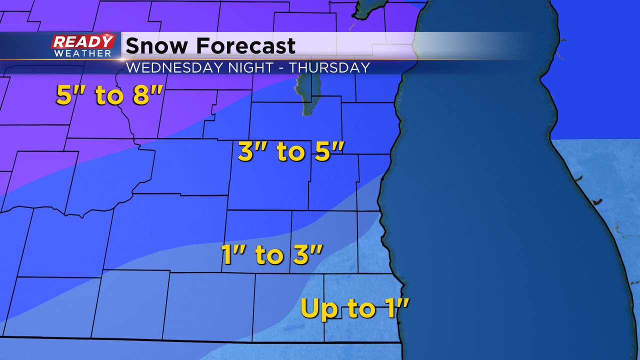
There is a lot of uncertainty regarding the zone of 1" to 3". Sleet is possible within that zone, and that could cut into totals. The best chance for 3" to 5" of wet slushy snow will be across our northern counties.
A lot of the lakeside areas will see more of a mix of rain and some snow with little accumulation.
______________________________________________________________________________________________________________
Updated: 12:30 p.m. Jan. 18, 2023
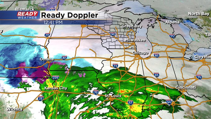
The forecast remains on track. This incoming system remains consistent as to what we've seen for so much of this season and that's RAIN, snow in spots and a slushy wintry mix. Here's the latest radar image:
Updated: 9:12 a.m. Jan. 18, 2023
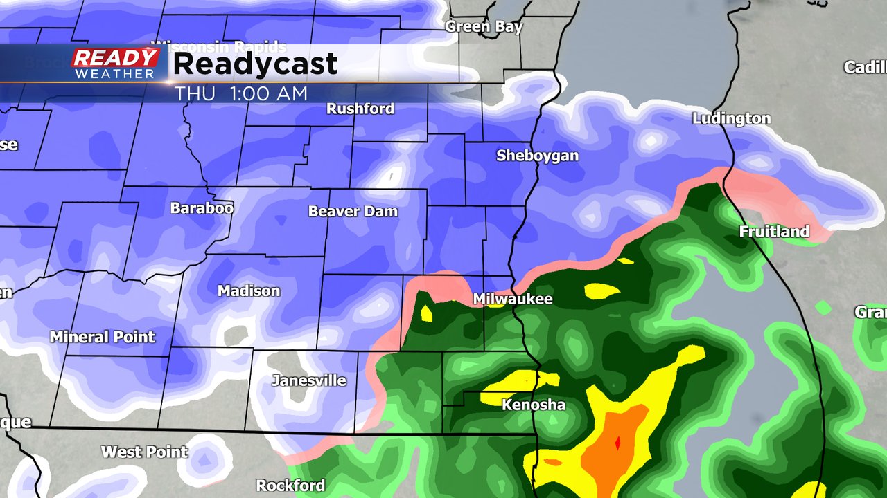
No changes with the track of the storm or our expected snowfall totals. Snow and mix rolls in after 8 PM Wednesday evening with the bulk of the accumulation overnight through 7 AM Thursday morning then lingering rain and snow showers the rest of Thursday. Even though snow totals shown below won't be super heavy, the snow is still going to come down at a heavy rate with an inch per hour possible at night. A high snow rate combined with a wind that gusts to 30 mph at night could cause some visibility issues and make driving at night tricky. We will also watch any freezing rain or sleet that develops. Roads should be improving during the Thursday morning commute.

------
Posted: 5:36 a.m. Jan. 18, 2023
After a brief break from precipitation Wednesday morning and afternoon we see our next storm system arrive Wednesday evening. Wet snow, sleet and rain will roll in after 8 PM Wednesday evening with wet snow likely for most early Thursday morning. The bulk of the accumulating rain and snow will happen before 7 AM Thursday morning. Light rain and snow showers are expected throughout the rest of Thursday with little additional accumulation.
A winter weather advisory has been issued for our counties that are expected to pick up the most snow. Fond du Lac, Sheboygan, Dodge, Washington, Ozaukee and Jefferson Counties are under the advisory starting at 9 PM Wednesday evening until noon on Thursday.

Even though Milwaukee, Waukesha and Walworth Counties are not included in the advisory, they likely see some light snow and mix. Racine and Kenosha Counties will have a harder time picking up much snow with mostly rain there. Snow totals will be the highest in northern counties where 3-5" of snow is expected. Parts of Ozaukee, Washington, Milwaukee, Waukesha, Walworth and Jefferson Counties are in the 1-3" range with less than an inch expected in southern Milwaukee/Waukesha Counties, eastern Walworth County and Racine and Kenosha Counties.
Download the CBS 58 Ready Weather app to track the mix and snow as it arrives.