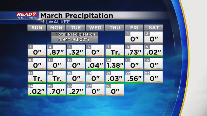
We've had a couple days to dry out, which was much needed across the area. March has been very wet, as you can see here on this calendar.
 Image
Image
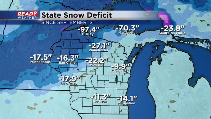
Through today's climate data we are running over three inches above normal on monthly precipitation. So far we are 6th wettest March on record and with more rain tomorrow night and Sunday night, it's possible we end in the top five, possibly 4th wettest. We even caught up on some needed snow with the roughly eight inch snowfall that fell a week ago. In case you were wondering, snow is still severely lacking in parts of the state. Check it out:
 Image
Image
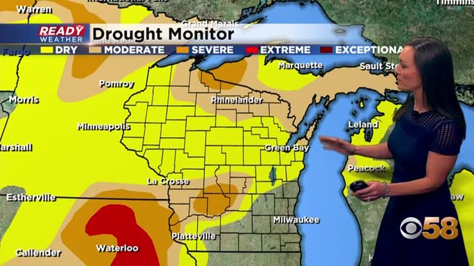
Hard to imagine what a deficit of nearly one hundred inches in Hurley looks like. Not good news for winter recreation or business that depends on snow. And now moving toward the growing season that already looks to pose a problem if we don't catch up in the drought areas that show up on this week's drought monitor.
 Image
Image
By contrast we are no longer in any kind of drought here locally. And we still have one and possibly two opportunities for more rain before the month is through.
 Image
Image
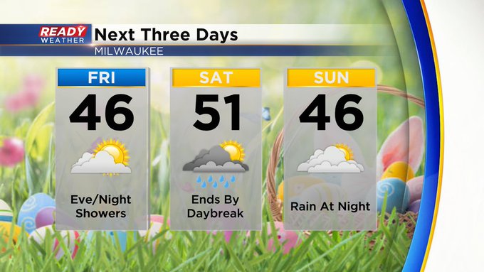
Rain and possible thunder showers roll in Friday night, mainly after 10pm, wrapping up by daybreak Saturday. Then, on the last day of the month more rain rolls in at night, just before we flip the calendar to April. At this point, the first three day of April may also bring accumulating precipitation. The forecast calls for rain Monday and Tuesday with Flurries Wednesday.
I'm meteorologist Rebecca Schuld


