Wednesday Snow Update
The models over the last 24 hours have been fun to watch with a lot of wobbling back and forth with the surface track of our next storm. The morning and afternoon runs have pushed some of the snow back across southeastern Wisconsin for Wednesday.
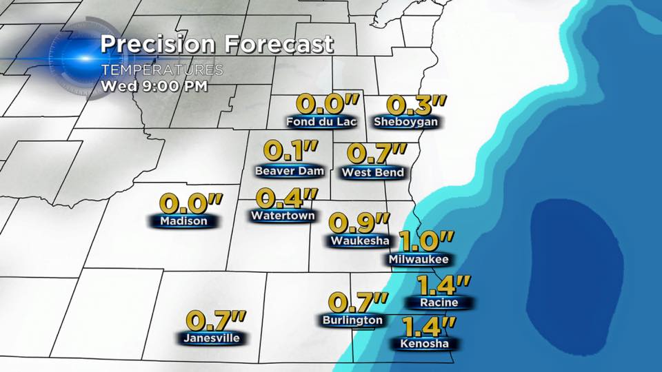
Here is the latest RPM depiction for snowfall totals. The models were in fair agreement this morning; however, the GFS model was the one exception with lakeshore locations receiving between 3 and 5 inches of snow.
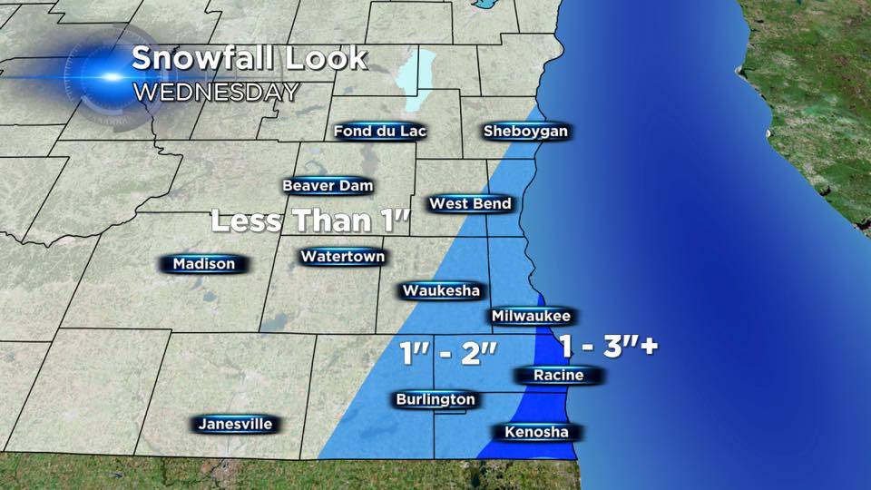
After taking a blend of the models, we have decided to go 1" to 3" inches of snow with the higher totals across Racine and Kenosha counties. Milwaukee could receive between 1" to 2" inches of snow.
Snow will arrive around Noon and could continue through the early evening before tapering off to flurries by Midnight. The snow should be done for the Thursday morning commute.
Temperatures will remain in the middle 30s, so main roads could be somewhat spared. The problem on Wednesday will be the strong northerly winds. Heavier snow and wind could create visibility issues for Wednesday afternoon. Use caution while driving through heavier snow squalls.
