Overnight Update: Light freezing drizzle will continue.


Most of the measurable winter weather has passed for now; however, freezing drizzle will continue overnight into the morning. Some slick roads will be possible.
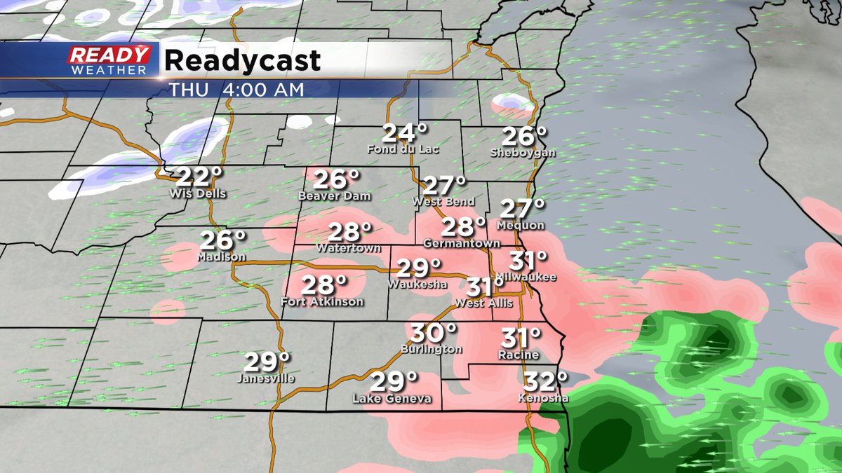
Another batch of freezing rain and sleet will move across the area between 4 am and 8 am. That could create issues for your morning travel.
8:30 PM Update
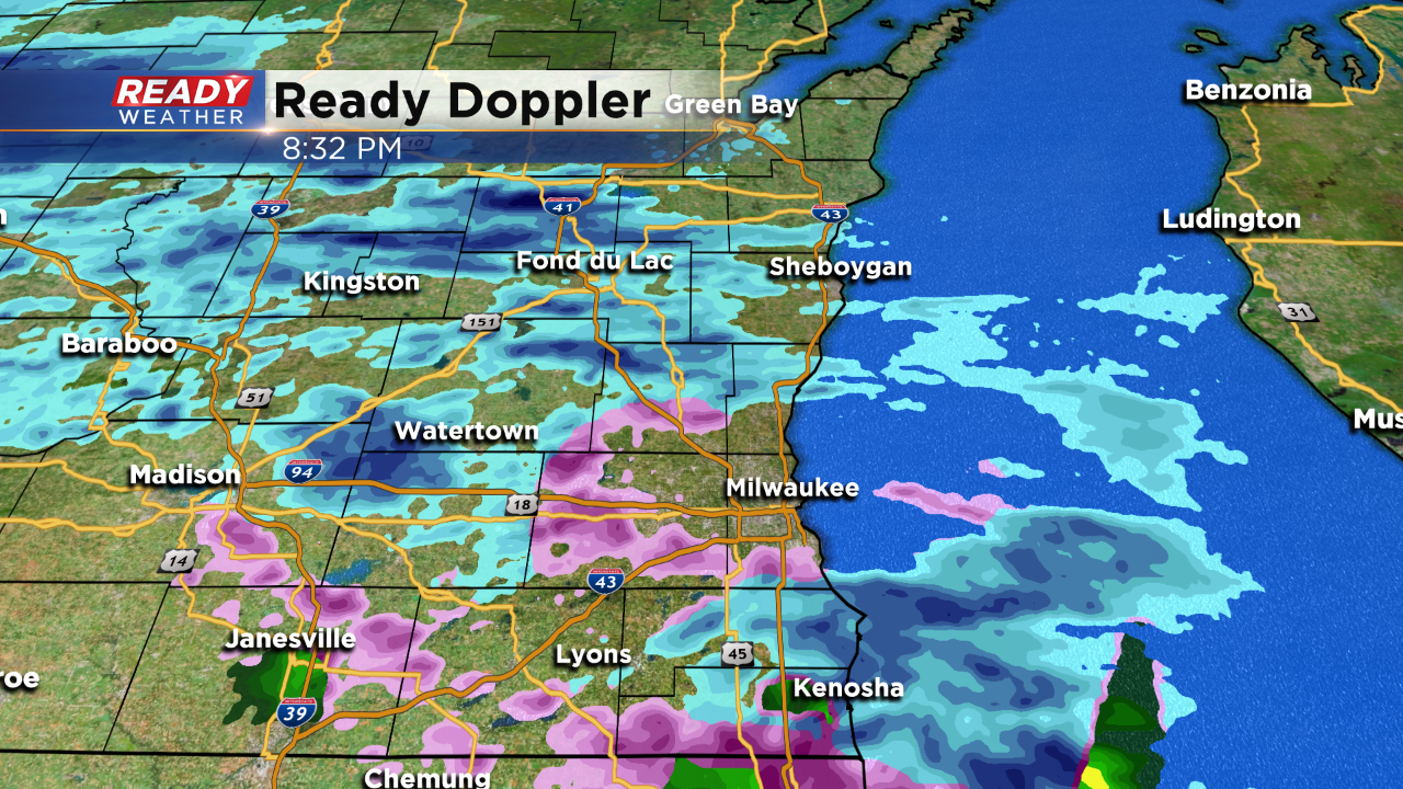
It's been a mix of sleet and freezing rain this evening with most locations in the upper 20s. The measurable freezing rain will likely continue through Midnight. Freezing drizzle is possible overnight creating slick roads.
______________________________________________________________________________________________________________
Evening Update:
A mix of sleet, snow, and freezing rain is likely this evening across the area. With surface temperatures in the upper 20s and lower 30s, icing will likely occur once again on roads and cars.
Freezing drizzle will develop overnight and last into tomorrow morning before another mix arrives.
Here's a clarification to the advisory. The counties west of Milwaukee are under the winter advisory until Thursday at 6 pm. The counties around Milwaukee go until 9 am.
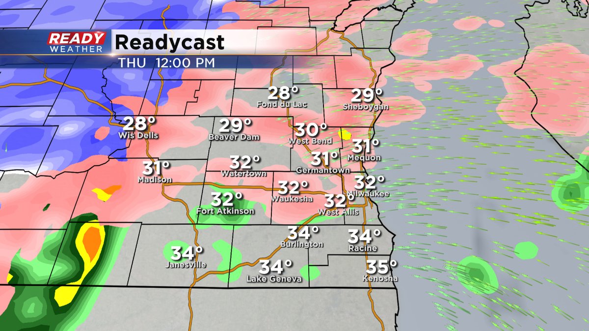
The areas west of Milwaukee tomorrow will have the best chance to remain in a mix of sleet, freezing rain,and snow during the day Thursday. Travel in those areas could be difficult.
______________________________________________________________________________________________________________
2:00 PM Update
Thankfully the temperature has warmed up into the lower 30s this afternoon allowing some roads and sidewalks to improve. Unfortunately more winter weather is set to arrive this evening and overnight.
A winter weather advisory has been issued tonight at 6 pm until Thursday at 6 am. Light freezing rain and sleet are expected between 6 pm and Midnight. This will cause more icing across the area. More could arrive overnight into Thursday morning.
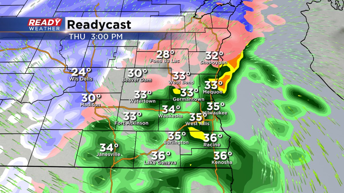
Thursday late morning and afternoon will feature a mix of rain and possibly sleet with most of the winter weather staying northwest of our area.
______________________________________________________________________________________________________________
Milwaukee (CBS 58)--We got a taste of what we'll be seeing Thursday morning. More ice on the way. Freezing rain and sleet possible just like we saw into Wednesday morning. Although it looks like a little milder air will surge into the region, switching any ice over to rain by the afternoon of Thursday. Colder air quickly takes over into the night time hours, bringing another blast of Arctic air in time for Friday.
The next Winter Weather Advisory kicks in Wednesday evening and lasts until 6 am Thursday. Across the metro, it begins at 9 pm but starts at 6 pm in outlying areas.
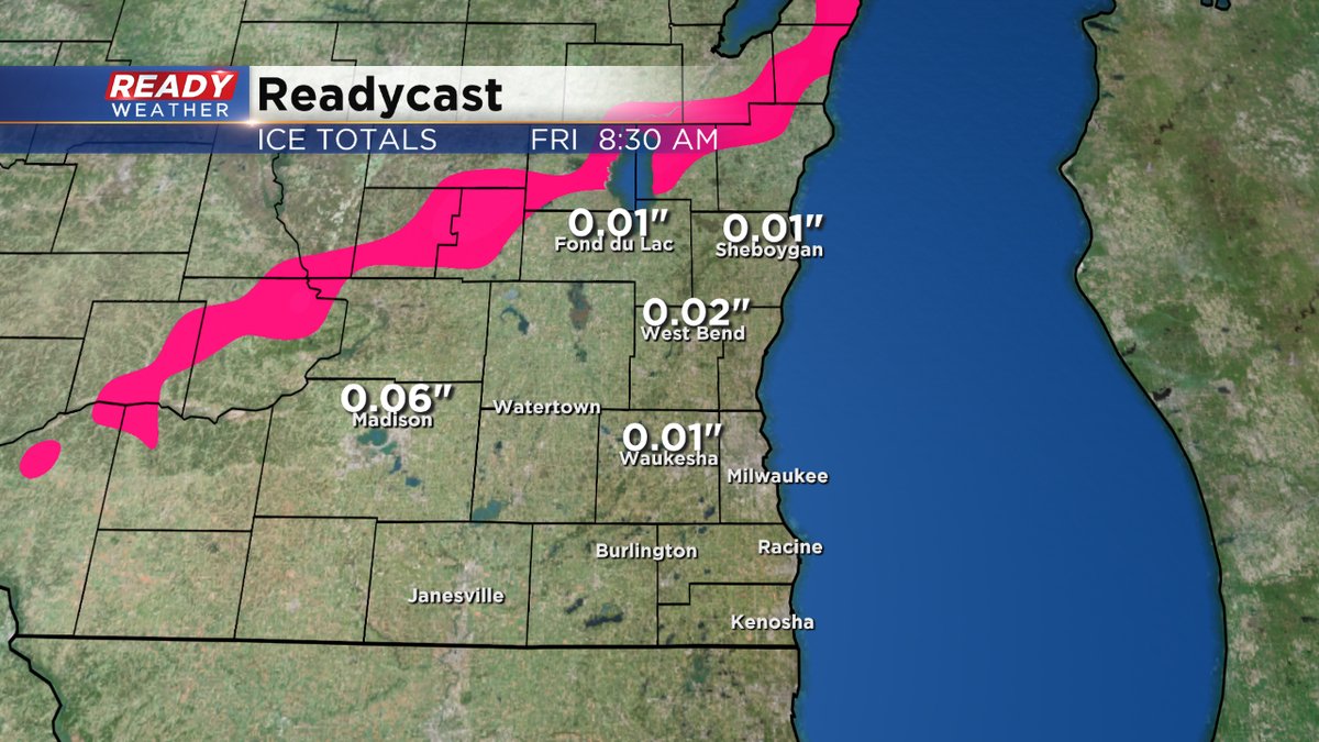
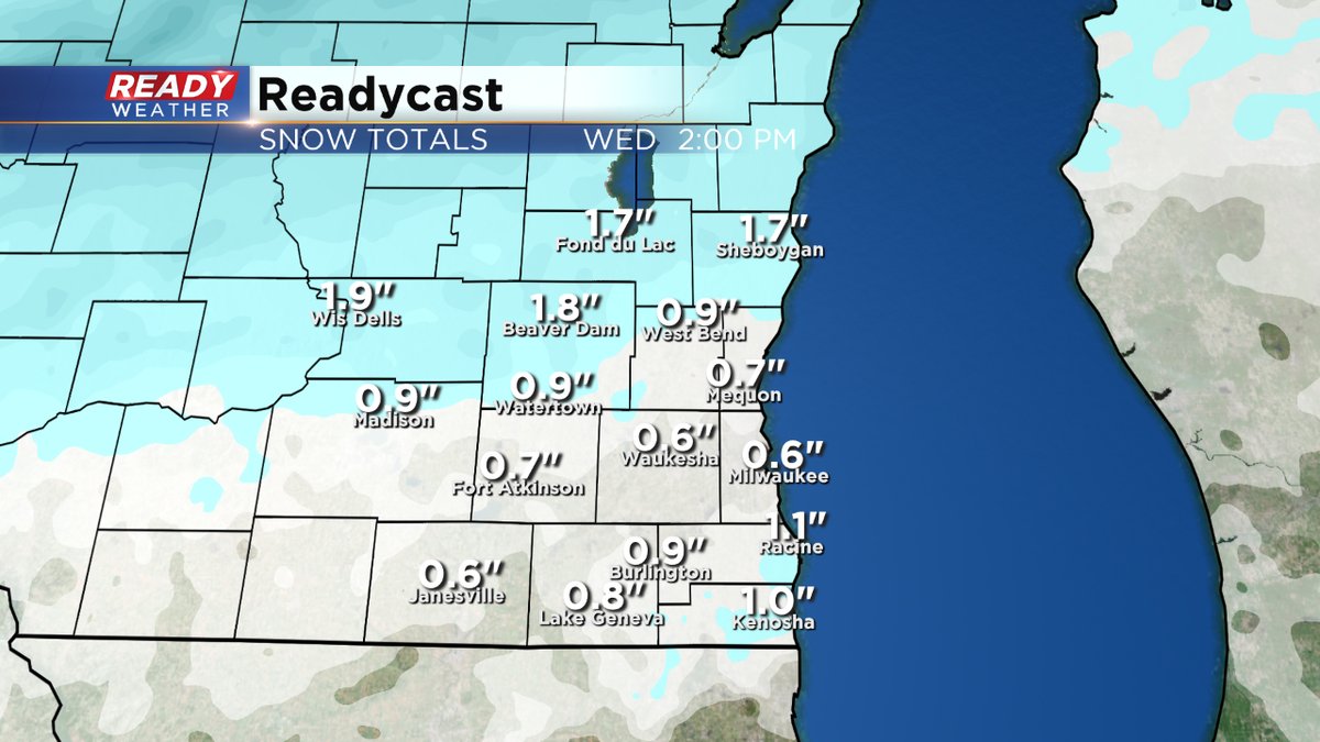
As it stands now, the ice amounts don't look that impressive but watch the roads and sidewalks nonetheless. Out of the deal we could even see a few tenths of an inch of snow but much more well north.
We have two chances for accumulating snow. This Sunday and then next Tuesday. Keep it tuned to the CBS 58 Ready Weather team for updated information.