Weather Whiplash: Near record warm temps to weekend snow


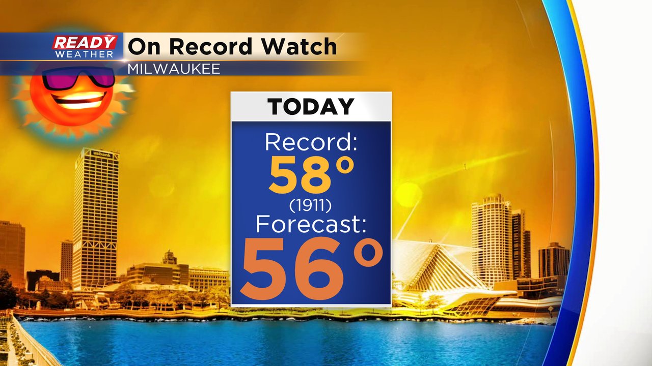
Wednesday was a super warm day with highs in the middle 50s, only 4* away from the record in Milwaukee. Thursday will be very similar with lots of sunshine, a light wind out of the southwest, and highs reaching the low to middle 50s. The forecast in Milwaukee is 56* and the record is 58* so we will come close to breaking records.
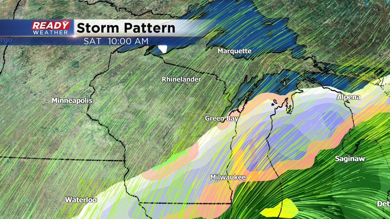
Our weekend storm is currently located over the desert southeast and will move due northeast over the next 24-48 hours. Our confidence in the storm forecast has started to increase. Timing looks pretty consistent with rain starting Friday afternoon and switching to snow Friday night with snow lasting through Saturday evening. The track of the storm has started to become more consistent increasing our confidence with the center of the low staying just to our south in Northern Illinois and Northwest Indiana. What we are still waiting for is better confidence on snowfall totals. Weather models have a wide range in snow totals anywhere from 0-16" depending on where you live.

Clouds will slowly increase Thursday night with most of southeast Wisconsin waking up to cloud cover Friday morning but waking up dry. A few weather models have rain starting as early as late Friday morning or around lunch time. Others hold off that snow until the mid afternoon. By the Friday evening commute most of southeast Wisconsin will be under rain with a few snowflakes mixing in.

By the time many of us are waking up Saturday morning most of our inland areas will have switched to just snow but lakeside spots could be under a rain/snow mix until late morning. For most of the afternoon and evening snow will be falling across all of southeast Wisconsin and could be heavy at times.
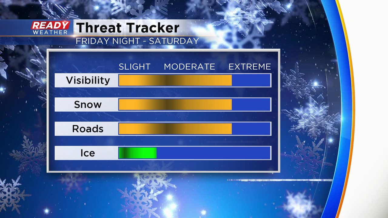
The rate of snow will reduce visibility and the wind will be strong with a NE wind gusting above 30 mph at points throughout Saturday. Road conditions will likely be impacted, especially Saturday afternoon and evening as surface temperatures fall below freezing and snow accumulates. Thankfully ice is not a big concern with this storm with a pretty straight forward switch from rain to snow Friday night.
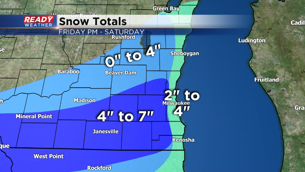
Here is our first take on the snowfall forecast with the caveat that THIS MAP WILL CHANGE. Given the uncertainty and wide range among weather models expect to see the ranges go smaller or larger and the areas they impact to change. As of now, our northwest counties will see the least amount of snow. There a dozen miles could separate no snow from a couple inches. Inland and southwest spots have the best chance to see some decent snow accumulating with 4-7" there. Lakeside spots are one of the biggest wildcards. How long the rain/snow mix will last will greatly impact how much snow we see - expect 2-4" along the lake right now.
Download the CBS 58 Ready Weather app so you can keep checking the updated blog and track the rain and snow when it arrives.