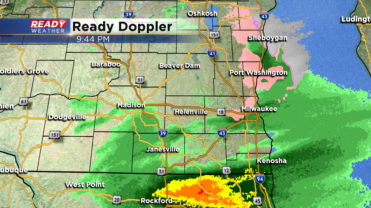
The month is almost over and we've got one last call for rain. It's in progress tonight! Take a look:
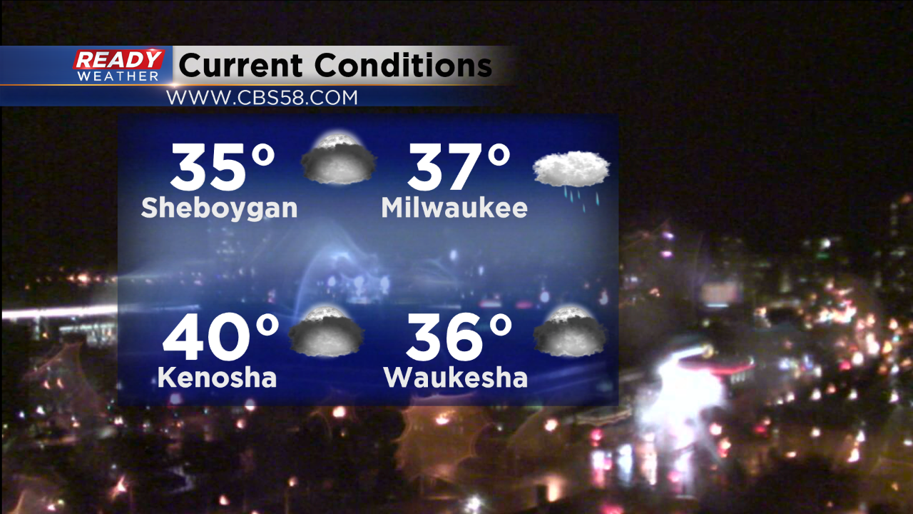
Temperatures are cooling back to the middle 30s for places like Sheboygan, so we'll have to keep a watch on any mix that falls. You can see the pink on Ready Doppler picking up on the colder air, and we've had a few viewer reports of a light mix as of 10pm.
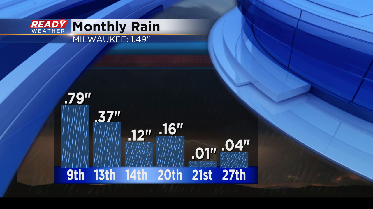
Overall this is still expected to provide mainly rain. We've had six days so far that have provided measurable rain. This should be the 7th and last for the month.
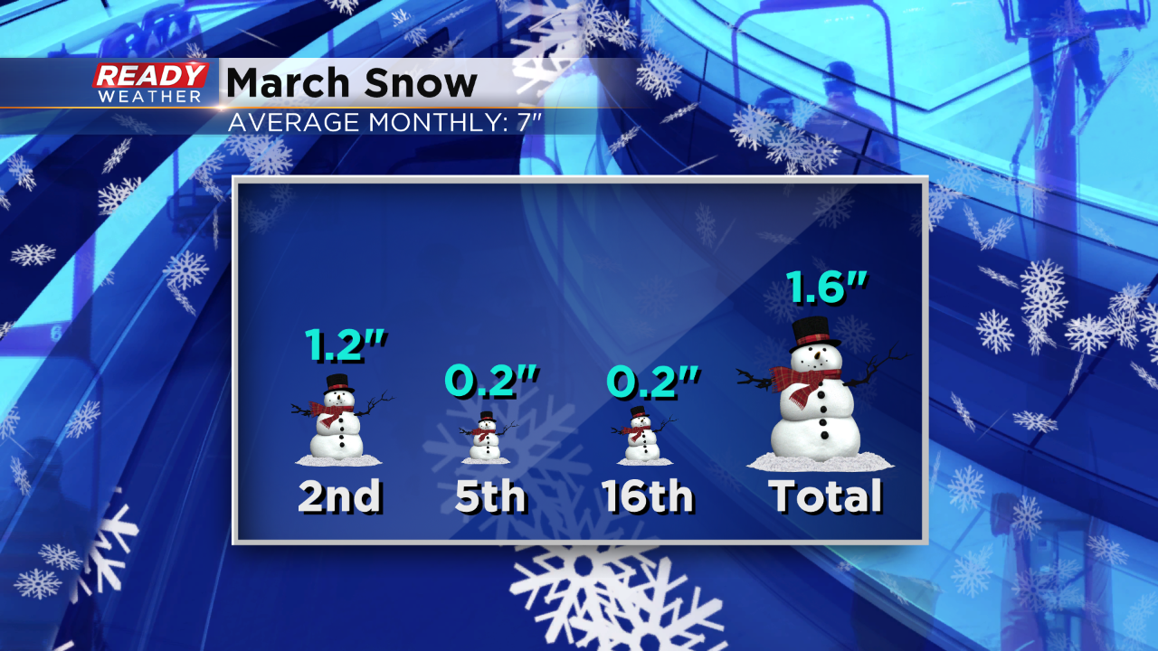
On the 9th we saw over 3/4" and that led to flooding concerns and melting snow and ice with ice jams on waterways causing additional issues. However, recently the rain has been hard to come by. To date we've got about an inch and a half of rainfall. We're actually drier than normal this month. That's due in part to the little snow this month has provided.
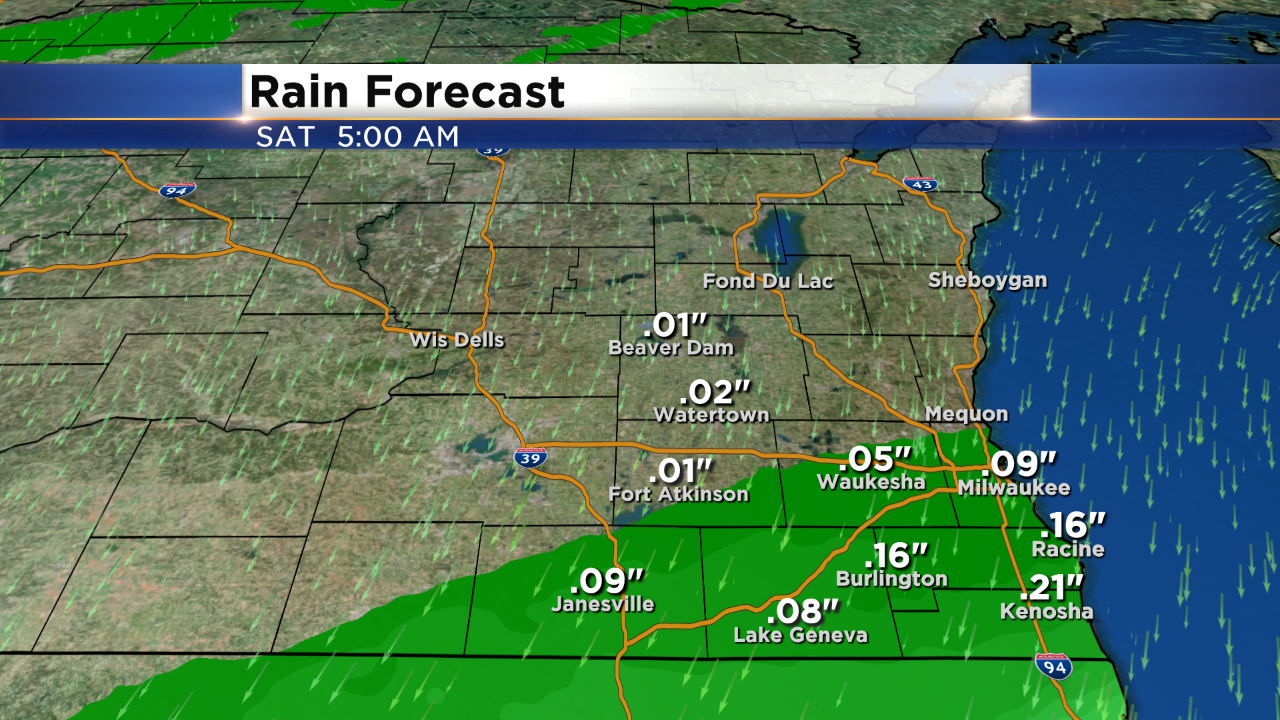
We're short of snow by over five inches. That's okay though, we already stacked up forty-seven inches of snow prior to March. So even though there is a small chance tonight's precip could be a touch wintry, this should still slide through as mostly rain. Rain chances will continue to around 3am Saturday morning. Here's a look at how much rain you can expect in your area.
The rest of Saturday features a strong northerly wind. Gusts could reach 30mph.
I'm meteorologist Rebecca Schuld