Afternoon Update: Storms firing near the Mississippi River could be strong to severe this evening


Updated: Thursday, February 8th 3:45pm:
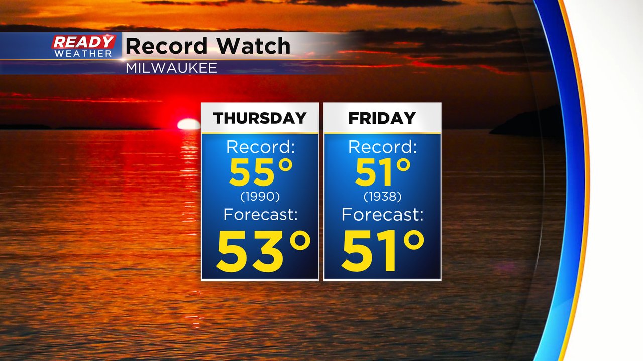
Record highs have been shattered today in SE WI with temps in the mid to upper 50s! We had a brief round of showers earlier this afternoon, but our focus is on the scattered storms developing near the Mississippi River.

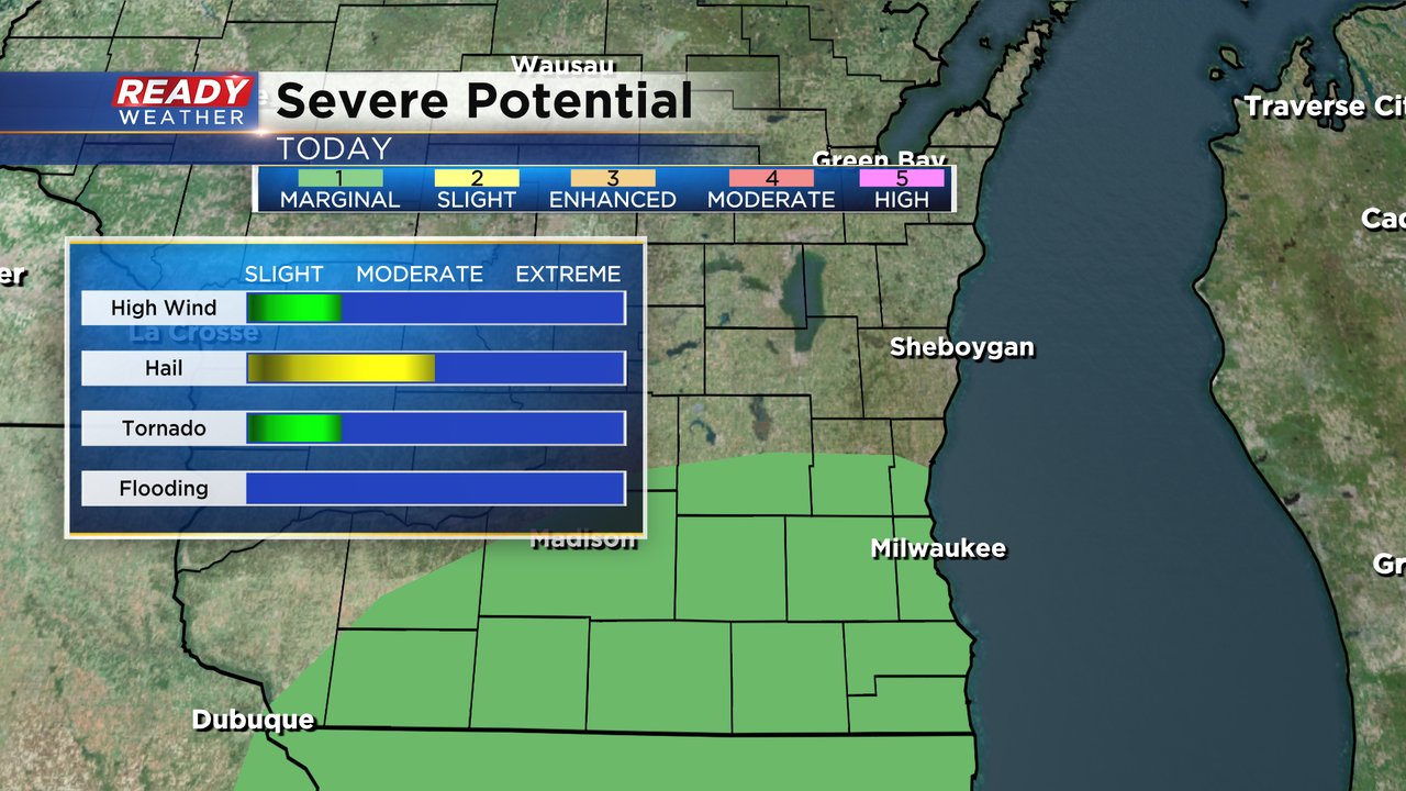
These cells are racing to the northeast and will move into southeast Wisconsin after sunset. We remain under a level 1 of 5, Marginal Risk, for severe storms this evening with damaging winds and hail being the main threats. If a storm can remain organized, we will have to watch for an isolated tornado.

---------------------------------------------------------------------
Finally no fog in the morning for once! Temperatures are already very mild Thursday morning in the upper 30s and low 40s. Highs Thursday afternoon are still on track to reach the 50s for the first time this year. A forecast high of 53* would fall just short of the record of 55*. Friday still has the better chance to tie or break a record. It would likely happen in the late morning or midday hours before temps start to drop Friday afternoon but the current forecast high of 51* would tie the current record set in 1938.
The near record warmth for Thursday is part of the reason we have a chance for thunderstorms. We likely see two brief rounds of rain on Thursday. The first rolls in late morning through the early afternoon with a few scattered light showers but no big storm chance.
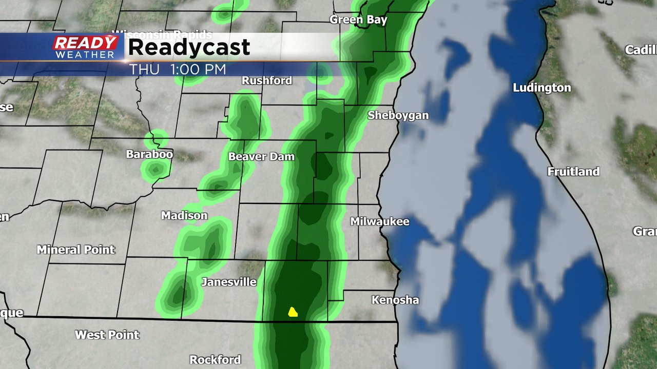
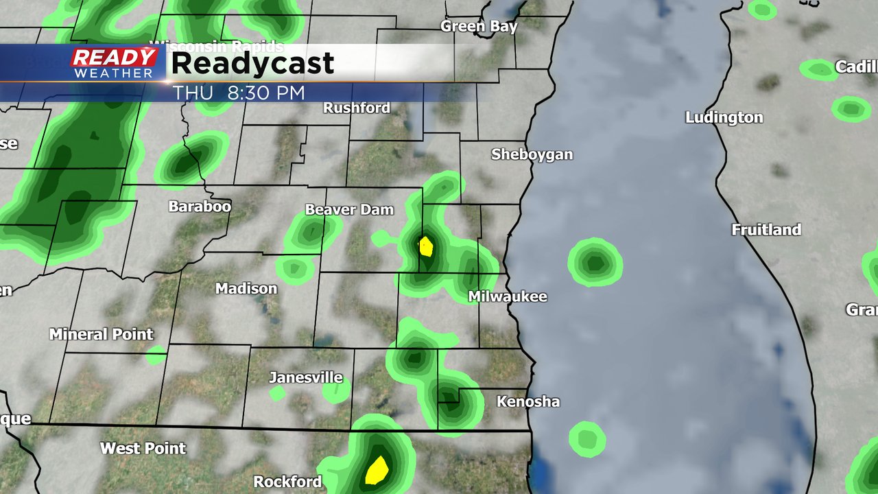
The second round has the better chance for a few downpours or isolated storms from late afternoon through early evening. A few showers could linger through midnight.
There is a very conditional risk for a strong or even severe storm Thursday afternoon/evening. Anytime you get thunderstorms in these colder winter months there's a risk for hail to form. We also can't rule out a very brief spin up tornado and some gusty wind. Most of southeast Wisconsin, especially from Beaver Dam, West Bend, Grafton south is in the Level 1 Marginal Risk for severe weather.
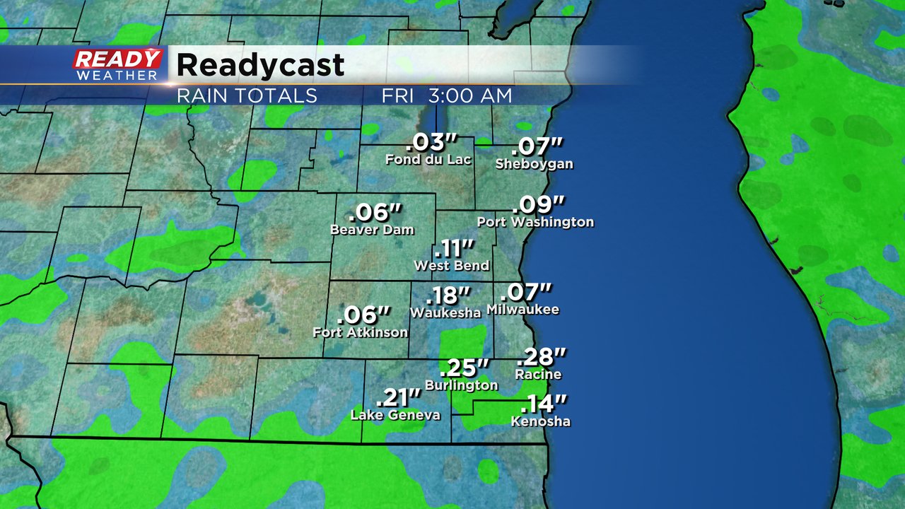
Overall rain totals look pretty light for Thursday with most of southeast Wisconsin picking up 0.10-0.25" of rain. Higher rain totals will be possible with any storms that develop.
Download the CBS 58 Ready Weather app to track the storm chances and get any alerts if warnings are issued.