


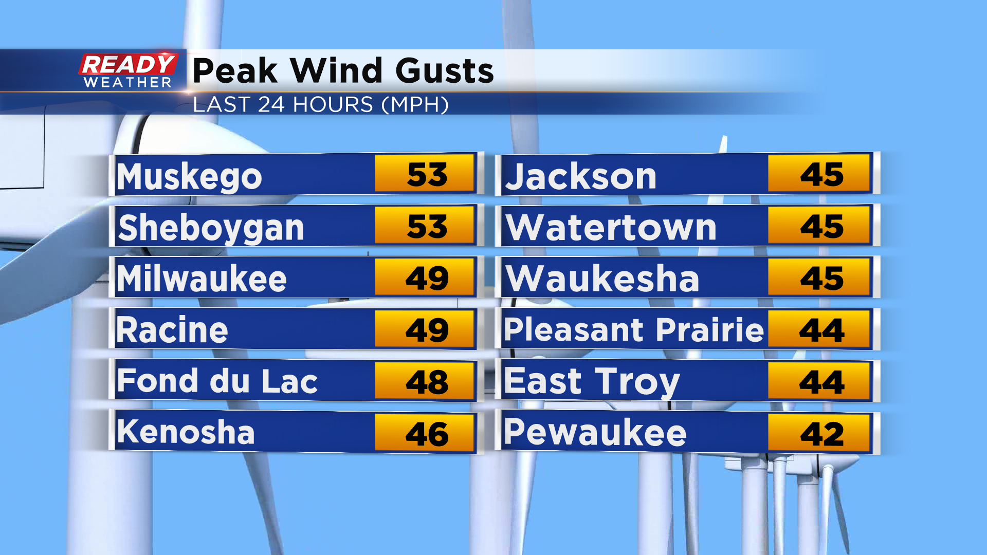
It's been a cold and windy start to the month of November with frequent wind gusts between 35-45 mph all day. Muskego and Sheboygan even had wind gusts over 50 mph! These gusty winds cause sporadic power outages across southeast Wisconsin.
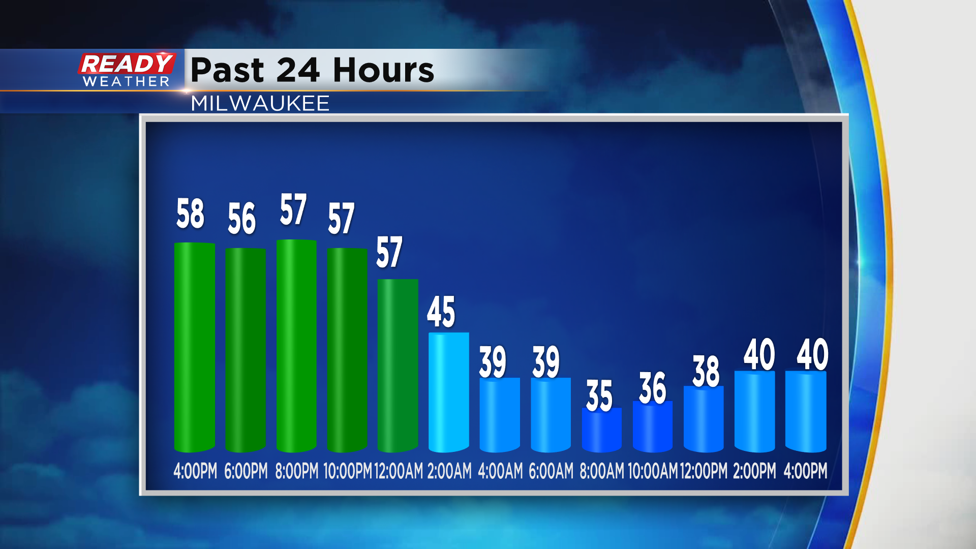
Even though our official high for the day occurred shortly after midnight, most of the day was spent in the upper 30s to around 40°, which is well below normal for the start of November.
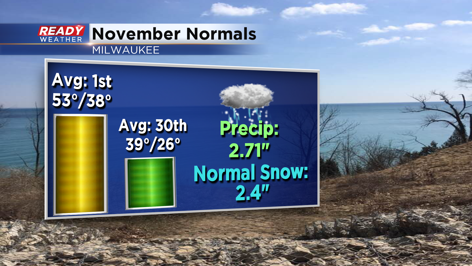
Milwaukee's average high on November first is 53°, but by the end of the month it drops to 39°.
Thankfully the cold weather we had today isn't here to stay. Monday will be the transition day as winds turn to the southwest and help temps rise close to normal in the low 50s. However, sunshine and southwest winds will continue to pump warmer air into the Badger state all week with highs generally in the low to mid 60s beginning on Election Day.
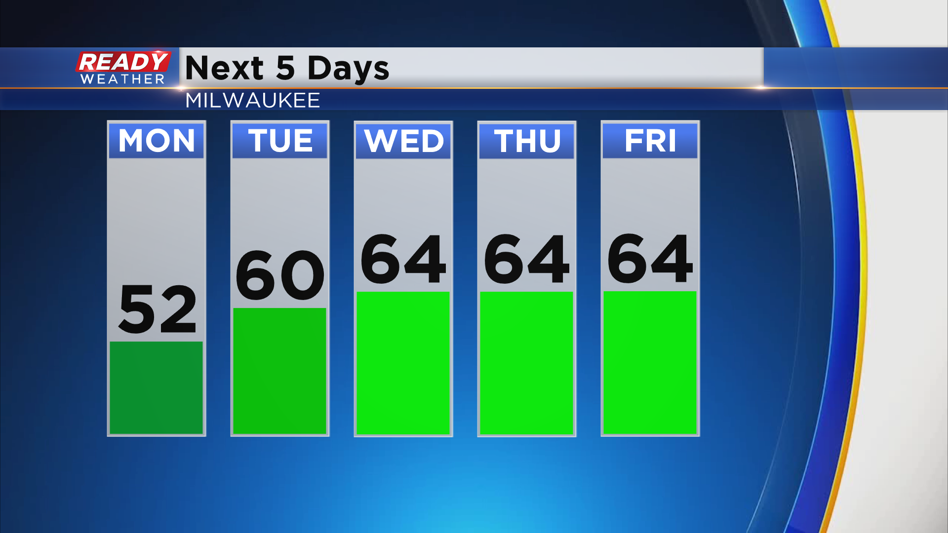
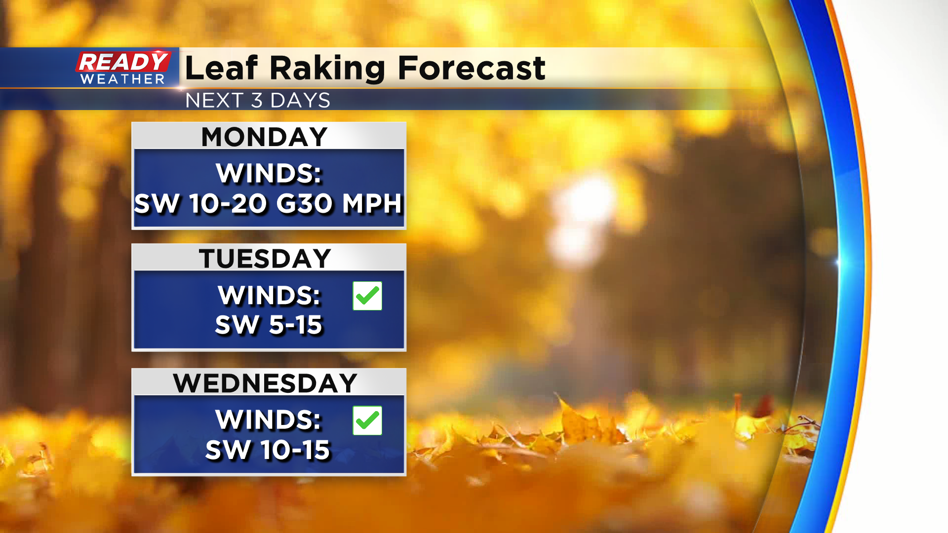
The southwest wind will still be a bit gusty on Monday with gusts up to 30 mph during the afternoon, but it wont be as strong Tuesday or Wednesday if you're looking to rake up all of the leaves that fell over the weekend.
While mainly dry and warm weather is expected this week, we know it won't last forever. Download the CBS 58 Ready Weather App to see when temps will fall back into the 40s for highs.