


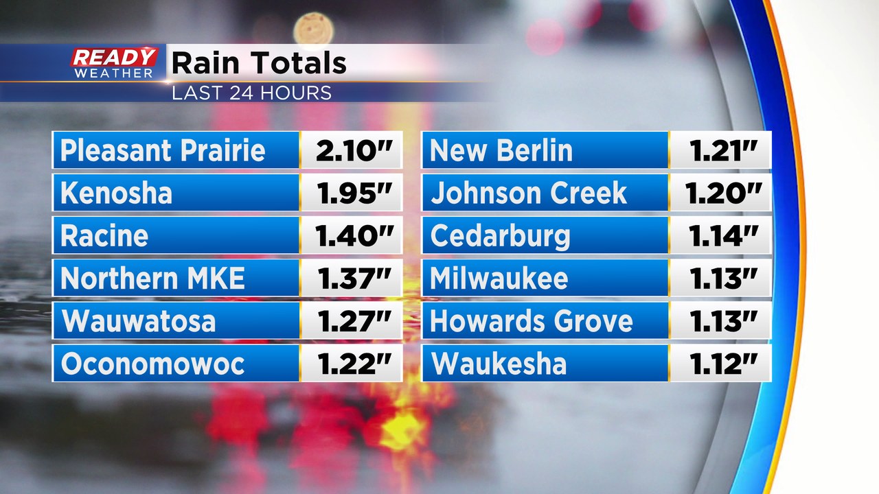
The strong area of low pressure that dropped 8-18" of snow across northern Wisconsin and triggered deadly has pushed off to the east, but it gave all of southeast Wisconsin a nice soaking rain. Most spots picked up around an inch or so of rain, but some spots in Kenosha had two inches!
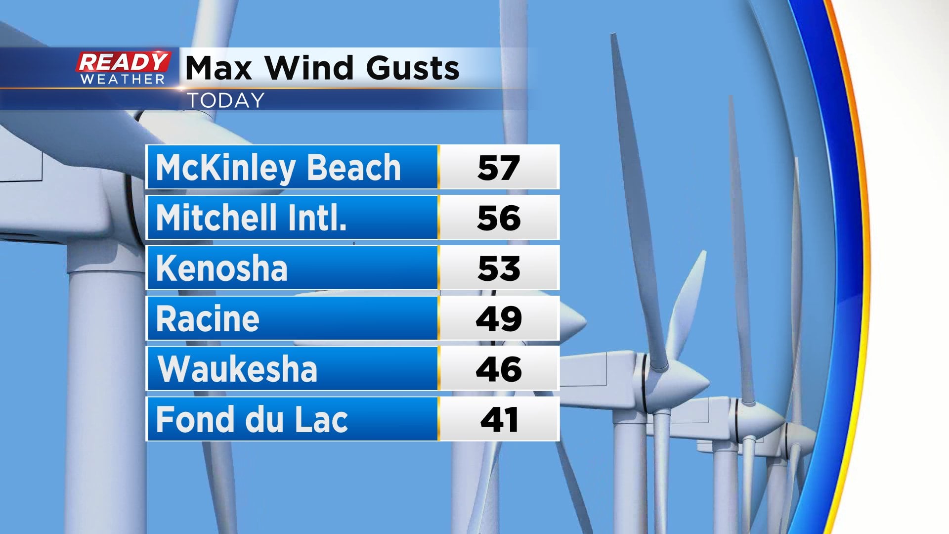
There were also strong winds on the backside of this system early this morning, with a few gusts over 55 mph in the Milwaukee area.
The strong winds subside this evening, but they'll stay around 15 mph or so overnight and gust between 20-30 mph on Sunday. However it'll be a southwest wind and combine that with abundant sunshine and temps looks to warm into the mid to upper 40s.
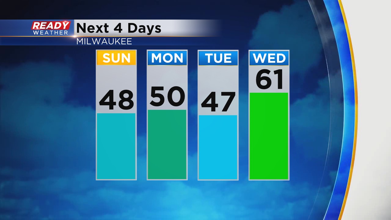
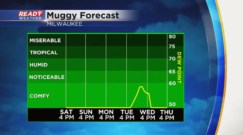
Temps make a run at 50 on Monday and will likely rise into the low 60s later in the day Wednesday! This will likely shatter our record high of 55° that was set in 1891. While we could have a few light showers or drizzle to start the day Wednesday, you'll likely notice some humidity as dew points potentially climb into the upper 50s, which may lead to a few storms at night when the cold front moves through.
Download the CBS 58 Ready Weather App to see how long this warm weather sticks around.