Warmest day of the year on tap for Tuesday with storm chance


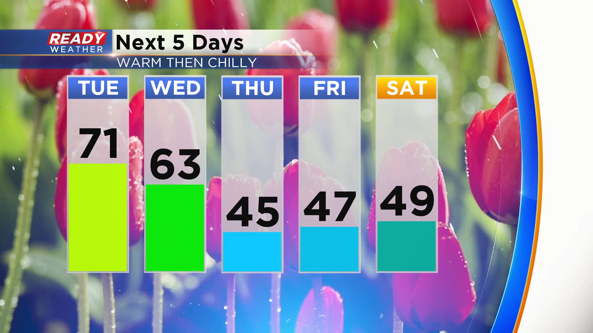
We're already feeling the warmth with temperatures Tuesday morning about 10-20* warmer than they were Monday morning. Despite some thick cloud cover at times we are still expecting a rapid warm up through the 40s and 50s Thursday morning with noon temps around 60*. Temperatures will continue warming through the afternoon with late afternoon highs expected around 70*.

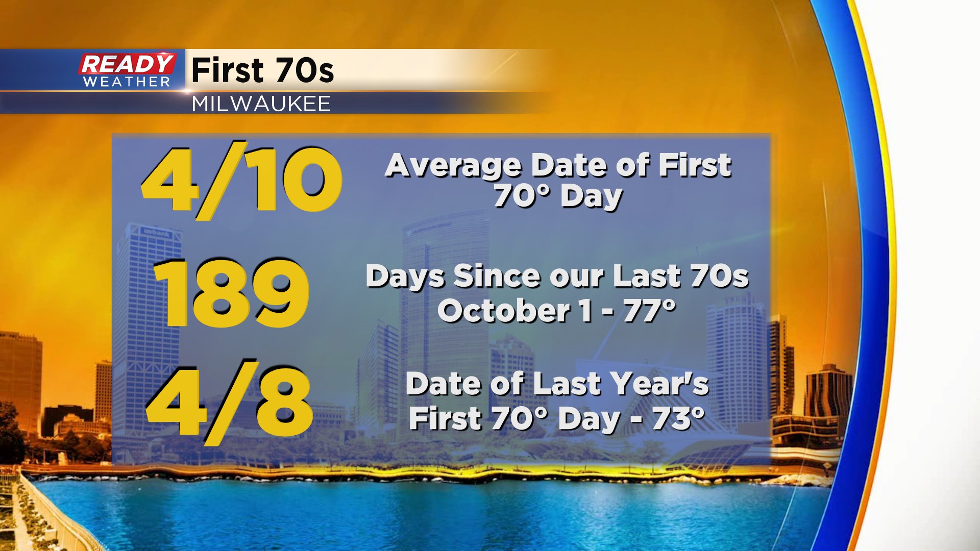
Thursday's warm air comes right on time compared to our average first days in the 70s. The long term average for our first 70* day is April 10. Last year we saw our first 70* day on April 8 so right around this time of year. It's been 189 days since we've felt temperatures in the 70s. The last time we had a day in the 70s was October 1, 2019 when we hit 77*
The warm air today does come with a storm chance. After 5 p.m. a few showers and storms could make their way through southeast Wisconsin ahead of and along a cold front. With all the warmth in the atmosphere it will be hard for storms to build which could keep our rain chance down, but if storms do form they could be strong to severe with damaging wind and large hail.

Temperatures will start to drop a little on Wednesday but still very mild in the low 60s. It's not until Thursday that the cold drop really arrives with highs only in the 40s and once the 40s arrive it looks like they are going to continue for the foreseeable future.
Download the CBS 58 Ready Weather app to track the showers and storms possible Tuesday evening and how temps fare after Easter.