Warmer and a bit more humid to end the work week along with a chance for storms
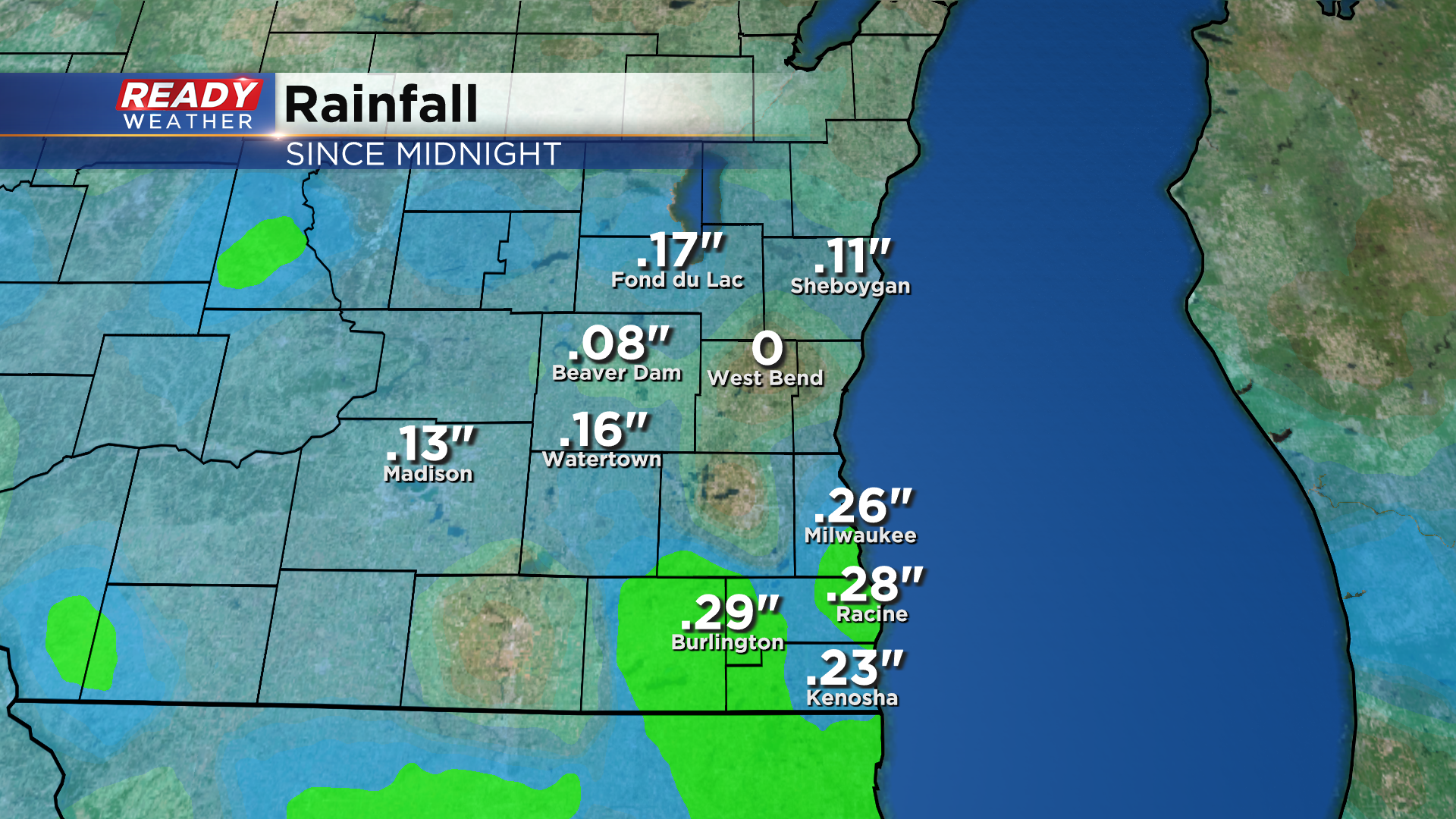
It's been a cool and gloomy Wednesday across southeast Wisconsin, but the showers we had push through this morning have come to an end. For some of us, it was our first decent rainfall in over two weeks.
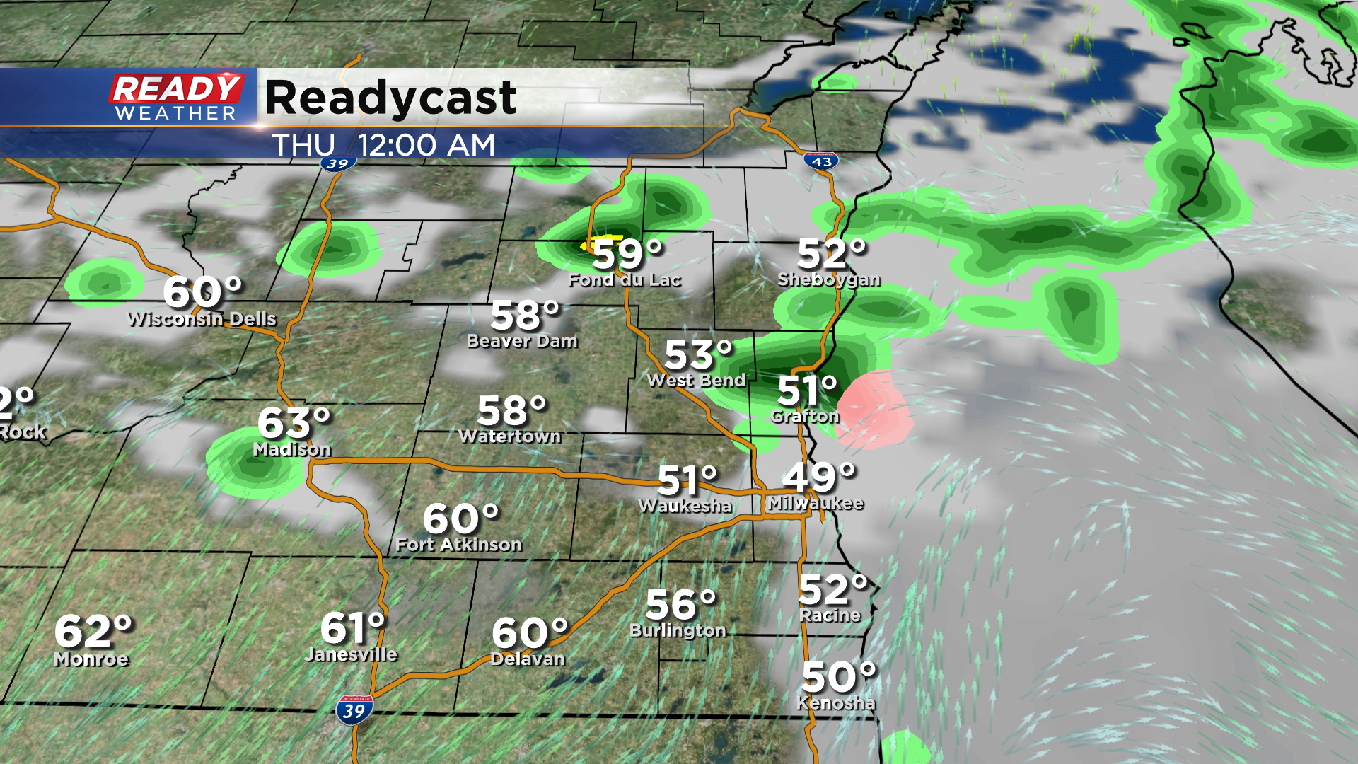
We'll stay dry for the rest of the afternoon and evening, but a few dissipating showers or storms may sneak into areas north of Milwaukee around/after midnight.
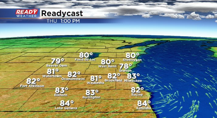
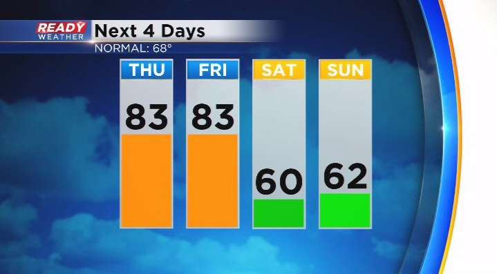
Dry conditions are expected during the day on Thursday with temperatures warming back into the upper 70s to low 80s as a warm front lifts through the state.
Along with the warming temps will come an increase in humidity, especially by the evening after the warm front lifts north. This warm and humid air will help fuel strong to severe storms across the state Thursday into Friday. The greatest risk for severe storms Tuesday afternoon and evening will be well to our west where a level 3 of 5 Enhanced Risk is in place.
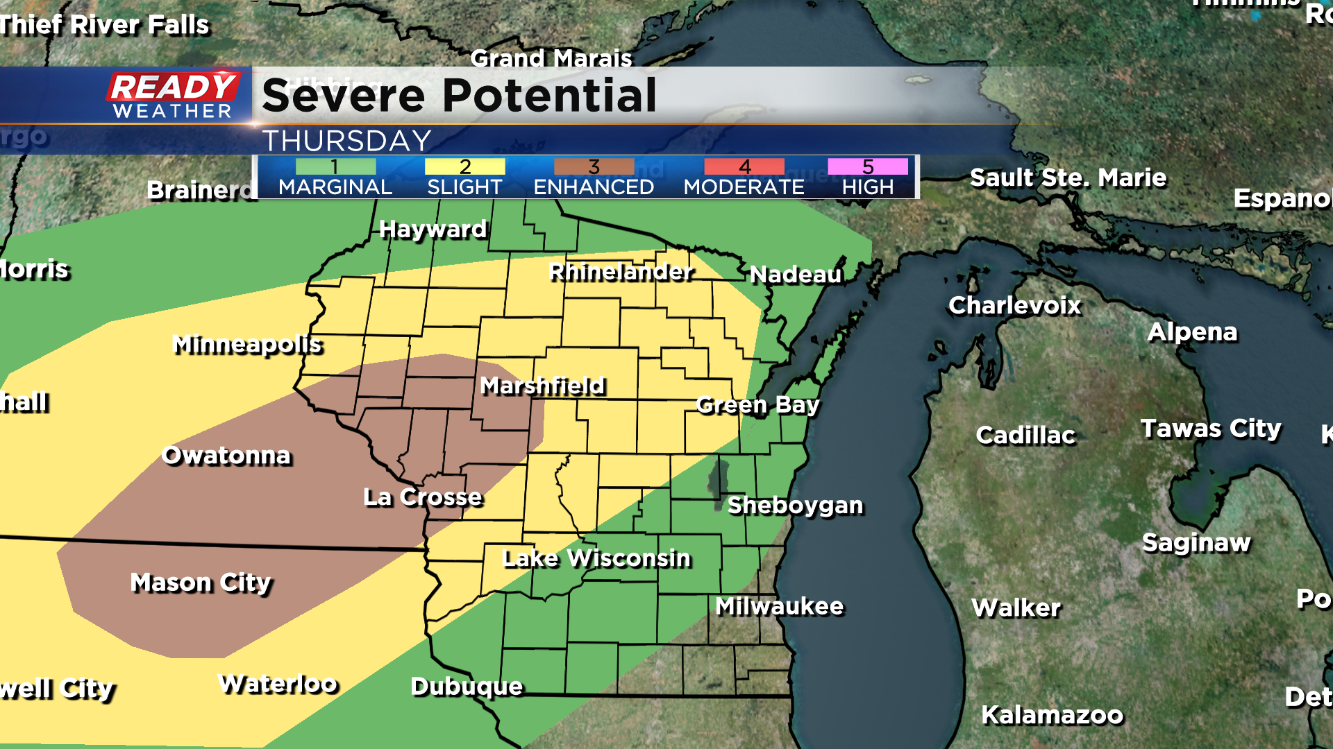
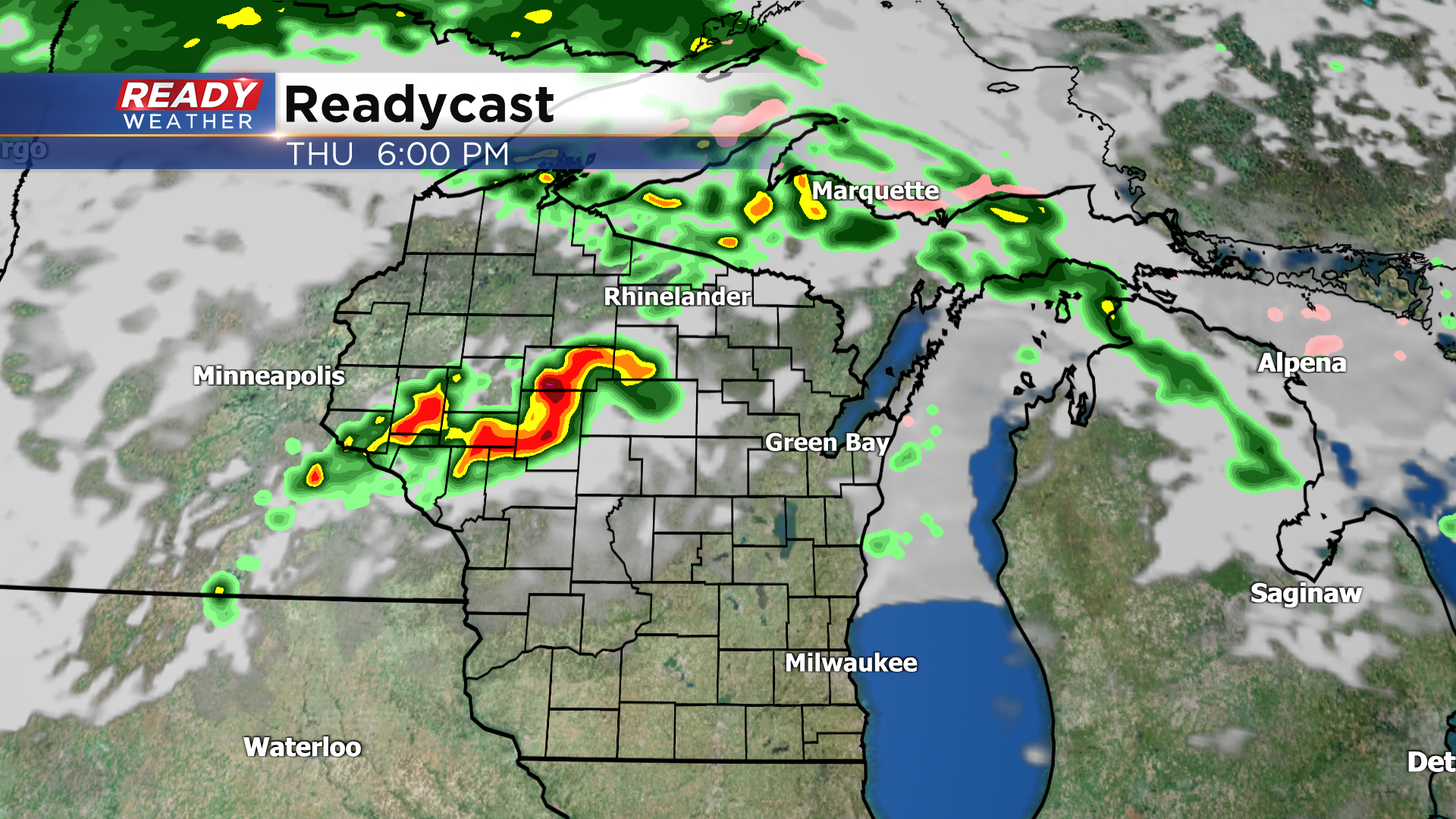
The complex of storms will generally be weakening by the time it reaches southeast Wisconsin early Friday morning, but strong winds or small hail can't be ruled out, especially NW of Milwaukee where the level 1/5 Marginal Risk is in place.
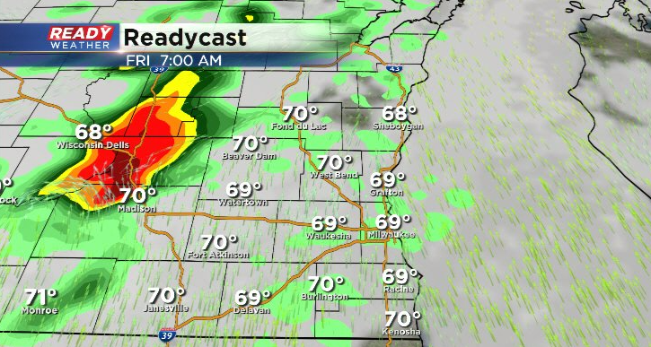
Once this area of storms diminishes, we'll be keeping a close eye on where the cold front stalls. There's a chance it stalls right across southeast Wisconsin, which would keep the warm and humid conditions in place for far SE WI into the afternoon. This may lead to another chance of strong to severe storms if we can get some sunshine ahead of that front. If the early morning storms are strong enough, there's a chance it pushes the cold front through late morning/midday Friday, which would eliminate the humidity and chance for more storms. While uncertainty exists, the potential for severe storms is still present, so a level 2 of 5, Slight Risk, for severe storms is in place for most of southeast Wisconsin.
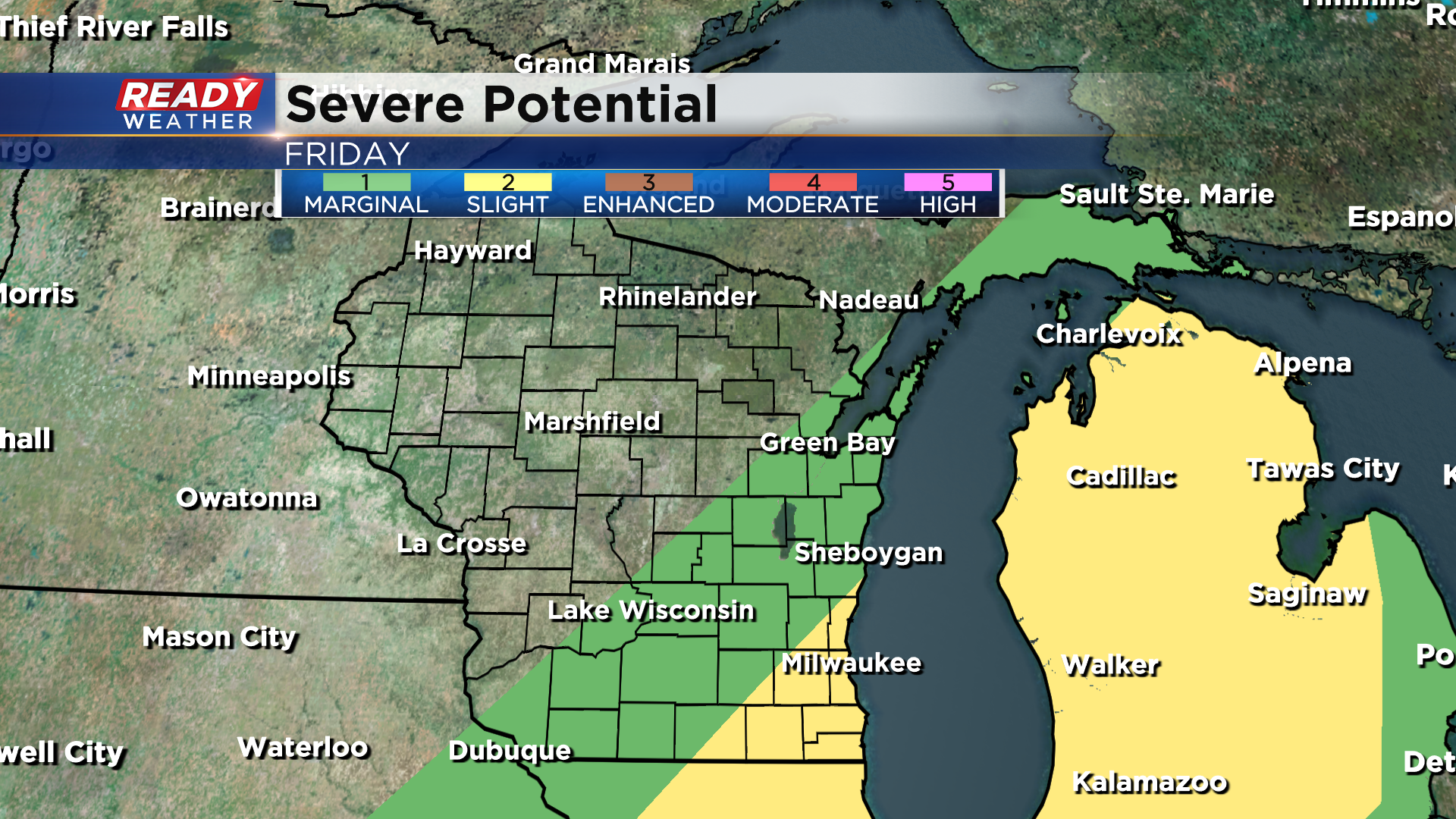
Damaging wind and hail will be the main threats. Behind this front temperatures will drop back below normal for the weekend with more showers expected on Saturday.
Check back for updates over the next 24 hours as the storm situation becomes more clear for Thursday night into Friday.
