


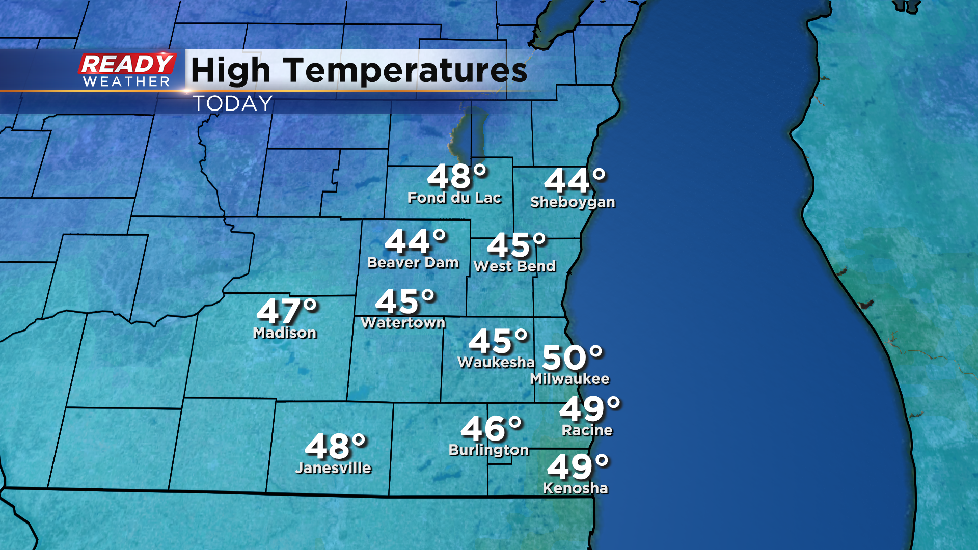
It was a spectacular Sunday across southeast Wisconsin with abundant sunshine and temps topping out in the mid 40s to 50°!
Temps will remain well above normal through the first half of the work week. Highs will be a few degrees warmer on Monday with most spots reaching the upper 40s to low 50s (coolest where there's snow on the ground) thanks to plenty of sunshine.
Winds won't be as breezy, but will still be around 10-15 mph from the southwest. Winds shift to the SE on Tuesday, and with more clouds moving in temps will be in the upper 40s for most, possibly reaching 50° away from the lake.
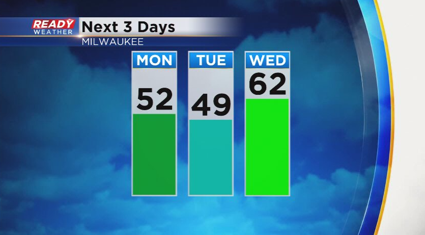
Strong southerly winds will boost temps into the upper 50s to low 60s on Wednesday ahead of a cold front. We'll likely shatter our record high of 55° that was set in 1891. You'll also notice some humidity on Wednesday, especially late afternoon and evening.
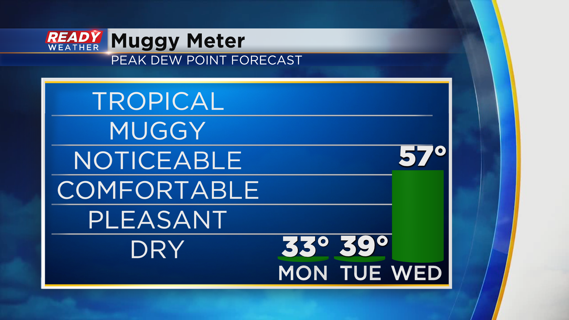
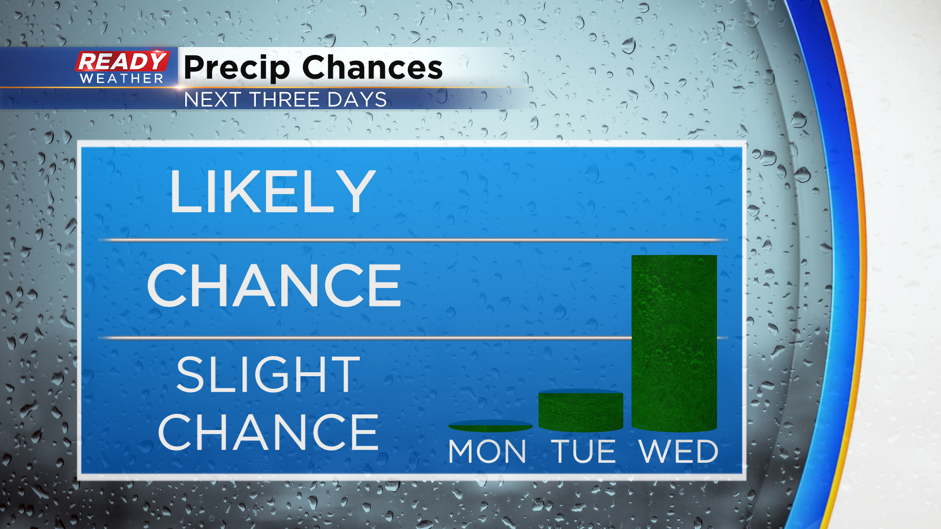
While we'll be dry on Monday and most of Tuesday, drizzle will be possible Tuesday night into Wednesday morning, along with a few isolated showers. A line of rain and a few storms is expected Wednesday night with the cold front.
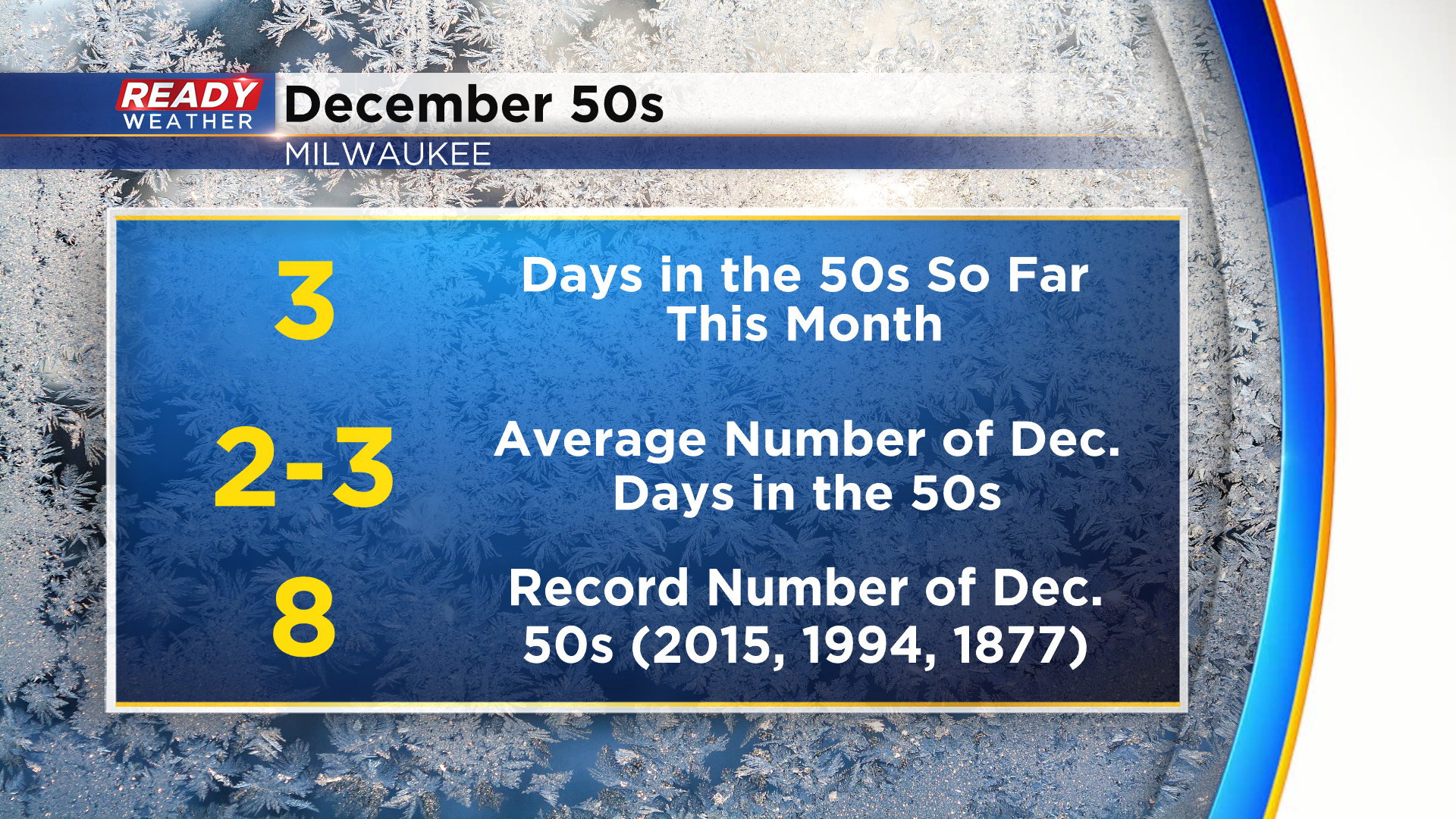
Temperatures will fall back to normal in the 30s behind the cold front for the second half of the week, so enjoy the warmer temps while they're here! Milwaukee usually has 2-3 days at 50° or warmer in December, so the warmth over the next few days is a real bonus for folks who don't like the cold.
Download the CBS 58 Ready Weather App to see the full forecast.