Warm stretch, rain coming early next week
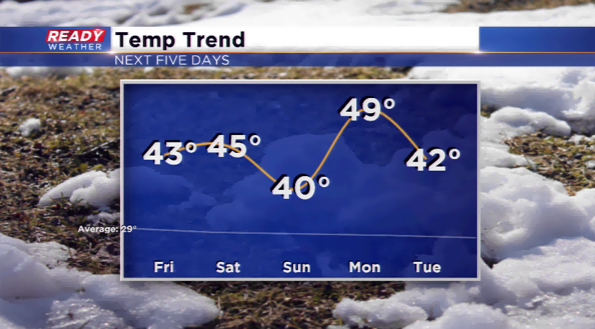
The mild pattern continues to kick off the new year! Highs made it 40 yesterday, and that trend will continue today and for the foreseeable future. Temperatures increase into the low to mid 40s today and Saturday before a weak cold front powers into the region on Sunday. Daytime temps still will be near 40 on Sunday. All days will feature sunshine.
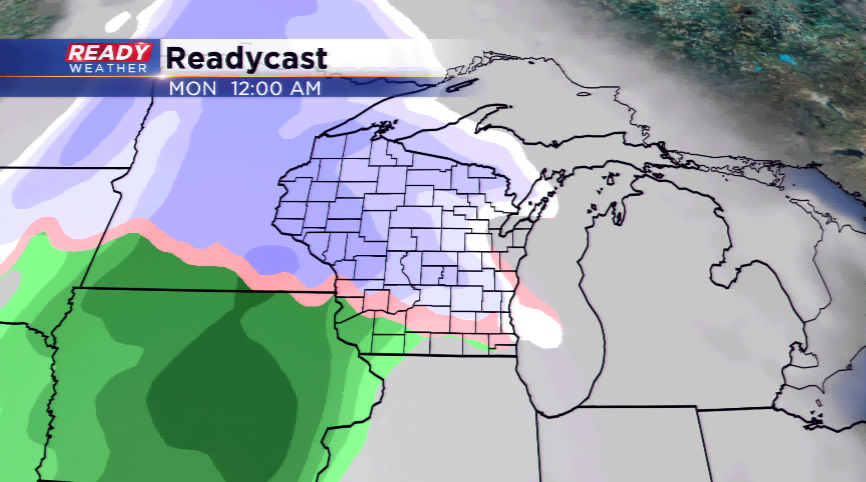
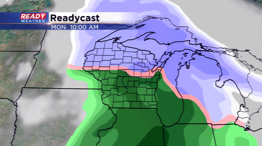
Changes with a storm system on Sunday night and Monday will be the big weather maker on deck for southeastern Wisconsin. If precipitation can invade the region overnight Sunday into early Monday, this may be a mix we’ll have to contend with. Otherwise, expect mainly rain from this low pressure as we will be in the warm sector of the storm. In the wake of the storm will usher in colder air.