Flash Flood Warning for Milwaukee and Waukesha counties


A flash flood warning has been issued for Waukesha and Milwaukee counties until 11:15 pm!
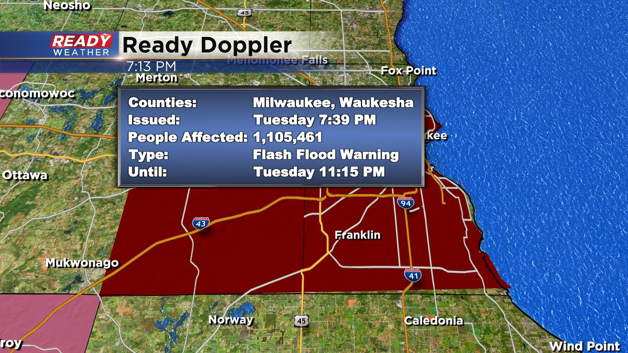
Very heavy rain will cause localized flooding across Waukesha and Milwaukee counties. Don't cross over flooded roads. It doesn't look like we have a real severe thunderstorm threat anymore.
The heaviest axis of rainfall is slowly shifting northeast. Hopefully, there will be a break for Milwaukee and Waukesha counties. Rainfall rates were 1" to 2" an hour.
Locally heavy rainfall could cause some localized flooding with slow moving storms. Models continue to develop more storms along and south of 94 through 12 am. Rain and storms could linger through 3 am.
Deep moisture will also create some torrential downpours!
Additional rain and storms are possible overnight into Wednesday morning; however, we aren't expecting severe weather to linger.
______________________________________________________________________________________________________________
Updated: 9:57 a.m. July 5, 2022
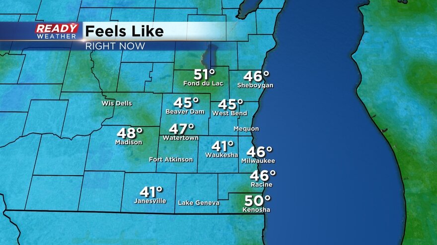
Temperatures are warming up into the 80s and dew points are already very tropical in the 70s. Current feels like temps have pushed into the 90s in southern areas and will get even hotter throughout the day.
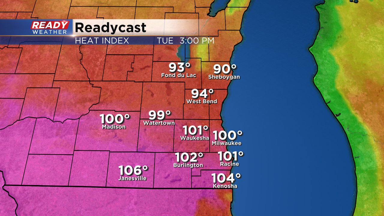
See current heat index values here:
We are still watching the strong to severe storm potential tonight, but it really looks best right along the IL border. The best timing for severe storms is after sunset.

------
Posted: 7:50 a.m. July 5, 2022
July 4th ended with some of nature's natural fireworks with some strong to severe thunderstorms rolling through southeast Wisconsin especially our southern counties. Rain totals for many communities saw totals between 0.50-1.25" of rain. The storms from Independence Day have left us with a ton of humidity. Dew points Tuesday morning are already in the low 70s and will rise into the middle 70s Tuesday afternoon. The dew points will drop a little for the middle of the week but still stay very humid.

That humidity combined with high temperatures in the upper 80s and low 90s will push heat index values well into the 100s in some communities. Southern areas have the better chance to feel the heat.
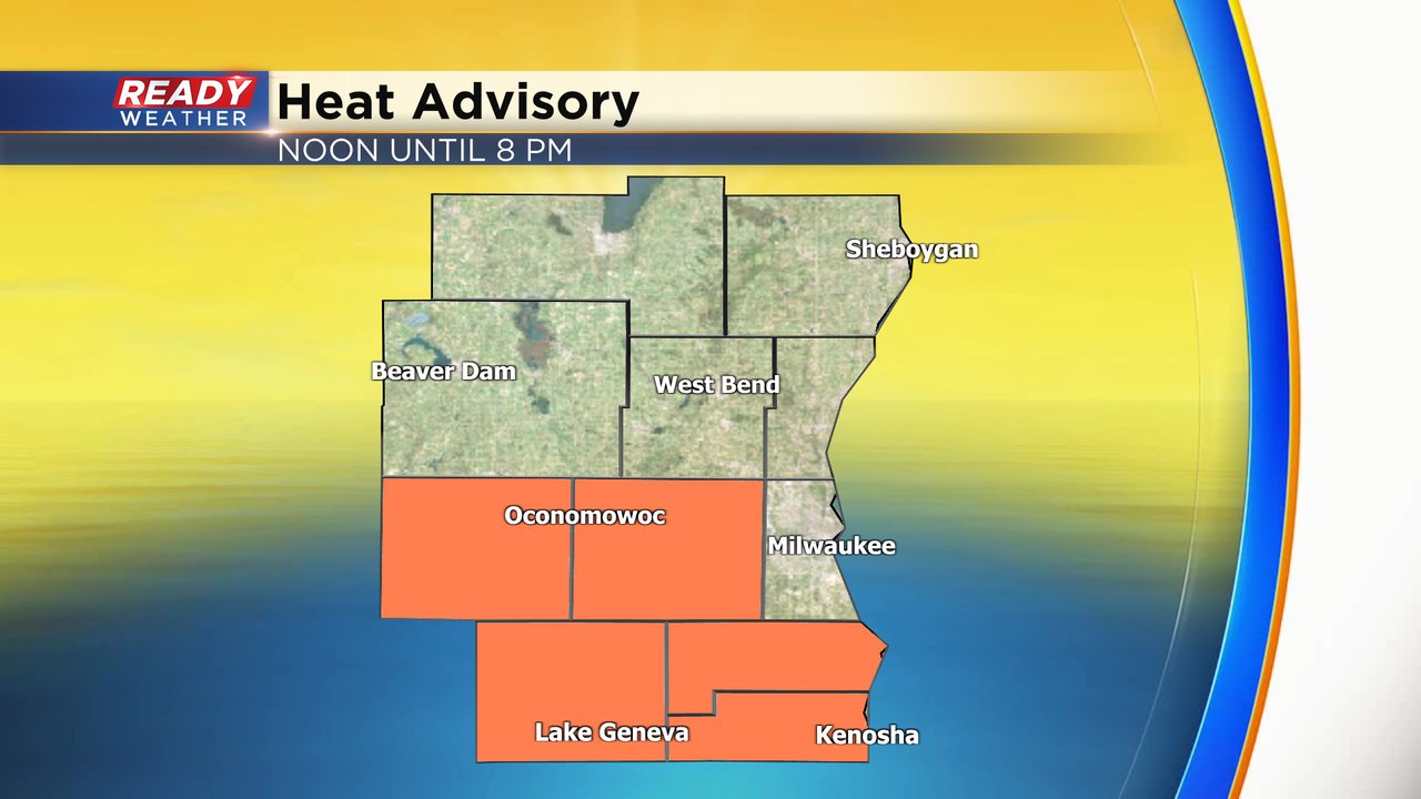
A heat advisory has been issued for these counties that have the best chance to see feel likes temps rise above 100*. The advisory starts at noon and lasts until 8 PM.
All of that heat and especially the humidity will give way to the chance for storms during the second half of Tuesday. After a dry morning and early afternoon we will bring in a storm chance around 4 PM. The bigger threat for storms looks to be after sunset through about 2 AM. Southern hometowns south of I-94 have the better chance for the storms with some weather models keeping our local area dry and the rain south of the border in Illinois.

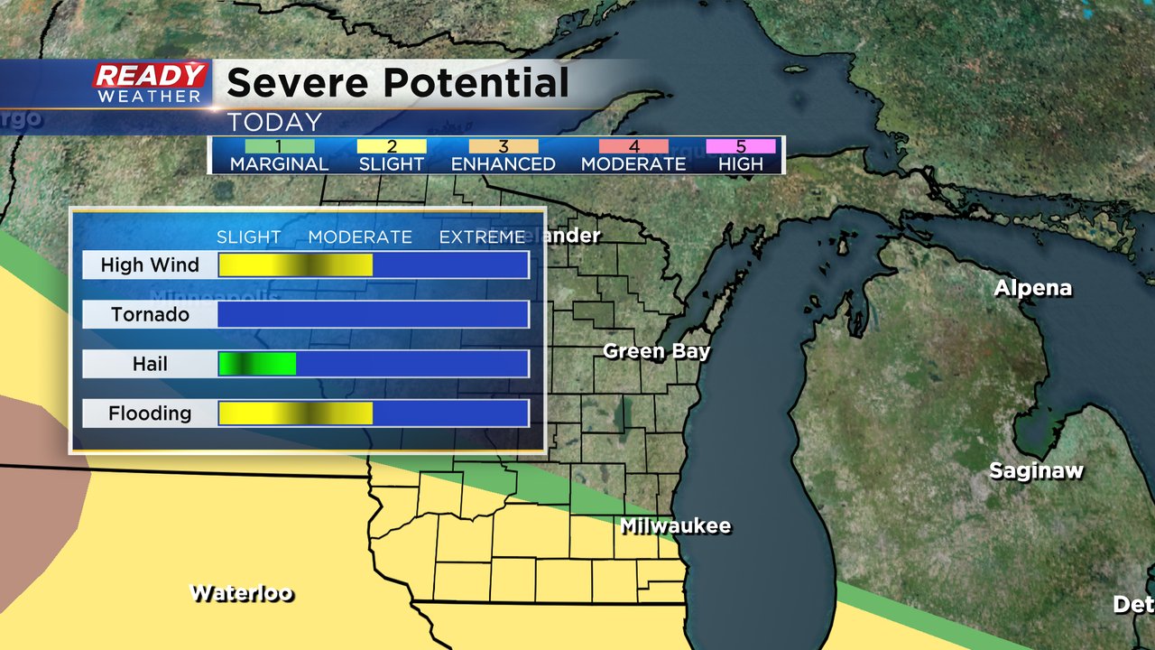
Some of the storms could be on the stronger to severe side, mainly in our southern counties where they are under either the Level 1 Marginal risk in green or the Level 2 Slight risk in yellow. High wind will be possible in any strong storms but flooding rains are also a possibility. There is 0 tornado threat and the hail threat is pretty low.
Tuesday isn't the only day to see a chance for storms this week. There are more rain chances Wednesday and Thursday. With the high humidity and moisture many areas around southeast Wisconsin will see at least a full inch of rain if not close to 2".

Download the CBS 58 Ready Weather app to track any storms that form.