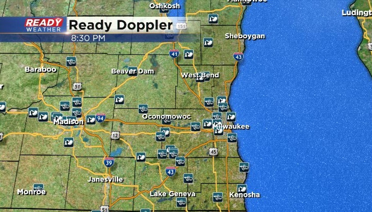
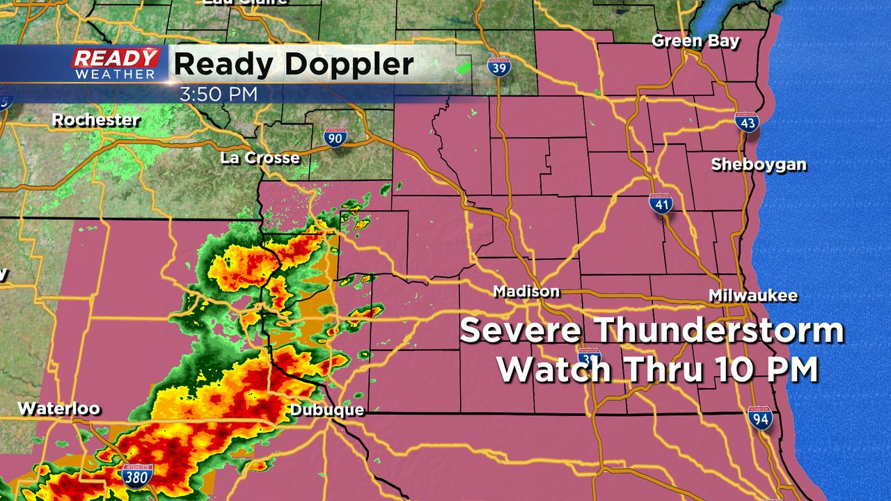
8:30 P.M. Update: Severe threat is over for southeast Wisconsin


Updated: 8:30 pm August 10, 2021:
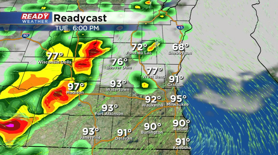
The line of severe storms has pushed over the lake. All severe thunderstorm watches and warning have been cancelled.
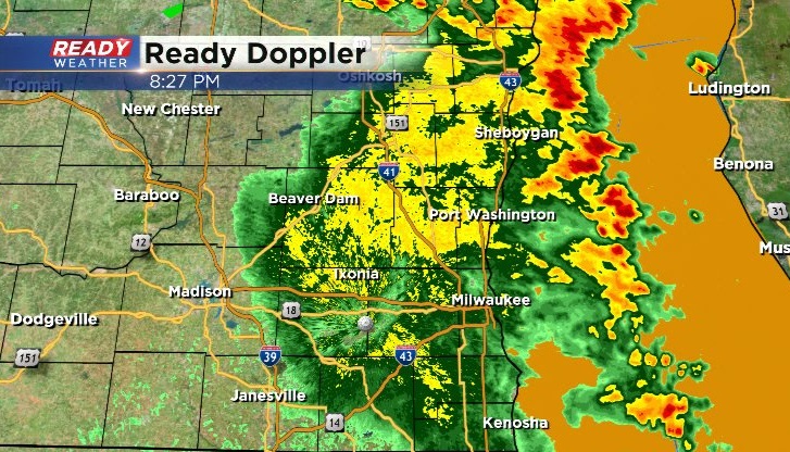
There's copious amounts of wind damage being reported across southeast Wisconsin. Southern Waukesha to northern Milwaukee county was hit the hardest with numerous trees snapped and uprooted.
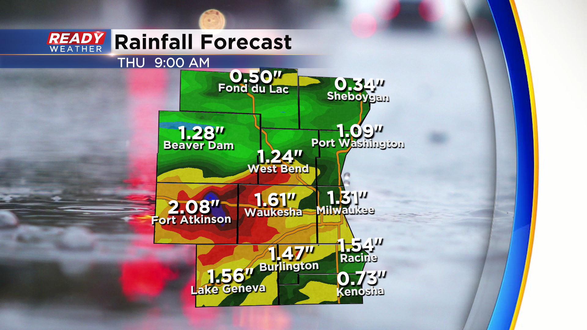
Severe risk is done for tonight, but another round of severe weather is expected on Thursday.
---------------------------------------------------------------------------------------------
Updated: 7:00 pm August 10, 2021:
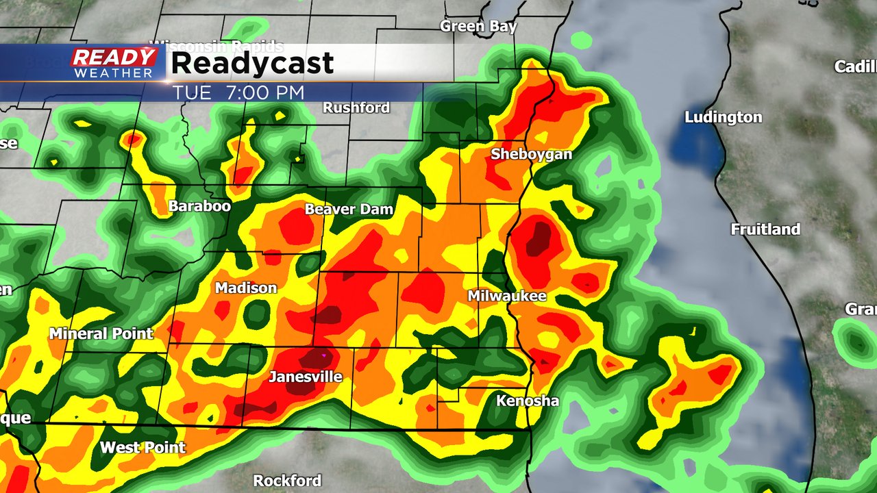
A Severe Thunderstorm Warning continues until 7:45 for all of SE WI besides Fond du Lac and Sheboygan counties. This intense line of storms is producing wind gusts between 55-75 mph and has been producing tree and powerline damage across the Madison metro, Jefferson, and parts of Dodge and Waukesha counties.
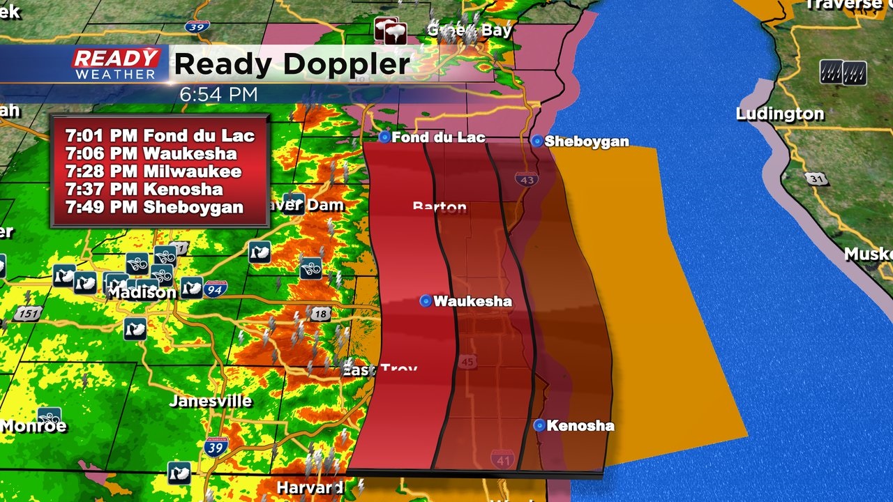
There was a recent wind report of 77 mph east of Eagle in Waukesha counties
--------------------------------------------------------------
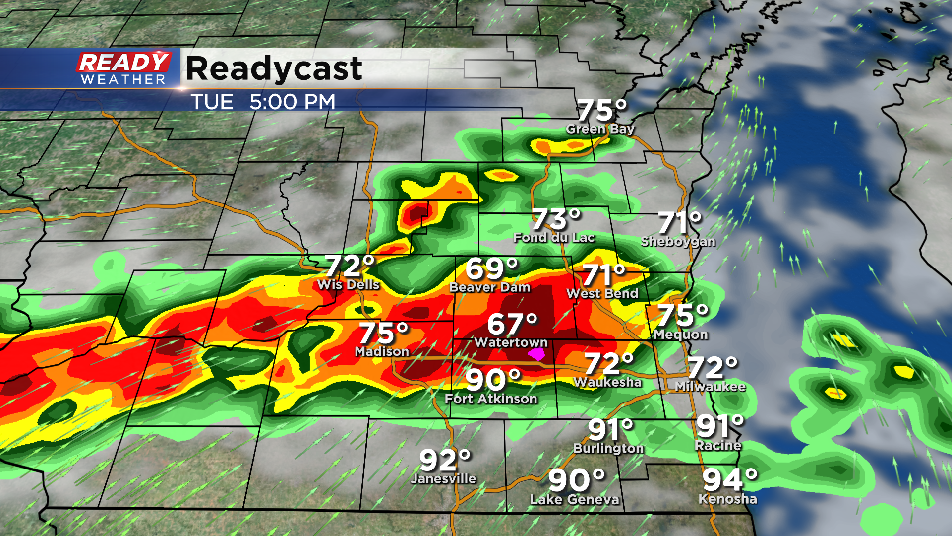
Updated: 5:50 pm August 10, 2021:
A Severe Thunderstorm Warning has been issued for western Dodge and Jefferson counties through 7 pm. Damaging winds of 60 mph are expected with this line of storms that's tracking ENE at 35 mph.
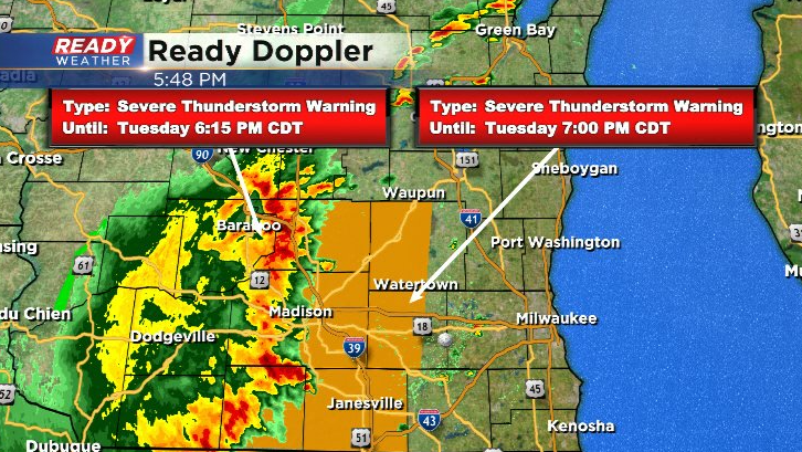
Additional severe thunderstorm warnings may be issued farther east over the next couple of hours.
------------------------------------------------------------------------------------------
Updated: 4:00 pm August 10, 2021:
A Severe Thunderstorm Watch has been issued for all of southeast Wisconsin through 10pm.
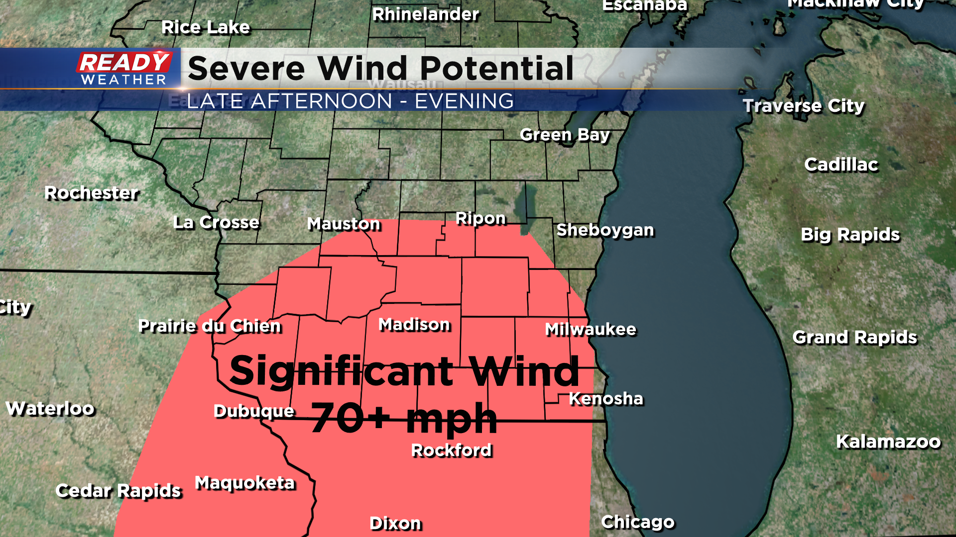
Severe complex of storms is getting its act together in far SW WI and eastern Iowa and is tracking east at 40 mph. Severe straight-line winds of 75+ mph are the main concern with these storms, with large hail being a secondary threat. Storm timing in SE WI: 6pm - 10pm
------------------------------------------------------------------------------------------------
Updated: 2:45 pm August 10, 2021:
A Severe Thunderstorm Watch has been issued west of our area until 8 pm as severe storms are rapidly developing in northeast Iowa.
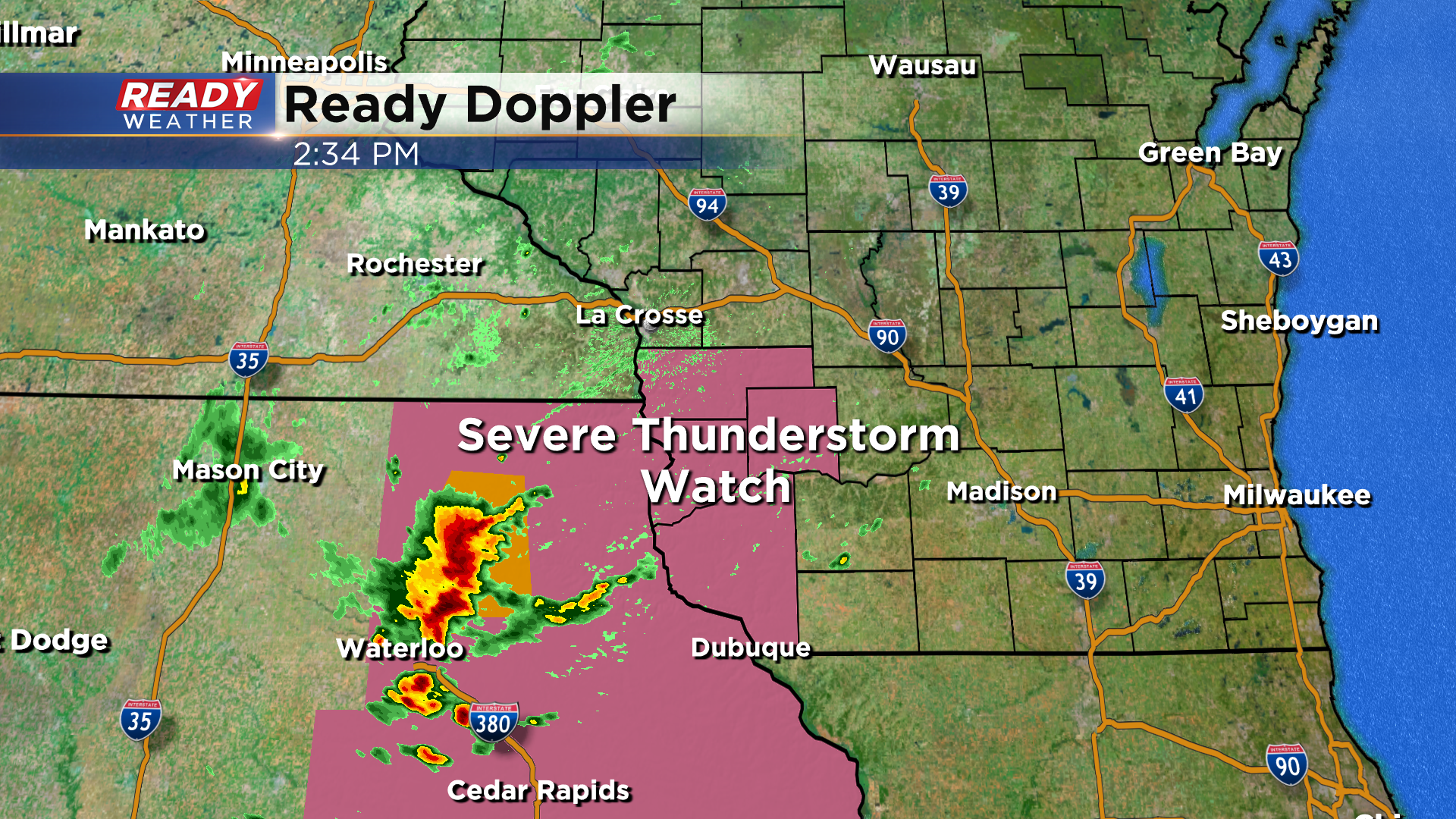
There is plenty of instability ahead of this developing complex of storms as temps are currently in the mid 80s to around 90 degrees with dew points in the mid 70s to low 80s, so the expectation is that storms will continue to intensify as they track eastward into southern Wisconsin.
Damaging straight-line winds of 70+ mph are the main concern with these storms, with isolated tornadoes and large hail a lesser (but not zero) threat.
Storm timing for southeast Wisconsin looks to be between 5pm - 11 pm
Download the CBS 58 Ready Weather App to get any warnings sent to your phone and to live stream any severe weather coverage.
------------------------------------------
Updated: Noon August 10, 2021
Conditions are heating up. It's possible with high temps and humidity levels it feels more like the century mark in your area!
Check in with the Ready Weather Team all afternoon as we provide updates with Facebook lives on our CBS58 page, our individual social media accounts will have the latest weather info and of course constant updates with here and during our evening newscasts as warranted.
Updated: 9:34 a.m. August 10, 2021
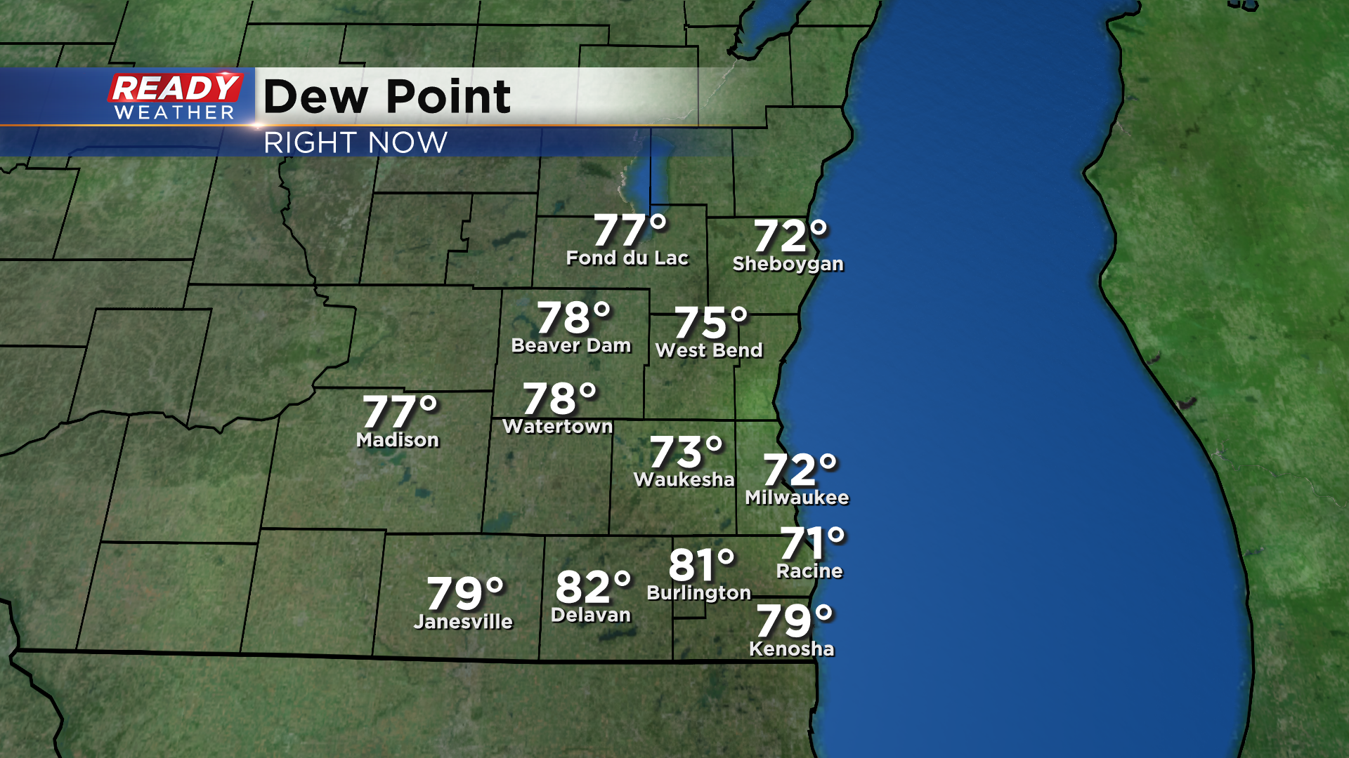
The forecast for Tuesday remains on track. Temperatures have been slow to warm so far with most of southeast Wisconsin hanging out in the 70s but the dew points are already feeling tropical and will get worse throughout the day day.
Storms are still expected to fire this afternoon and last through the evening hours. The biggest threat is damaging wind and heavy rain however some hail and isolated tornadoes will be possible as storms first fire.
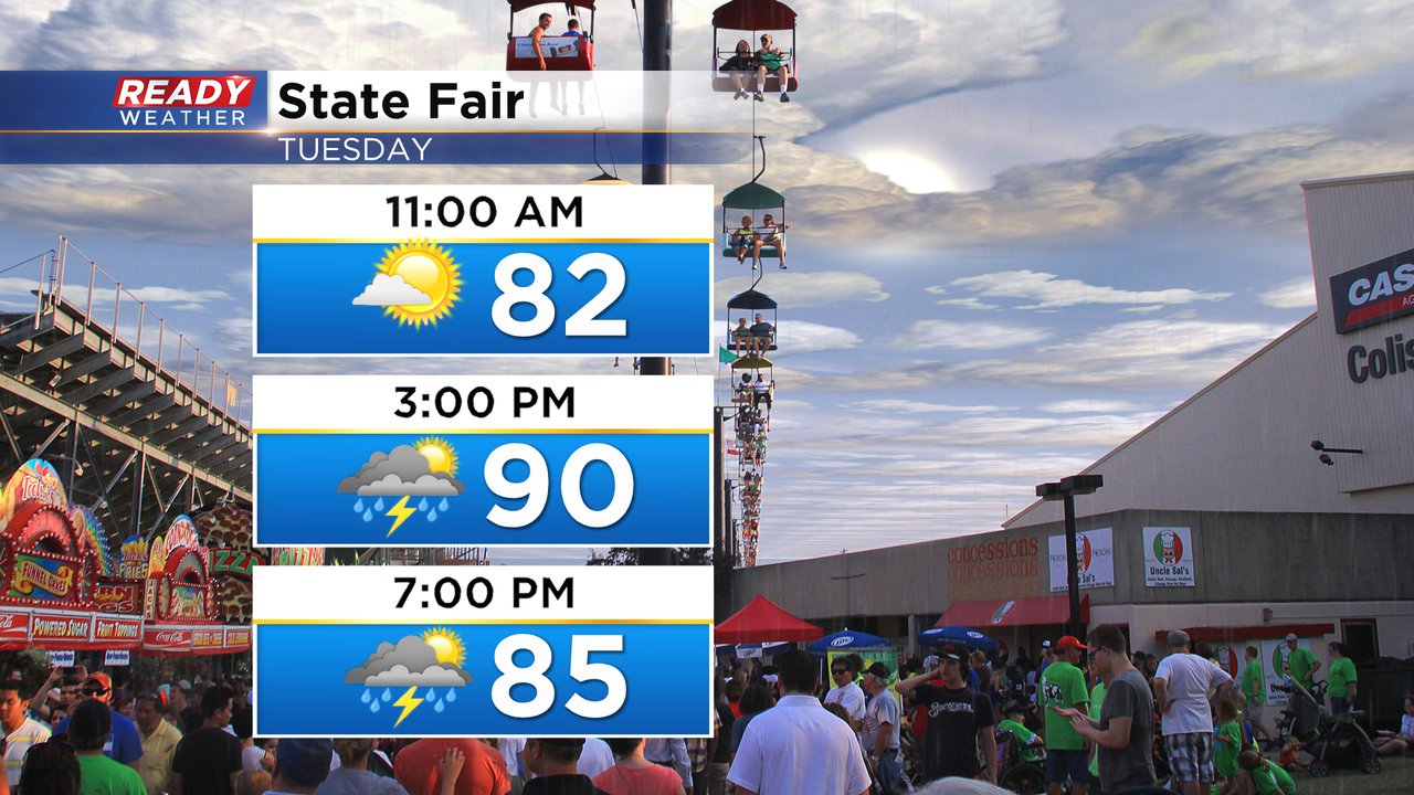
Make sure you have a way to get warnings today and if you are going to the State Fair drink plenty of water and no what sturdy building you need to go into if storms roll in.
------
Posted: 6:28 a.m. August 10, 2021
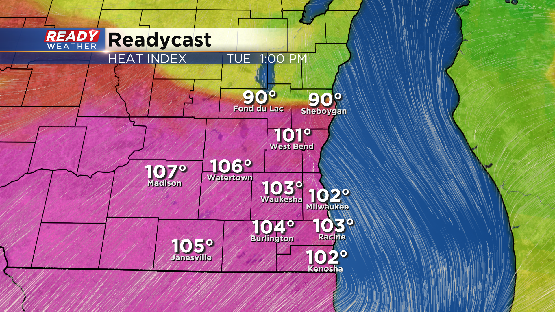
Get ready for a very hot and humid day in southeast Wisconsin. The temps will be similar to what we've experienced numerous times this summer with highs in the low 90s, but the humidity will be miserable. Dew points Tuesday and Wednesday will likely surpass 95* which is something we usually only see once or twice during a summer in Wisconsin.

That miserable humidity will push the heat index values (feels like temps) over 100* in many communities. It will feel as warm as 105* in some locations. There is some uncertainty on the temps due to the timing of storms. If storms arrive in the early afternoon it could halt some of our warming.

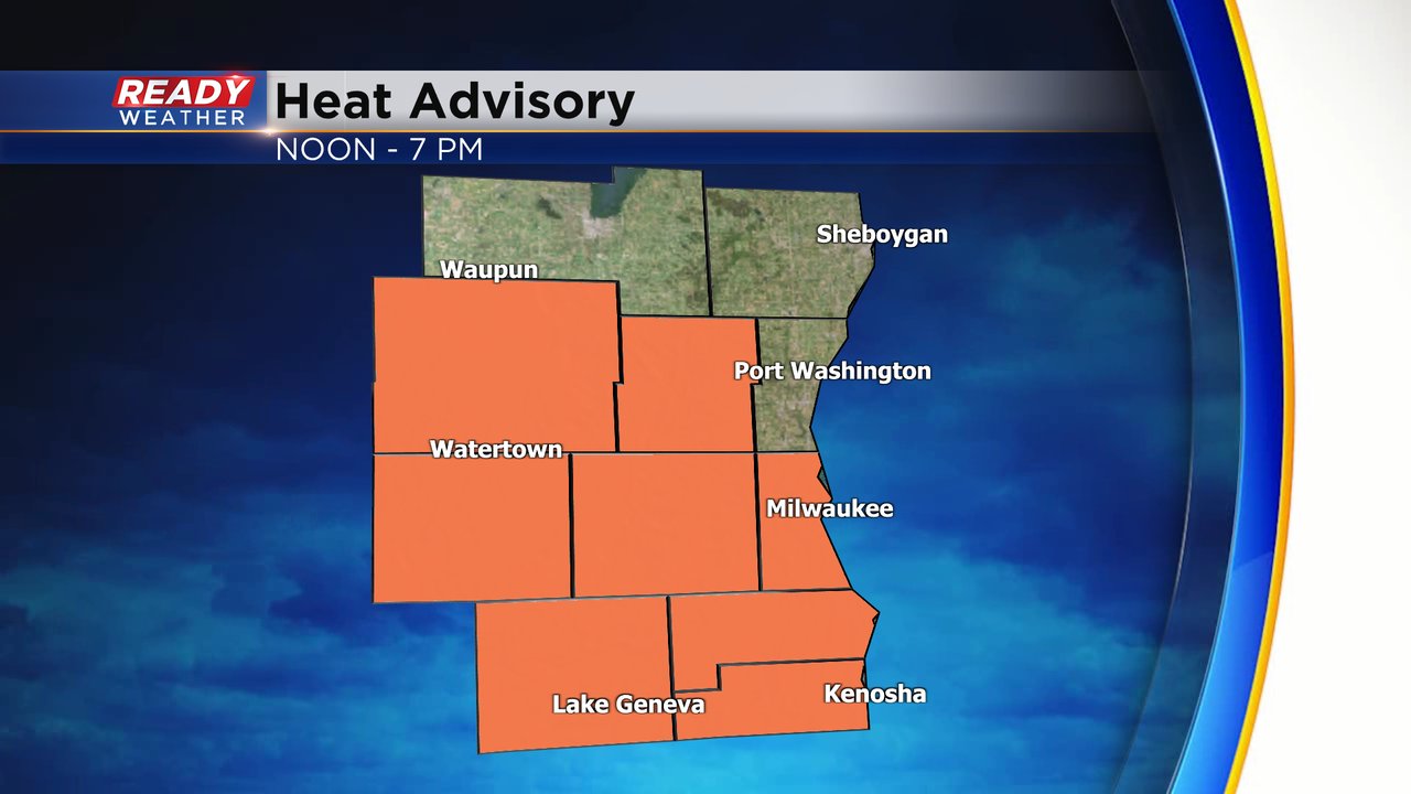
The hot and humid weather has sparked a Heat Advisory for most of southeast Wisconsin. Everyone in orange on the graphic below is under that advisory which runs from noon until 7 PM.
All of this heat and humidity will lead to the chance for some severe storms. There's no big front or force for the storms but thanks to rain and storms on Monday there are a lot of leftover boundaries for the storms to fire along. The timing of the storms is a little uncertain but could be as early as the early afternoon or as late as after sunset.
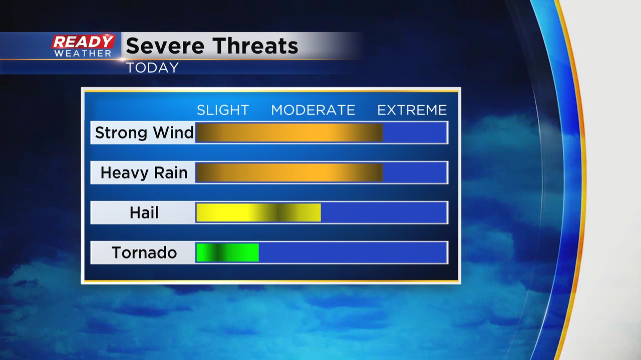
Any storms that do fire will likely be strong to severe. Most of southeast Wisconsin is under an "enhanced" risk for severe weather which is level 3 of the 5 severe levels we have.
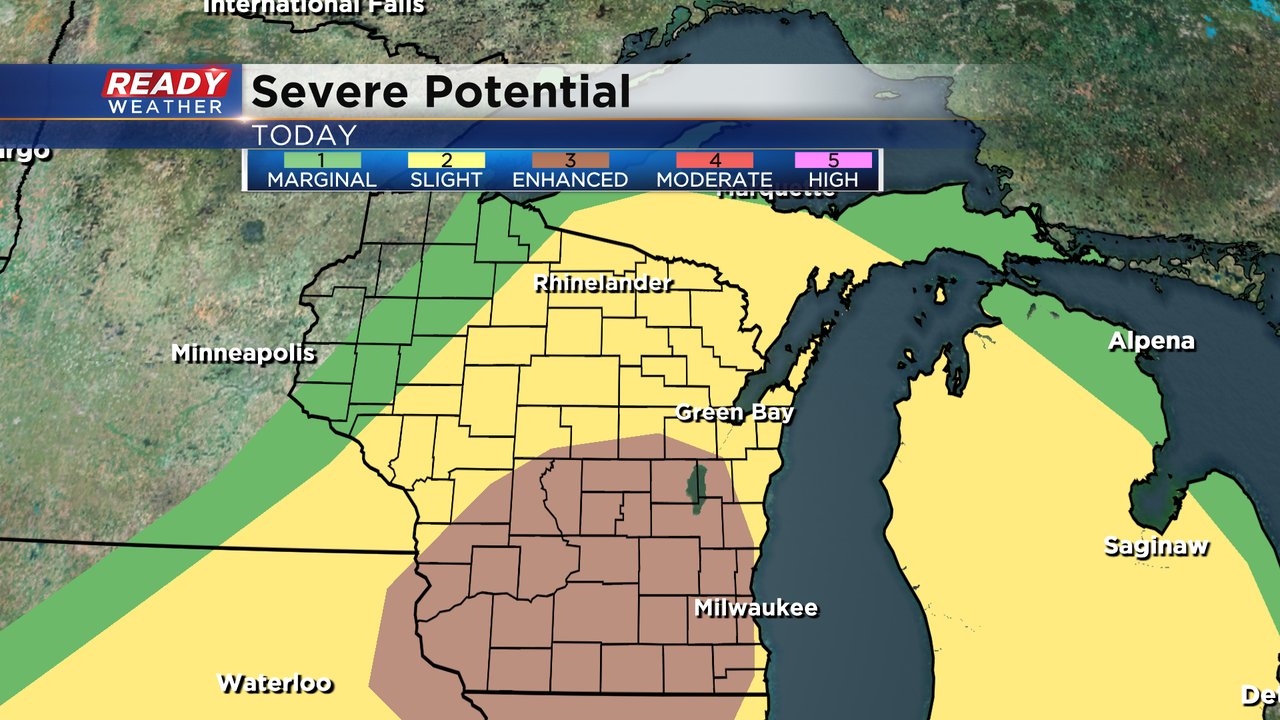
The biggest severe threat will be damaging wind. Some heavy rain will also be possible. Hail and tornadoes could happen when storms first fire but that risk decreases as the evening goes on.
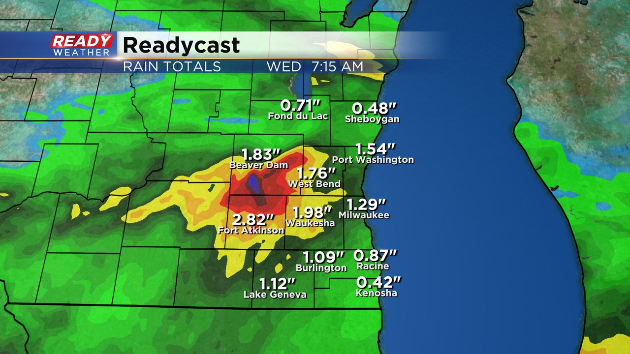
Rain totals will really depend on who sees the biggest storms. I think everyone gets at least a half inch of rain but strong storms could lead to one, two or even three inches of rain. If the heavy rain falls in the wrong areas (those that saw flooding over the weekend) we could be looking at more flooding concerns.
Download the CBS 58 Ready Weather app to see how hot it gets where you live, track the storms and get alerts if severe thunderstorm warnings are issued.