Evening Update: Slight chance for more storms.


Most of the atmosphere remains quiet this evening. The short term models still have a chance for a shower or storm before sundown; however, they will remain very isolated if they actually develop.
The bigger story will be the temperature drop for Friday. Highs will be 25 degrees cooler with temperatures in the 50s with scattered showers on strong northeast winds.
3:00 PM Update:
The MCS that rolled across the area has now moved well south. There remains some outflow boundaries across southeastern Wisconsin for some more storms to pop on; however, the majority of the storms are done for the day.
There remains a slight chance for a few more storms to pop late this afternoon into the evening. Storms that do develop could become strong to severe.
______________________________________________________________________________________________________________
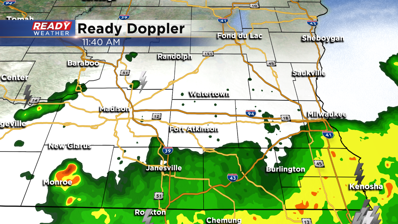
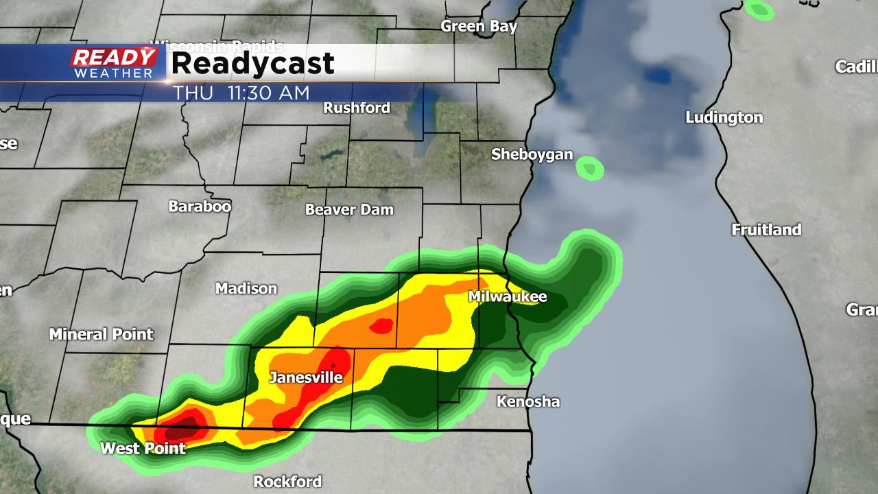
Updated: 11:45 a.m. May 16, 2019
Round one of rain is exiting the area.
Updated: 9:50 a.m. May 16, 2019
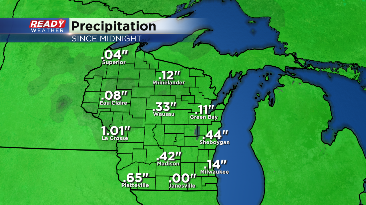
Steady rain with some storms is currently pushing through southeast Wisconsin. Expect the rain to continue through 1 p.m.
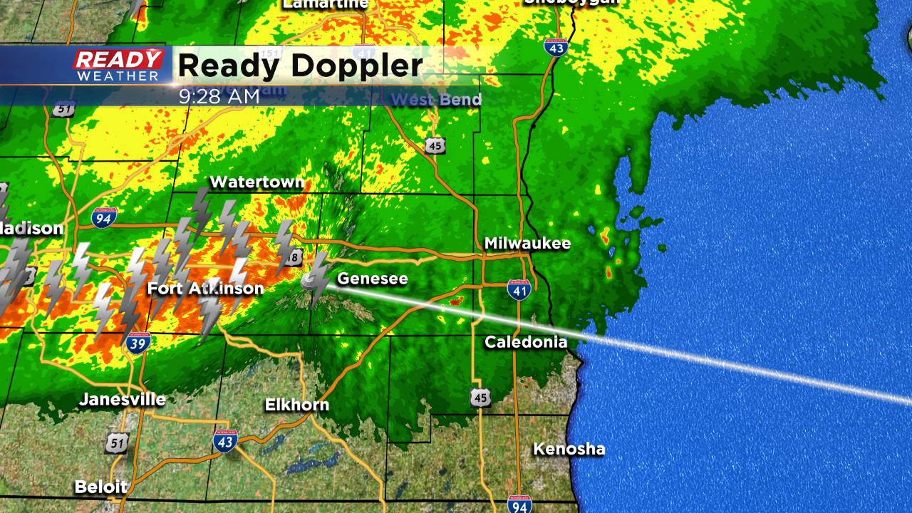
Storms have stayed below severe limits so far, but another of storms is possible this evening. The likelihood of the second round is less, but if storms do form they could be strong to severe. Good afternoon sunshine would increase our chance for storms.
------
Updated: 7:44 a.m. May 16, 2019
Some rain with a few isolated storms are currently moving through Fond du Lac County and pushing southeast. The area of heaviest rain and storms is around the Dells and may miss most of our local area. Storms are still on track to move through between 9 a.m. and 1 p.m.
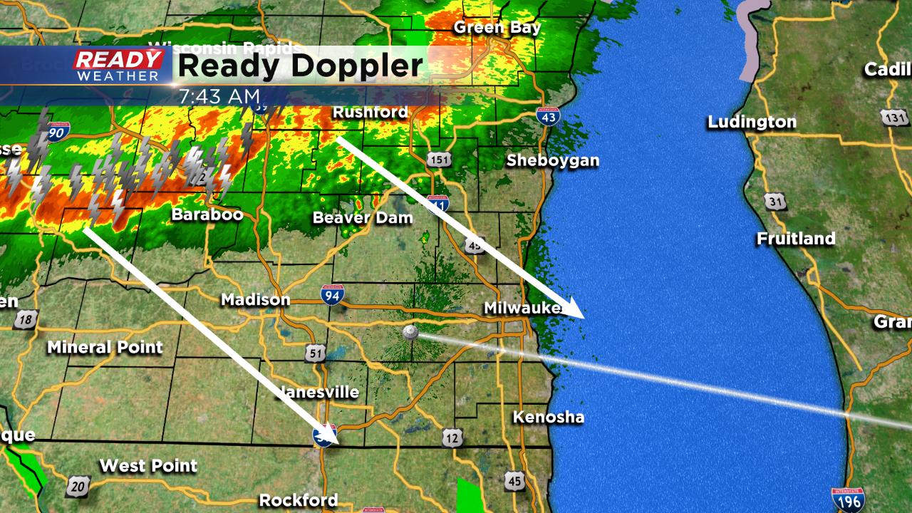
A dry stretch is expected for most of the afternoon with a chance for showers and storms during the evening.
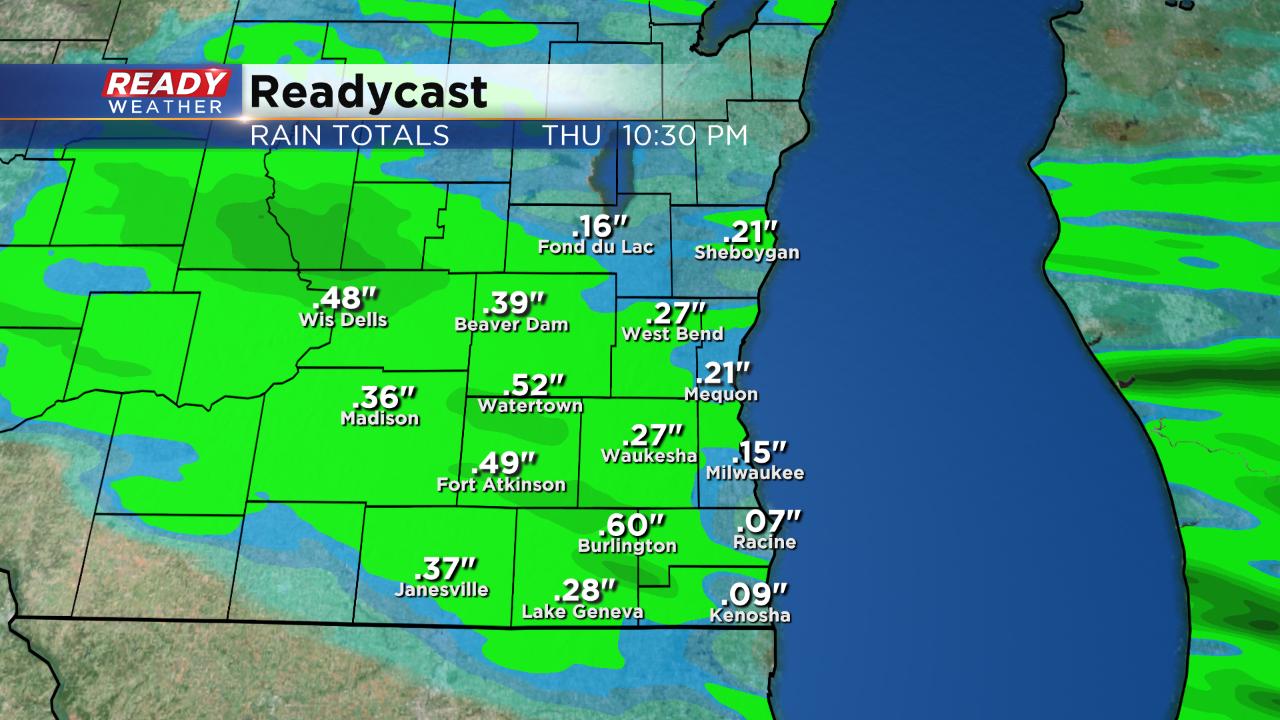
Today's storms could drop a soaking rain, but multiple rounds of heavy rain will be possible Friday, Saturday and Sunday. By the end of the weekend some spots could pick up close to 3" of rain.
------
Posted: 5:37 a.m. May 16, 2019
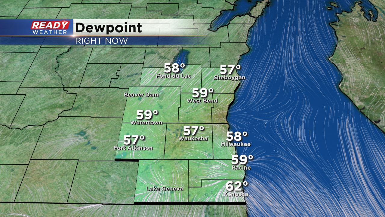
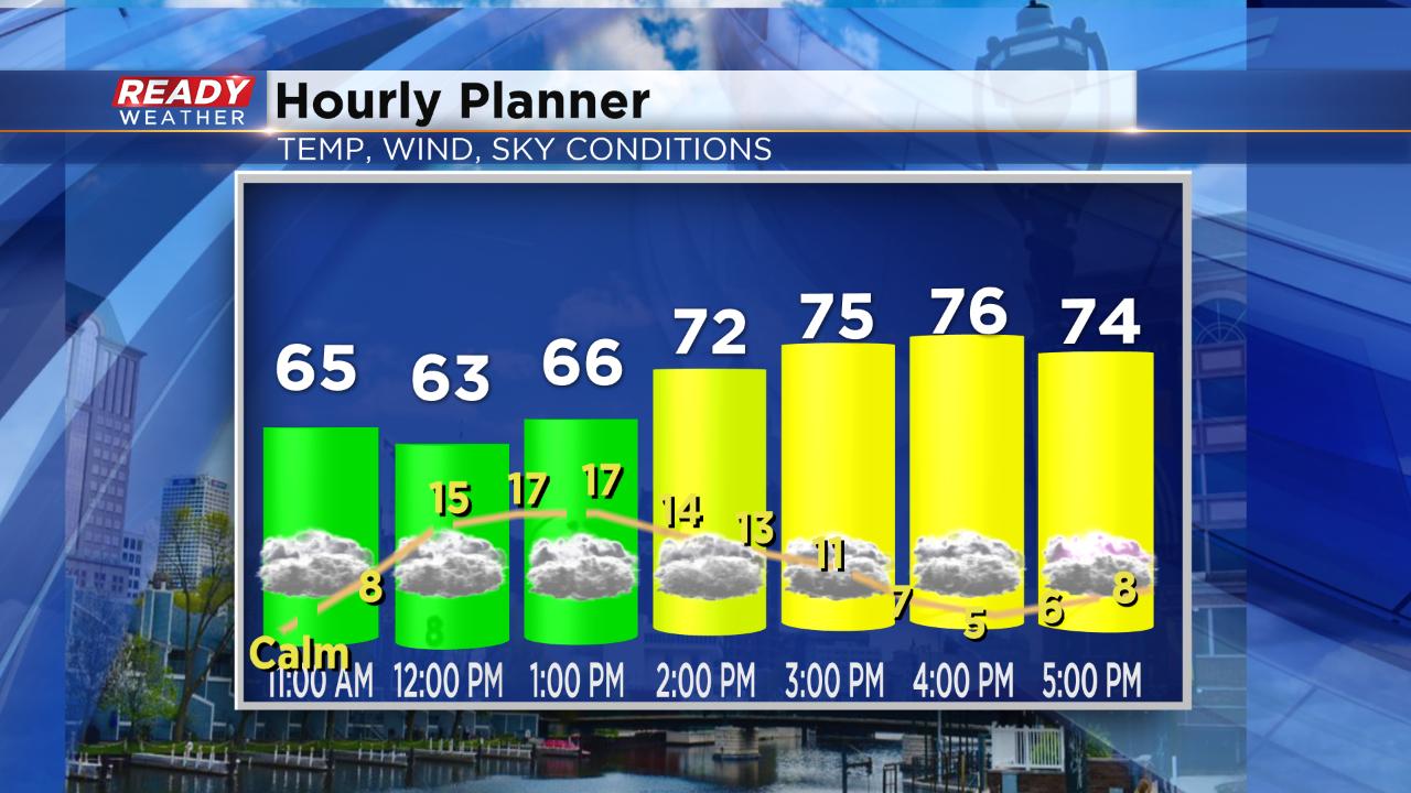
After two straight days in the 70s we are expecting a third on Thursday, but all of that heat and even a touch of humidity will give way to showers and storms. Two rounds of storms will be possible on Thursday. The first arrives Thursday morning between 9 a.m. and 1 p.m. with the second possible this evening.
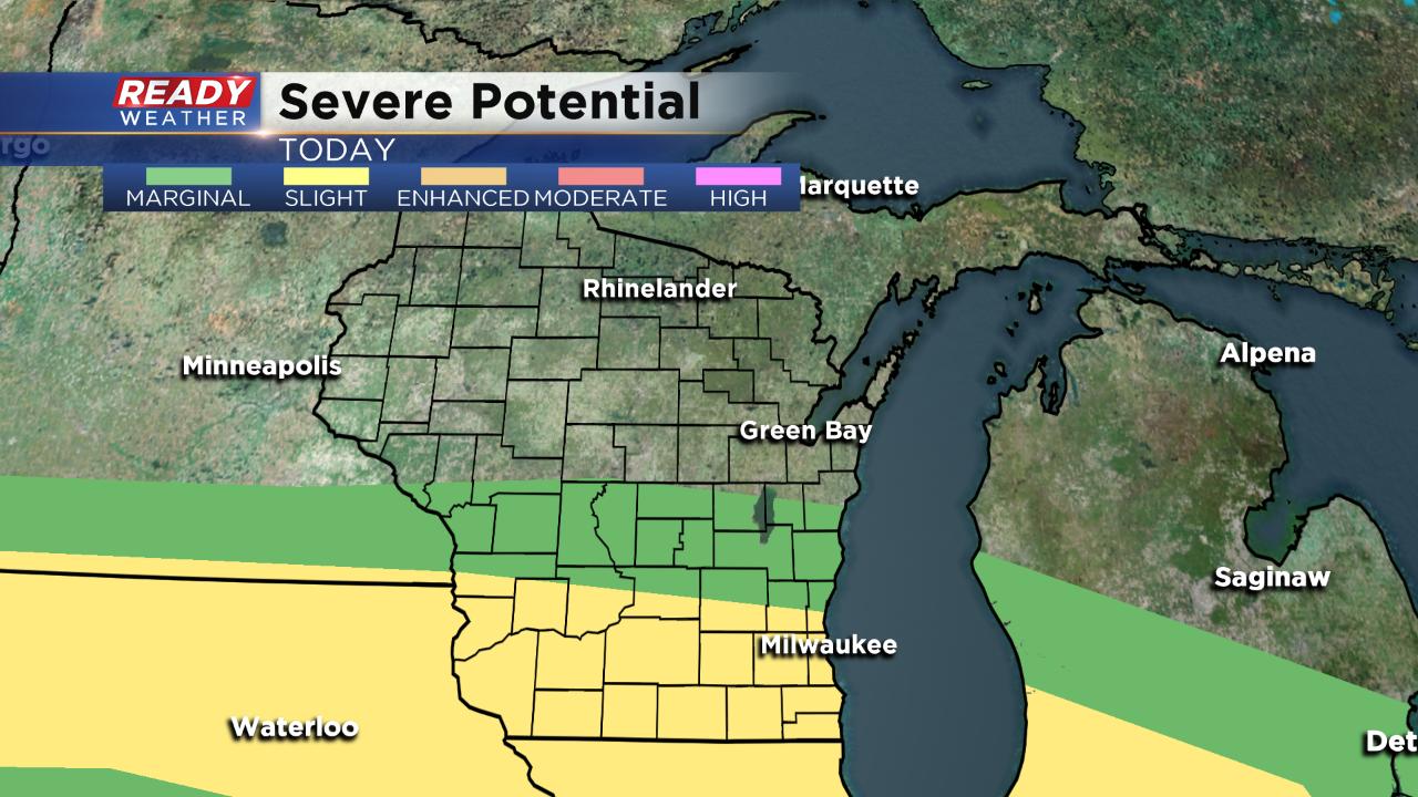
Southern Wisconsin is in the "slight" risk for severe weather. The morning round will be the better chance for severe storms, but an isolated strong storm may be possible in the afternoon.
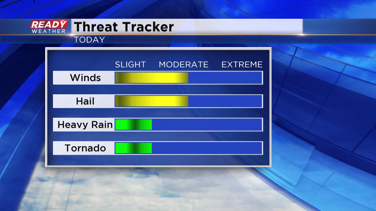
The biggest threats if severe weather happens will be damaging wind and some hail. Heavy rain may be possible but flooding rains aren't likely. The tornado risk is low.
Download the CBS 58 Ready Weather App to track and storms as they develop and receive warnings.