Two rounds of storms could bring minor flooding and severe weather
The wet weather continues in southeastern Wisconsin as a boundary system grabs hold of the Midwest and Great Lakes. This boundary will keep rain and storms in the forecast this morning, then bring more back in the picture by later today and tonight.
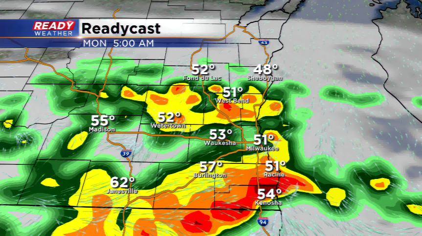
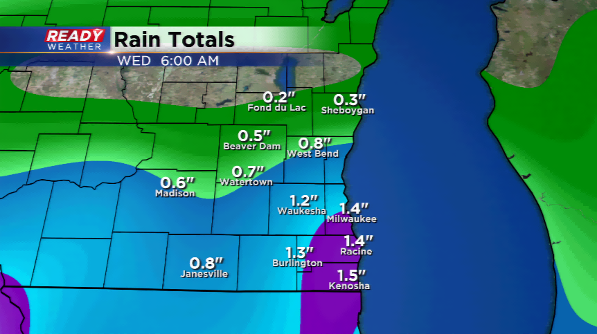
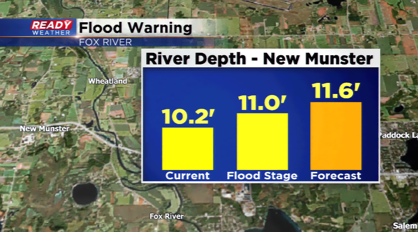
Round one of storms will see training; redevelopment of showers and storms over the same areas. This will be the focus the next few hours to determine how much rain will fall. Remember, it was a very rainy weekend so flooding could be a problem. The Fox River near New Munster could hit minor flood stage by late this morning or this afternoon. Most storms that fire this morning will produce heavy downpours, lightning and hail.
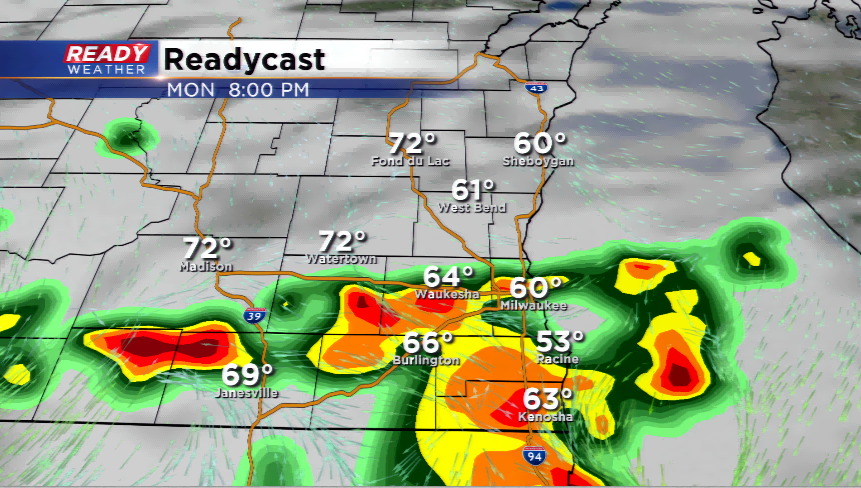
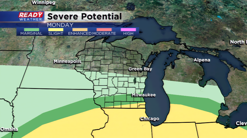
Another line of showers and thunderstorms will develop in Iowa this afternoon, then the activity will push eastward. This will be another round of heavy rainfall, lightning, and possibly, large hail. The Storm Prediction Center does have a marginal risk of severe weather for Milwaukee south, and a slight risk of severe weather for the far southern branch of our viewing area.
When all said and done, the region could easily pick up an additional 1”-1.5” of rainfall, with locally higher amounts. Make sure your drainage is clean, sump pump is working, and do not travel through flooded roadways.