Tuesday's Winter Storm Update: 10 PM
Just 48 hours after record-shattering 60s, snow will be back in the forecast for Monday night into Tuesday.
The Tuesday morning commute will likely be the hardest hit with moderate steady snow moving in for the duration of the commute before becoming more scattered Tuesday afternoon. That being said, the evening commute will likely be slick and snowy as well. Lake enhanced snow will be possible from Sheboygan all the way to the border with strong northeast winds. That could increase totals for folks right along the lake. Best timing for that will be from 5 am till 8 am.

As mentioned above, snow totals have been shifting the past 24 hours, but our forecast indicates Interstate 94 from Milwaukee to Madison will be the dividing line between minor snow and moderate snow. Those north of I-94 will likely see less with 1-3"+ possible while those south of I-94 should pick up more with 4-8"+ possible. Isolated higher amounts are possible across our counties that border Illinois. Sheboygan and Ozaukee counties will likely be closer to 3 inches of snow.
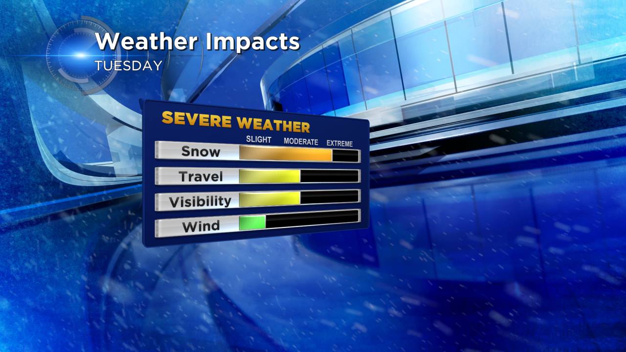
Besides snow, wind will be on the breezy side with gusts to 30 mph. Visibility will be reduced, especially along the lake. Travel will be an issue Tuesday morning with temperatures in the lower 20s. Heavier snow will have a good chance of sticking to the roads.

We could break a daily snowfall record in Milwaukee tomorrow. Keep in mind we average 7 inches of snow for the entire month!
As always download the CBS 58 Weather App and follow updates on the CBS 58 Weather Blog for the latest forecast information.
