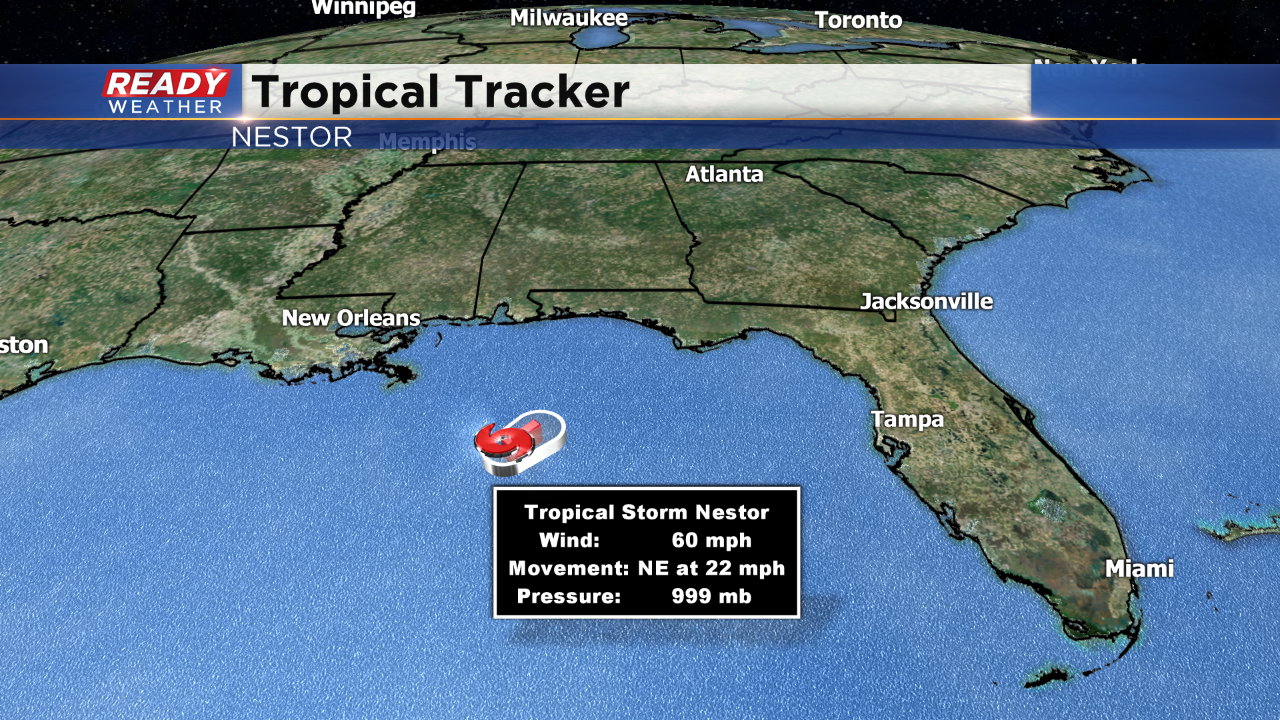
It's been a while since we've tracked the tropics. But the last couple days we've had our eye on Tropical Storm Nestor, spinning out in the Gulf of Mexico. Currently, Nestor is a Tropical Storm with sustained wind at 60mph. Here's the current info from the National Hurricane Center:
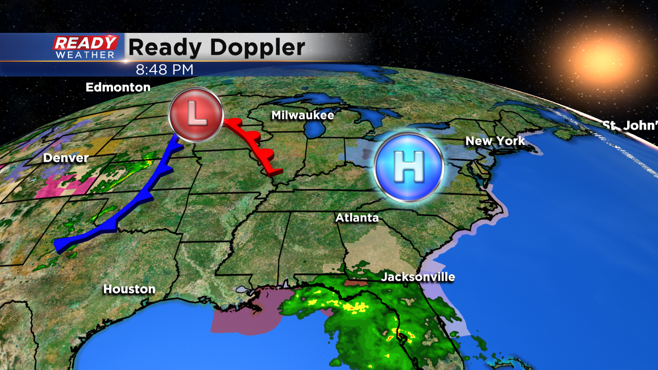
This will be a quick moving storm so that will help lessen the impact of high surf and flooding rains. As a cold front is parked just west of the Mississippi River and moving east, that will help continue to nudge this tropical storm to the east.
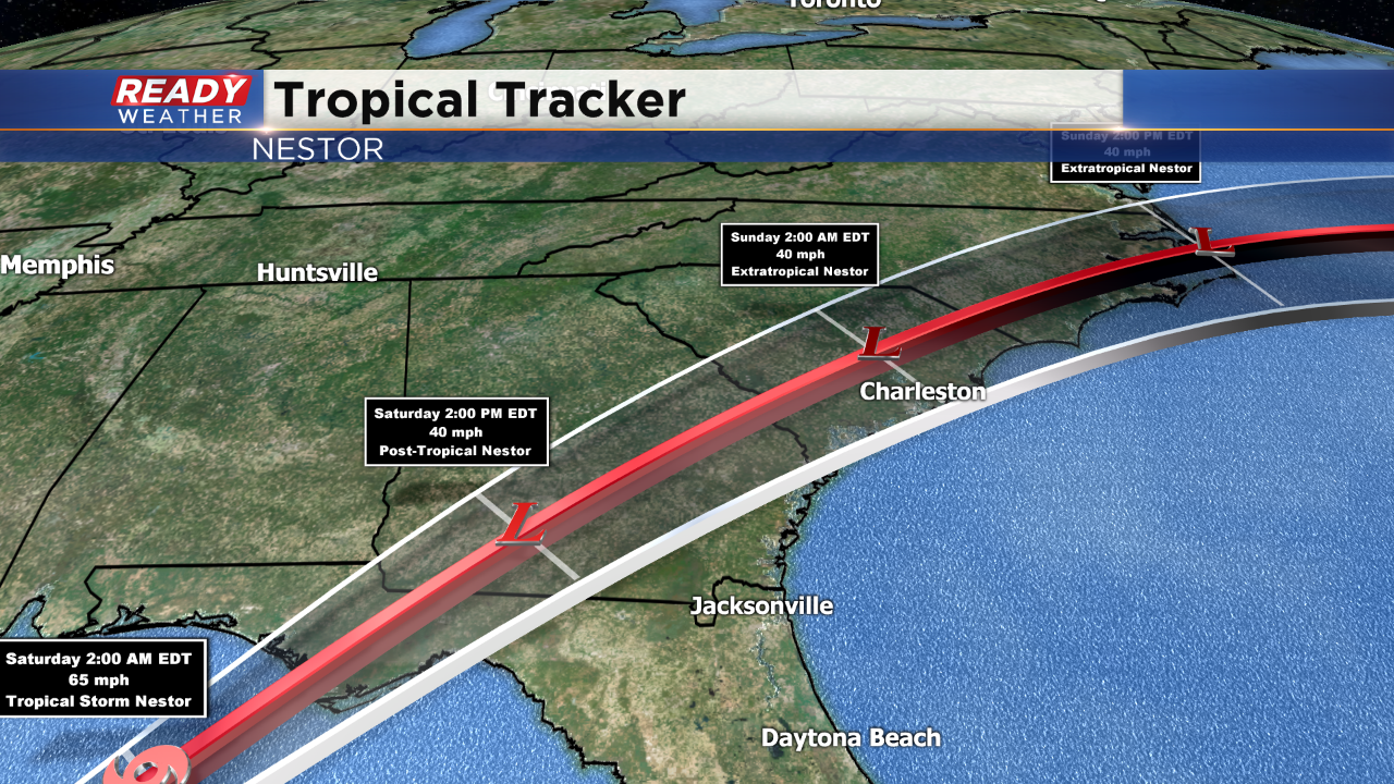
At this rate, only slight strengthening is expected before landfall. The storm should flow over the land already by tomorrow afternoon.
As it nears the coast forecasted winds of 65 mph will keep this under Hurricane status. A category one hurricane needs winds of 74mph of higher. That doesn't appear to be likely with this storm, which is good news for those along the Gulf Coast. They will however deal with strong wind and as much as 2-5" of rainfall.
As you can see by late Sunday the storm, post tropical at that point, should move out into the open waters of the Atlantic.
I'm meteorologist Rebecca Schuld