Tracking weekend winter weather


All eyes are to the southwest as a winter storm takes shape. This system is set to move northeast over the next 48 hours bringing a lot of changes across southeastern Wisconsin by Friday and Saturday.
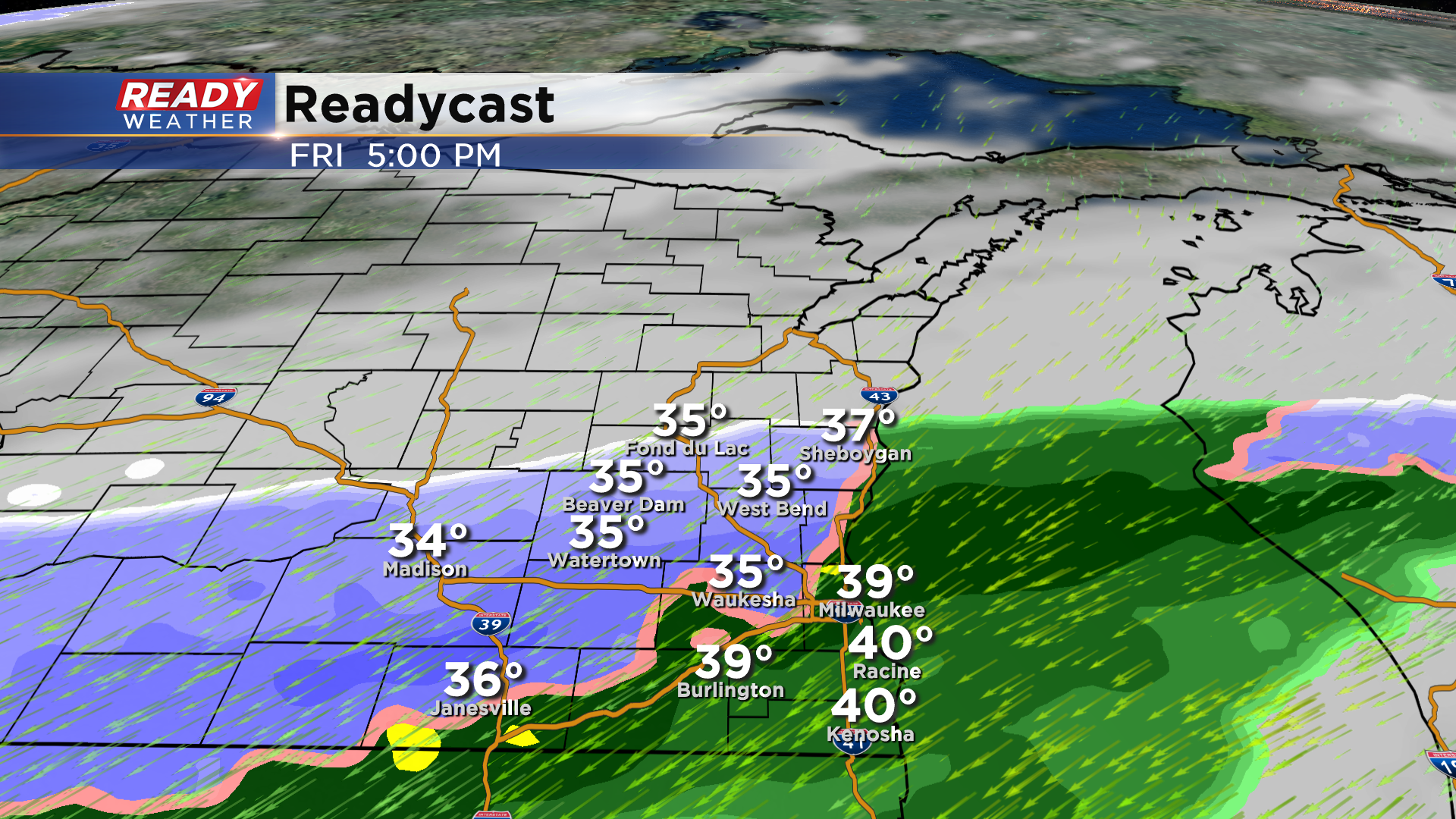
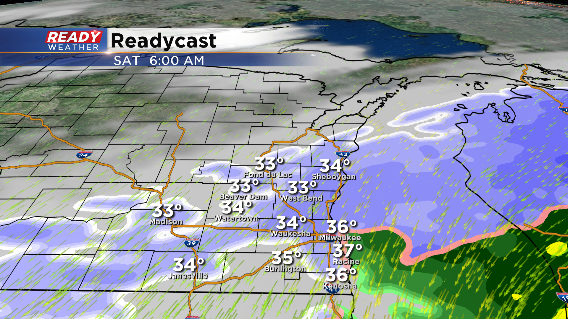
Tomorrow we expect light rain to develop across the area by the afternoon into the evening. This rain will start to mix with snow west of the lake by Friday evening. With a northeast wind the lakefront will likely toggle between rain and snow Friday night before turning to all snow Saturday morning. Winds on Saturday are expected to quickly shift to the north as the back edge of the snow moves through.
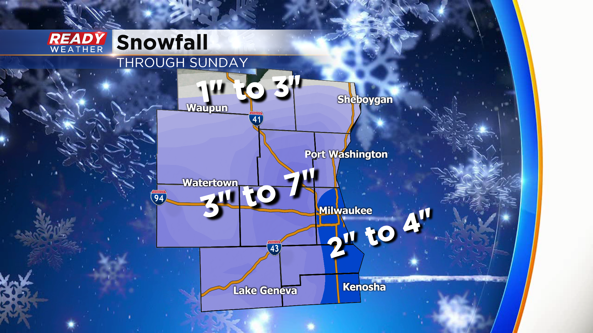
Areas north of Milwaukee will have a better chance to experience more snow across Ozaukee and Sheboygan counties. Fond du Lac and northern Dodge counties will be close to the edge of the snow, so totals there are closer to 1" to 3".
Most areas west of the lake will experience a swath of 3" to 7" inches of heavy wet snow. Along the lakefront from Milwaukee to Kenosha is the toughest to forecast with that northeast wind. Snow could end up just being a few inches; however, if it turns over faster, those totals could be locally higher.
The snow should end by Saturday evening with no impacts for Sunday. Roads will likely be slushy Saturday morning and afternoon, so use caution with travel! Snow and wind will reduce visibility on Saturday. Winds from 20 to 30 mph are likely!