Tracking a mix late Wednesday into Halloween. Snow accumulation likely


We are watching our next storm system very closely as it will likely impact Halloween plans. The storm is moving across the 4 corners region of the US tonight. Ahead of the storm, moisture is starting to work northeast, and will likely stay south across Illinois into Wednesday morning.
Scattered rain is possible on Wednesday, mainly south of I-94. Later Wednesday night there will be a bigger push of moisture that will be a mix of rain and snow.
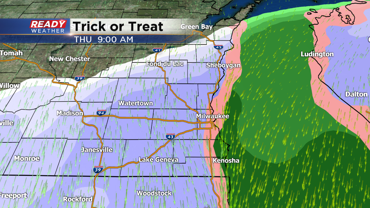
Winds will remain north to northeast early Thursday morning, and that will likely keep the lakefront more of a mix, while areas west change to snow.
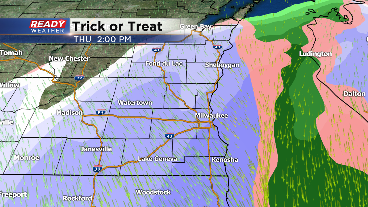
Most of the models are showing all snow throughout the morning and afternoon on Thursday. This is going to be a wet snow, and will also be blowing on strong winds. Low visibility could be an issue.

Snowfall totals for now look to be a few inches lakeside thanks to the warmer lake waters; however, higher totals are expected west of the lake.
Snow will wrap up early Thursday evening, but plan on the 30s with wind chills in the 20s for Trick or Treating!