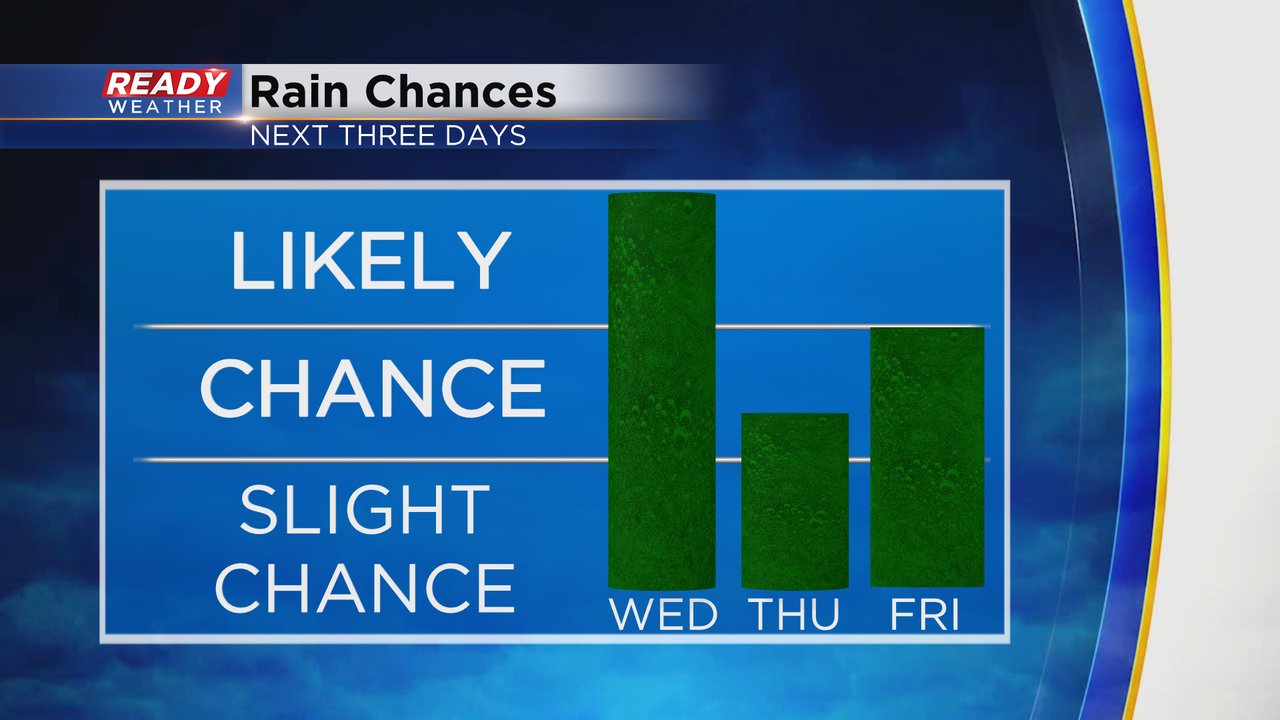
A few light showers rolled through southeast Wisconsin early Wednesday morning from 2-5 AM. It didn't amount to much and those that saw it only had enough to wet the pavement and drop a few raindrops on the cars. But more rain is on the way! The mid-morning to early afternoon hours from about 10 AM - 3 PM still look best for an area of steady rain to roll through southeast Wisconsin. The latest model trends have kept most of this steady rain south of I-94 so our northern counties might only see a few showers out of this round.
Here's a radar image that will update with time:
A few isolated showers will be possible again on Thursday but Friday could feature some steady rain especially in the afternoon and evening. Saturday and next Monday also feature rain chances.
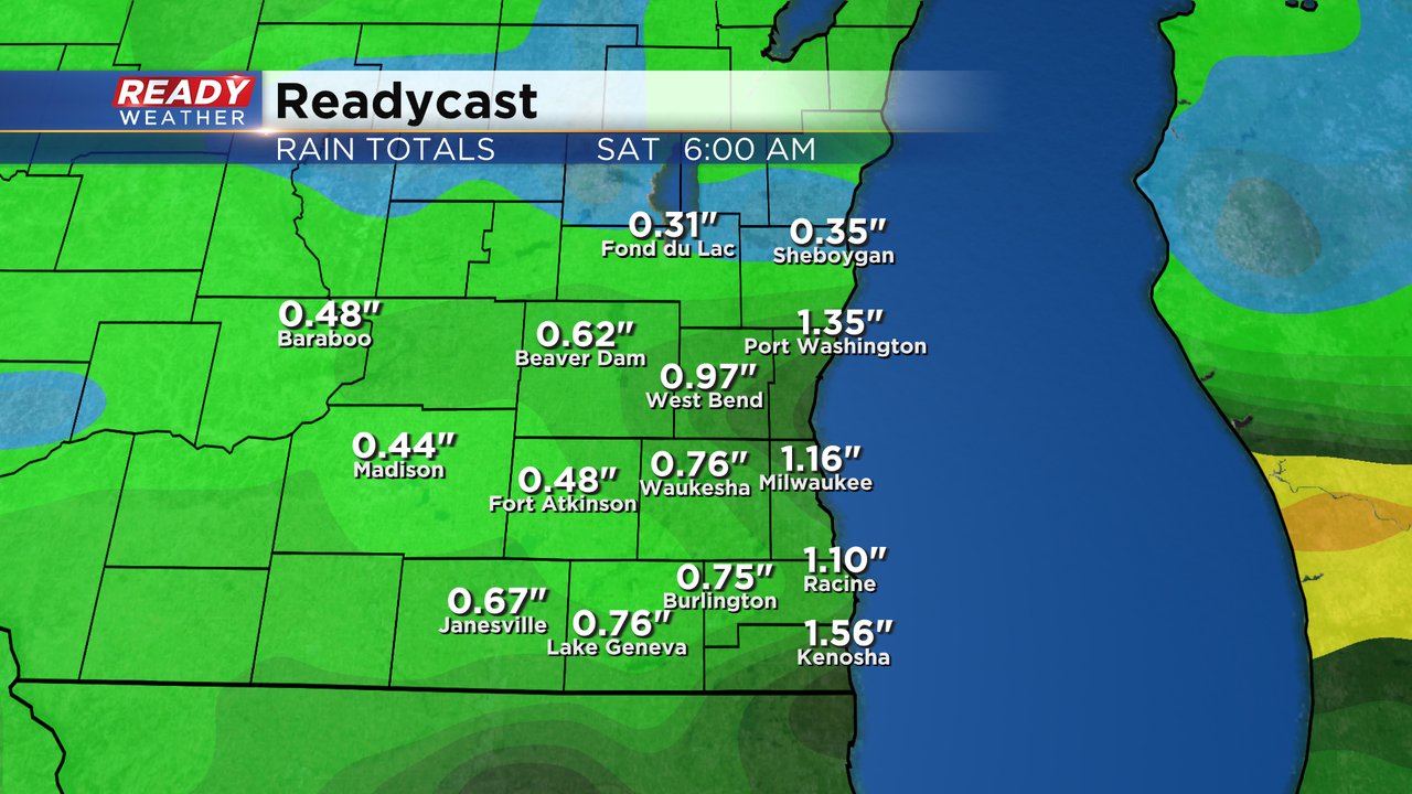
Up to an inch of rain is possible Wednesday especially in areas near the IL border. Any showers or storms on Thursday only amount to a tenth or quarter inch of rain but Friday could feature another soaking rain. By Saturday morning most of southeast Wisconsin could see 0.50-1.50" of rainfall with more chances during the day Saturday and again next Monday.
Download the CBS 58 Ready Weather app to track the rain chances the next few days.


