We've flipped the calendar to September and so the season of Meteorological Fall begins! It's a season of transition with falling temps, and at the extreme, the first flakes flying. But let's not get too carried away, there's plenty of pleasant weather days ahead! For starters, NOAA's Climate Prediction Center is easing us into fall, with above average temperatures expected across the board.
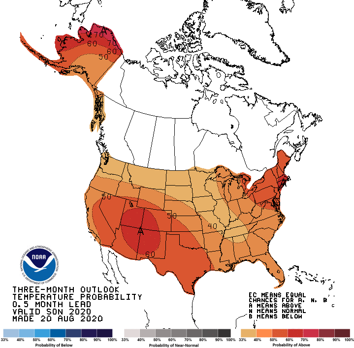
Locally, we are looking for about a 40% chance of warmer than normal temps the next three months. For perspective, here's how average highs shake out during this timeframe.
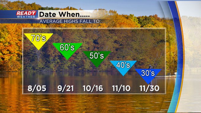
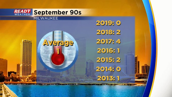
As you can see the downslide is a bit abrupt, especially later in the period. But that doesn't mean we won't feel hot days. In fact, all but four days this month still hold record highs in the 90s. One day in the 90s is average during September. Here's a look a recent history when it comes to September 90s.
On the flip side, we introduce our first record lows in the 20s this month. That's chilly air we haven't felt since April 16th, the last time we fell to the 20s dropping to 26 degrees. If you're counting, that's 140 days ago! While most all of the precipitation this month falls as rain, check out the handful of years flakes were flying.

Nothing measurable in the books, but enough to remind us winter weather is looming in the not so distant future!
I'm meteorologist Rebecca Schuld
