


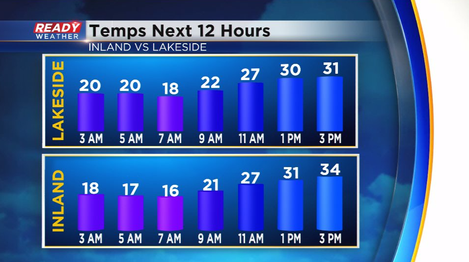
It was nice to end the weekend with abundant sunshine even though temperatures only warmed into the upper 20s to low 30s. Monday will also feature plenty of sunshine, but the chilly airmass will remain in place. Temps will likely top out in the mid 30s away from the lake, but a lake breeze will hold temps in the low 30s lakeside.
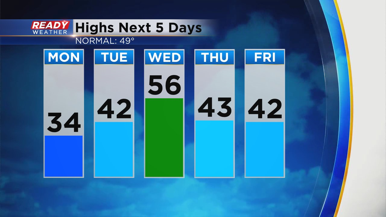
Monday will be the chilliest day of the week, but most of the week will be below normal with highs in the low 40s. Wednesday is the exception as strong southerly winds boost temps into the 50s. However, it'll also be the soggiest day of the week.
Clouds will increase during the day on Tuesday with showers rolling into the area late afternoon - early evening ahead of a warm front. There may be a brief wintry mix of sleet and wet snowflakes initially before changing to all rain heading into Tuesday night.
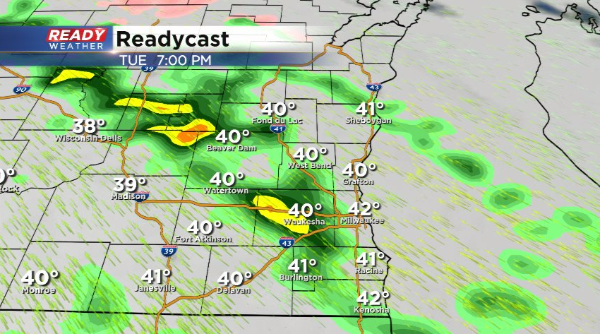
As the low pressure system tracks into the state on Wednesday, rain will become more widespread. A few isolated storms are also possible Tuesday night into Wednesday, so don't be surprised if you hear thunder!
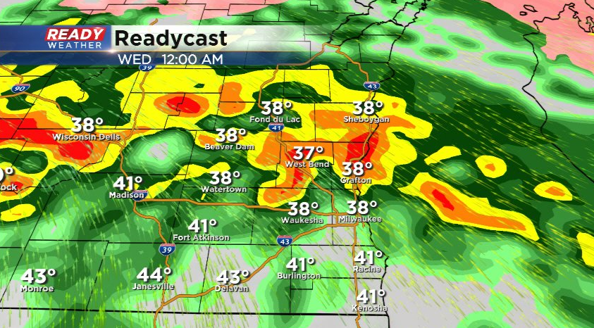
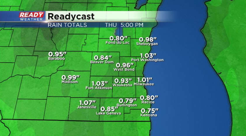
The heaviest rain will fall on Wednesday, but light, wrap around rain and snow showers are expected on Thursday. Overall .50-1" of rain looks likely across southeast Wisconsin, but higher amounts are possible.
Download the CBS 58 Ready Weather App to track the incoming wet weather.