Sun to Storms: An Active Week Ahead
How perfect was the weather we had over the weekend? Enjoy it today because it's ending on Tuesday. A cold front moves in from the Upper Midwest and literally parks itself across the area all week long and throughout the holiday weekend. This means an uptick in thunderstorm activity. Temperatures will stay mild with readings in the 70s during the day.
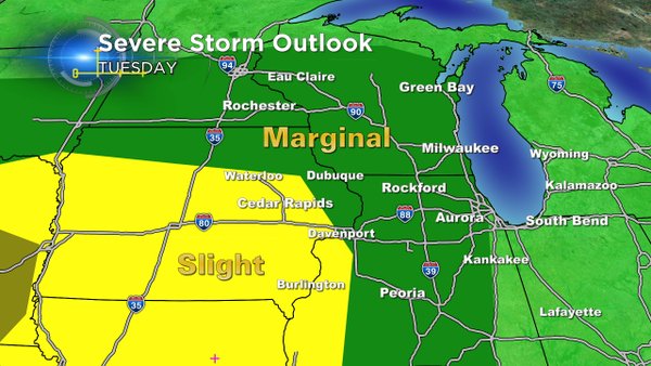
With the impending storms, heavy rain, hail, and damaging wind are all possible. The risk of strong to severe weather increases as well. It's hard to pinpoint exactly when the storms will fire or how gusty they'll be. At least for now, the severe weather threat should be well south and west of the area. The same holds for Wednesday.
But being prepared always helps. The free CBS58 weather app is a very useful tool. And one of the best things is you can put lightning detector on the radar. So you know where it's storming when you're on the go.
