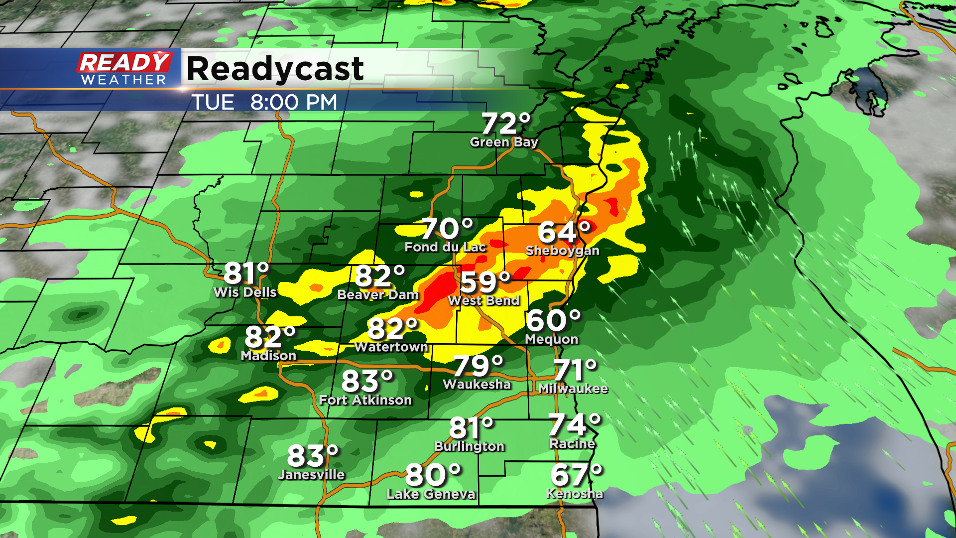
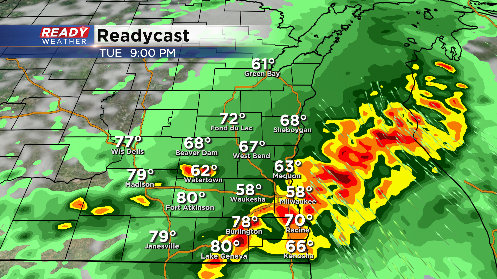
Tornado watch has been dropped for most of the area. Storms are slow to develop.


Updated: 7:30 p.m. May 10, 2022
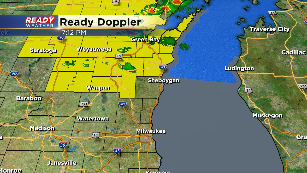
The severe weather threat continues to diminish this evening. Fond du Lac is the only remaining county under the watch until 9 pm.
Storms have been very slow to develop. There is a cap or a lid of warm air aloft. That cap is not allowing storms to fire right now. If that lid holds, storms will remain weak and isolated.
Isolated storms remain possible; however, they will likely be confined across the northwestern part of the area.
____________________________________________________________________________________________________________
Updated: 7:00 p.m. May 10, 2022
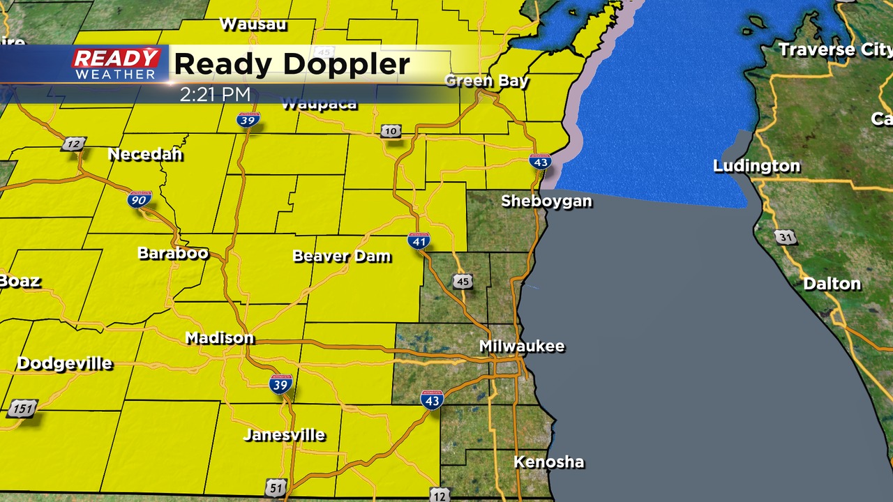
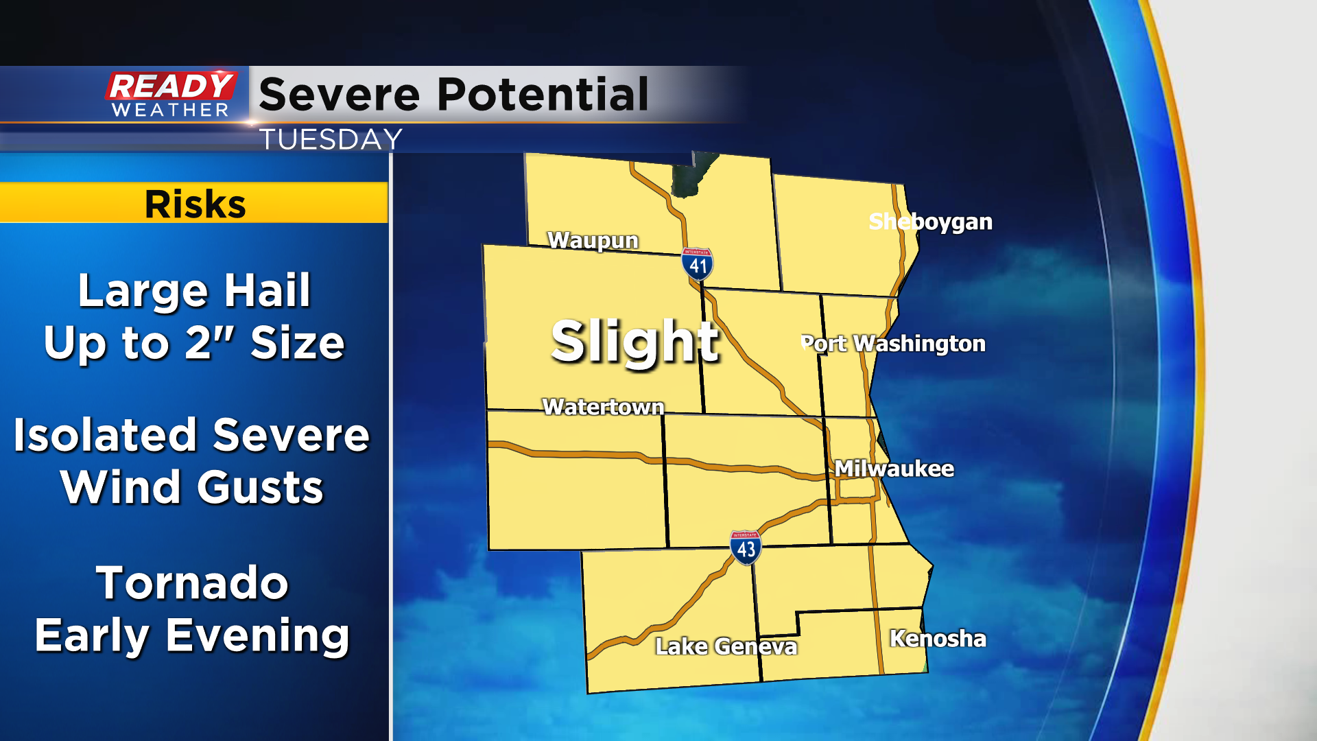
A tornado watch has been issued until 9 pm for our western areas. The best ingredients for strong to severe storms will be well away from the lake this evening. Isolated tornadoes, hail, and gusty winds remain possible. Widespread severe weather is not expected.
Storms are very slow to develop this evening. There is a cap or a lid of warm air aloft. That's not allowing storms to fire right now. If that lid holds storms will remain weak and isolated.
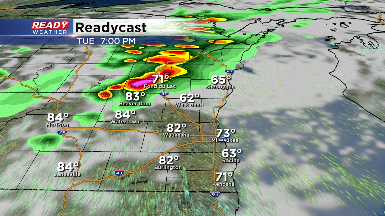
There remains questions on how far south the storms will build. Right now the greatest severe potential is across Fond du Lac, Jefferson, and Dodge counties. We will continue to monitor!
_____________________________________________________________________________________________________________
Updated: 1:30 p.m. May 10, 2022
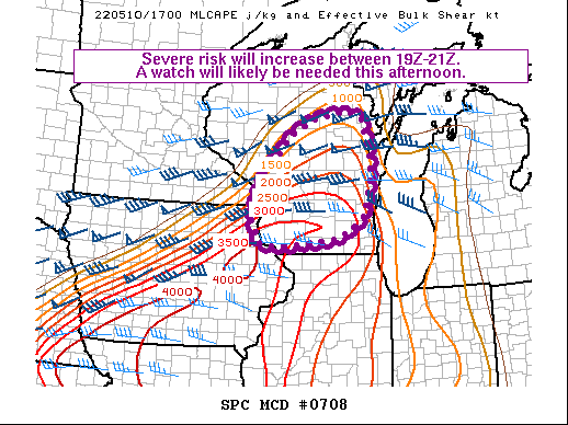
The SPC is expecting a watch to be issued at some point this afternoon, especially for the western part of the state. We do expect that some of our counties will be included.
Scattered storms are expected to pop over the next several hours to our west. These storms will make a run at us later this evening.
We will update this afternoon!
______________________________________________________________________________________________________________
Updated: 12:20 p.m. May 10, 2022
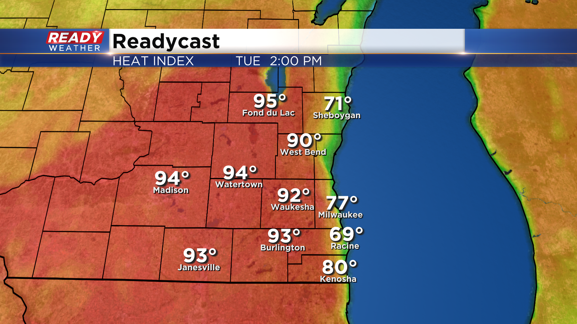
We continue to be on storm watch today. Leftover boundaries from decaying overnight storms should help fuel additional storms late this afternoon and through the first part of the night. On a quick side note, we are quite warm and feeling increasing more humid. While those are two essential factors needed for storm development, on their own may catch you off guard today if you are spending decent time outdoors. Combined the two features will lead to feels-like temps pushing the 90s so be sure to use some common sense to stay cool today.
Updated: 9:30 a.m. May 10, 2022
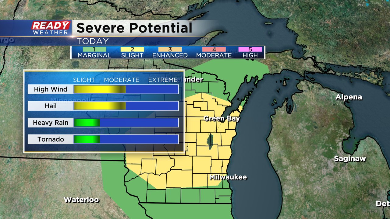
The latest severe potential update from the Storm Prediction Center now puts all of southeast Wisconsin down to the IL border in the Level 2 Slight risk for severe weather. The timing for storms remains the same after 5 PM through about midnight.
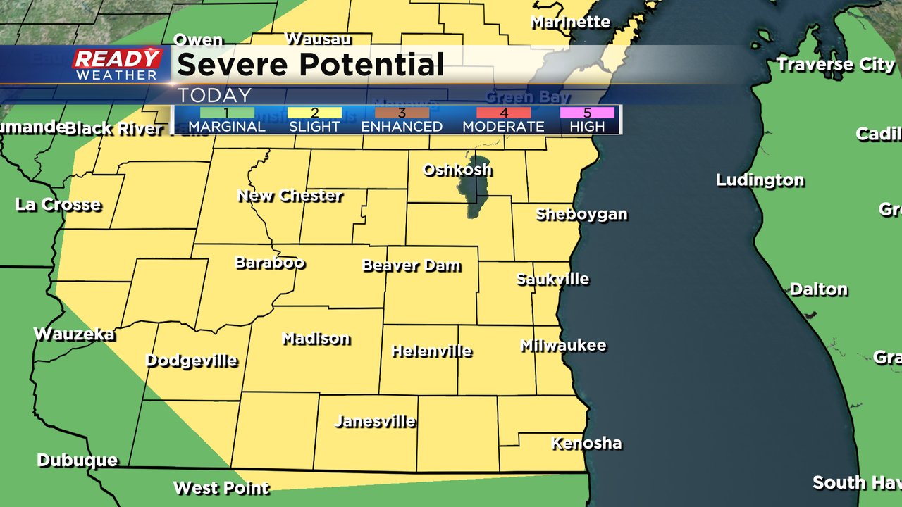
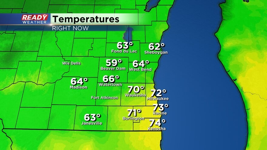
High wind and hail remain the big threats however some of our northern counties could potentially see a tornado. Temperature are already warming fast with most of southeast Wisconsin in the 70s as of 9 AM.
------
Posted: 6:52 a.m. May 10, 2022
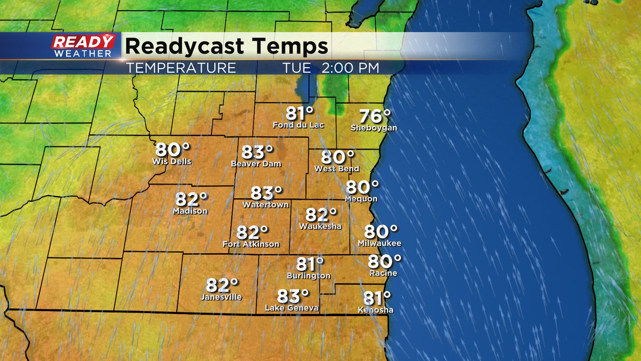
Tuesday will be the warmest day in a few weeks in southeast Wisconsin. High temperatures will likely rise to around 80* in many communities with some areas getting into the lower half of the 80s.
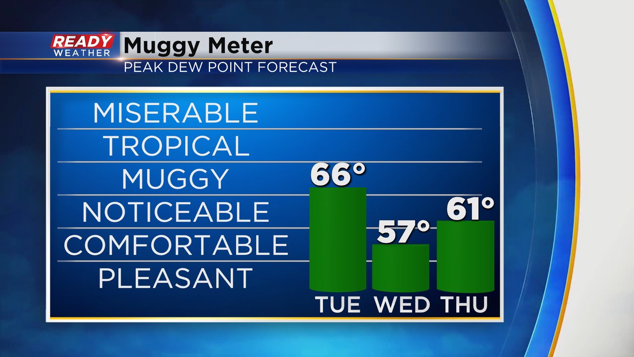
It will also be one of the first times that humidity plays a role this spring. Dew points on Tuesday likely rise into the middle 60s making it feel pretty muggy. The humidity will likely stay noticeable, at times, through the end of the work week.
All of that heat and humidity along with a decently sunny sky will provide a lot of fuel for thunderstorms to form Tuesday evening. The best timing for storms looks to be around 5 PM in our northern counties with storms moving south during the evening and exiting southeast Wisconsin into Illinois around midnight.

Most of our local counties, especially northern ones, are under a level 1 slight risk for severe weather. The storms will likely be strongest shortly after they form and then lose a little intensity as they form more of a cluster. Southern counties are in the level 1 marginal risk. Damaging wind and hail will be the main threats with any storms that form. An isolated tornado or two can't be ruled out when storms first storm in northern counties. Heavy rain is likely with any storms that do form.
Download the CBS 58 Ready Weather to track the storms with the interactive radar and get alerts if watches and warnings are issued.