Storms This Morning, More in the Forecast This Week!
---------------------------------------------------------------------------------------------------------
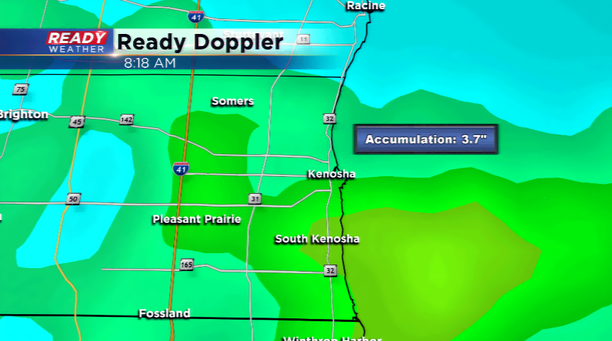
A complex of showers and t’storms raced through the southern tier of the state this morning. There were reports of flash flooding and big time rainfall in the Madison area was the story. Totals exceeded five inches in parts of the Madison metro. In southeastern Wisconsin, it was mainly lightning and brief heavy downpours as the storms slowly moved east.
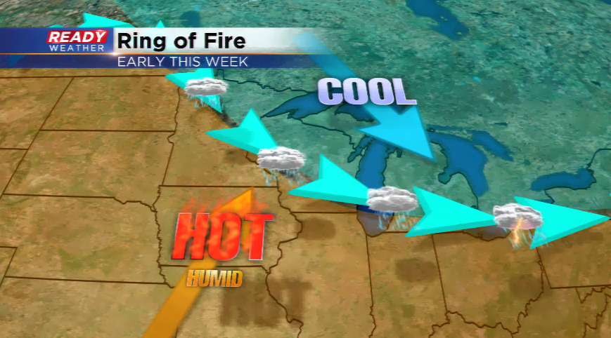
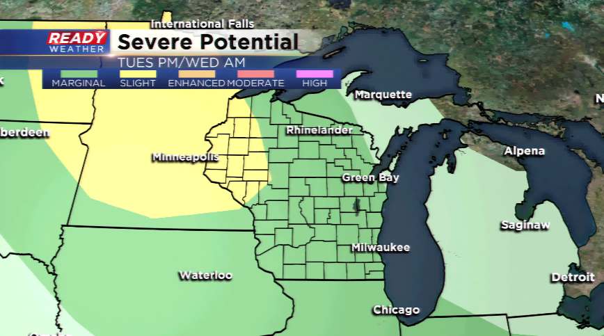
It could be an active start to the week with storms in the forecast. Scattered showers or storms are possible again throughout today. Another round of showers and storms are

Cooler air filters in by the end of the week with highs tracking back down below average in the upper 70s.
