7:45 PM Update: A flood advisory has been issued for Milwaukee and Waukesha counties until 9 pm. A flash flood warning has been issued for southern Walworth county.


A flash flood warning has been issued for southern Walworth county until 10:45 pm. That part of the county has been hit with 1" to 2" of rainfall. More rain and storms could create flooded roadways.

A flood advisory was just issued for Milwaukee and Waukesha counties until 9 pm. Locally heavy rainfall between 0.50" to 1.50" as fallen and could create some localized flooding. Stay away from flooded roads.
The best coverage for storms this evening will be along and south of 94, especially for our southern counties.
________________________________________________________________________________________________
The first round of showers and storms have passed. The severe thunderstorm watch continues to be removed; however, we aren't out of the woods yet.

Scattered rain and some storms have popped across western Wisconsin this afternoon and will move east this evening. While the overall severe weather risk is low, we can't rule out some stronger storms with gusty winds.
To the south the atmosphere is ripe across northern Illinpois. The storms could impact the double header at Wrigley this evening.
______________________________________________________________________________________________________________
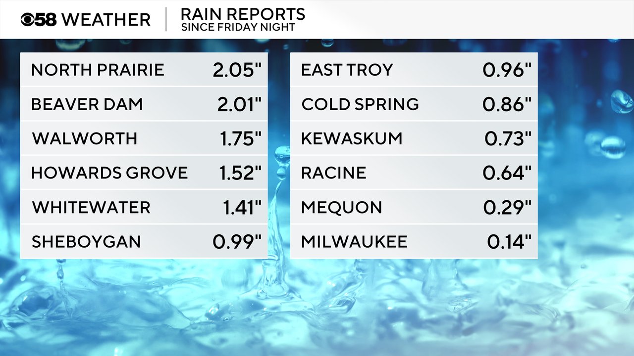
We had rain chances all weekend long. A few strong to severe storms did roll through southeast Wisconsin Friday night into Saturday morning with even more Saturday afternoon and evening. Some of the storms came with wind gusts near 60 mph, heavy rain, hail and some thunderstorm wind damage. A few locations saw around 2" of rainfall. Most of the strong storms stayed away from the flood stricken areas falling mainly in our northern, western and southern counties.
A few showers are out there Monday morning with more showers and storms likely Monday afternoon and evening. Some of the storms could be on the stronger side during the second half of the day. Best timing for stronger storms will be from Noon through the late evening hours.

Rain totals for most on Monday will be from 0.25-0.75" but a few areas could see 1" of rain or a bit more.

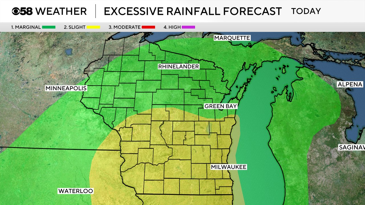
The Excessive Rainfall Outlook from the National Weather Service has all of southern Wisconsin in the Level 2 Risk for heavy rain. Even if we do see 1" of rain in flood stricken areas, most of the area rivers should be able to handle that water. Anything over 2" could be of concern if storms overperform.
Download the CBS 58 Weather app to track the chance for severe storms Monday and get alerts if any warnings are issued.