Southeastern Wisconsin the Target for Severe Storms Thursday
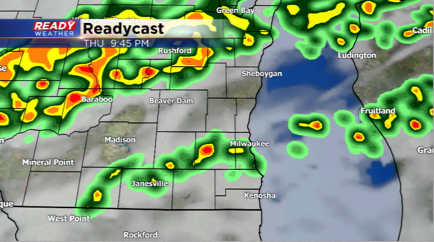
Tis the season for severe weather in the Badger State. It will be hot and muggy throughout your day on Thursday with highs in the lower 90s and dew points well into the 60s. With these types of weather conditions, along with upper-level dynamics, storms will fire as early as this afternoon and into the night. Some of these storms could turn strong to severe.
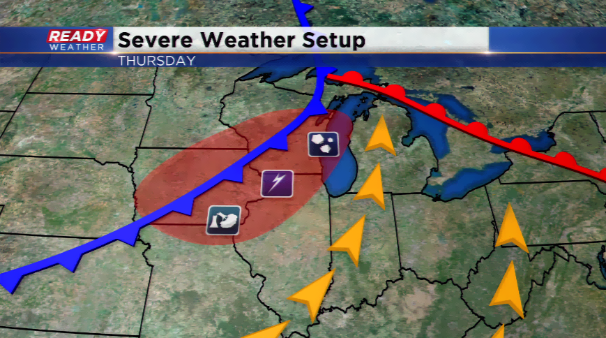
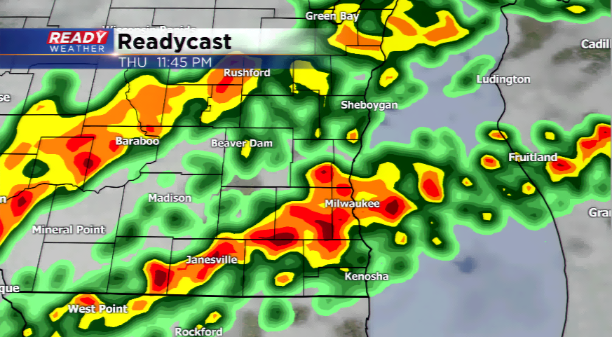
The setup looks like this. Upper-level support along with hot temperatures and high humid will help generate showers and thunderstorms along a cold front. The main threats will be large hail and damaging winds. With a higher shearing environment, some storms could begin to rotate. As in any severe weather situation, tornadoes are possible. The timing will be this afternoon and early evening for our northern counties, and later this evening and tonight as you go south closer to the metro. Most of the activity will end by sunrise on Friday.
Behind the cold front, temperatures cool back to around 80 on Friday. Drier conditions will continue into the weekend as cooler air continues to filter in. Highs drop into the 70s with a slight chance of a shower this weekend.
