Some sprinkles possible but watching Francine for any local impacts


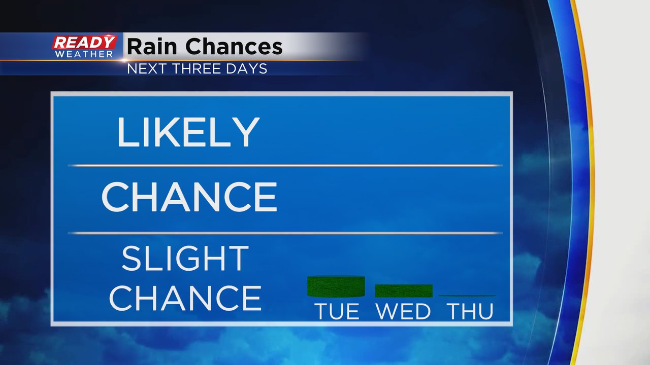
The start to September has been very, very dry. We have had no meaningful rainfall for most of southeast Wisconsin so far this month and the sprinklers are going to water the lawns and gardens. Unfortunately, we do not have any good rain chances over the next week but a few sprinkles or isolated showers cannot be ruled out. The best chance for any rain will be Tuesday afternoon through Wednesday morning but it's only a 5-10% chance so the vast majority of us stay all dry.
After that rain chance, Thursday and Friday look all dry but we will be watching Tropical Storm Francine. That tropical system looks to strengthen into a Category 1 or 2 Hurricane before making landfall along the coast of Louisiana Wednesday afternoon then moving north into the southern Midwest.
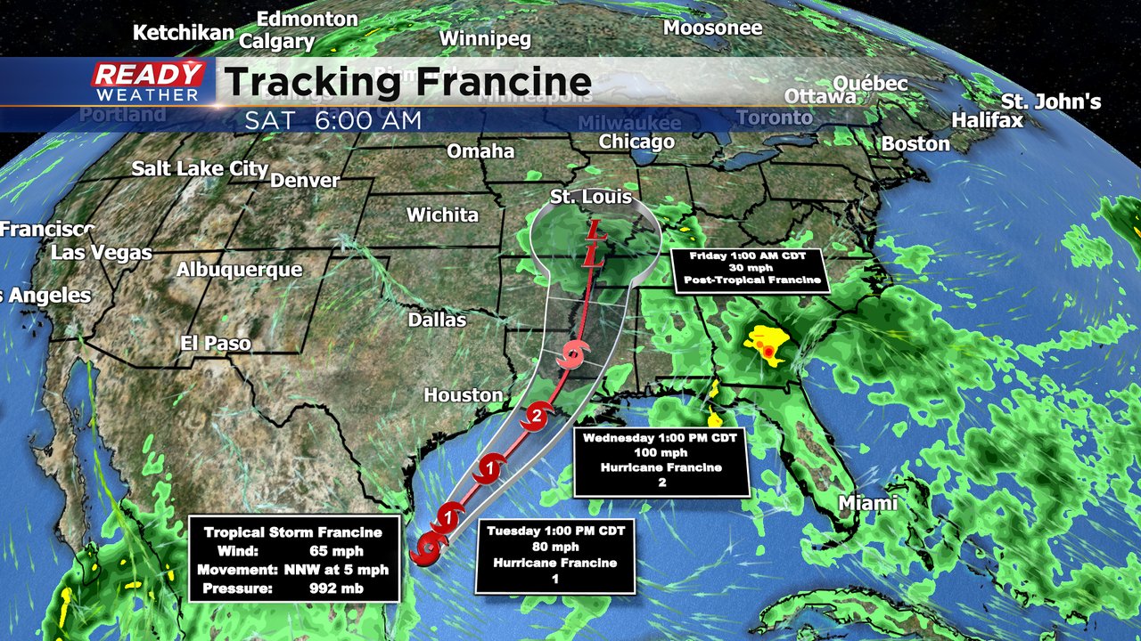
Some of the remnants of Francine could impact southeast Wisconsin over the weekend but no chance looks particularly good at this point. Download the CBS 58 Ready Weather app to track any rain chances the next week.