This morning was the coldest of the winter season across southeast Wisconsin with actual air temperatures dropping into the single digits and teens below zero. It was Milwaukee's first night below zero since February 15th, 2021!
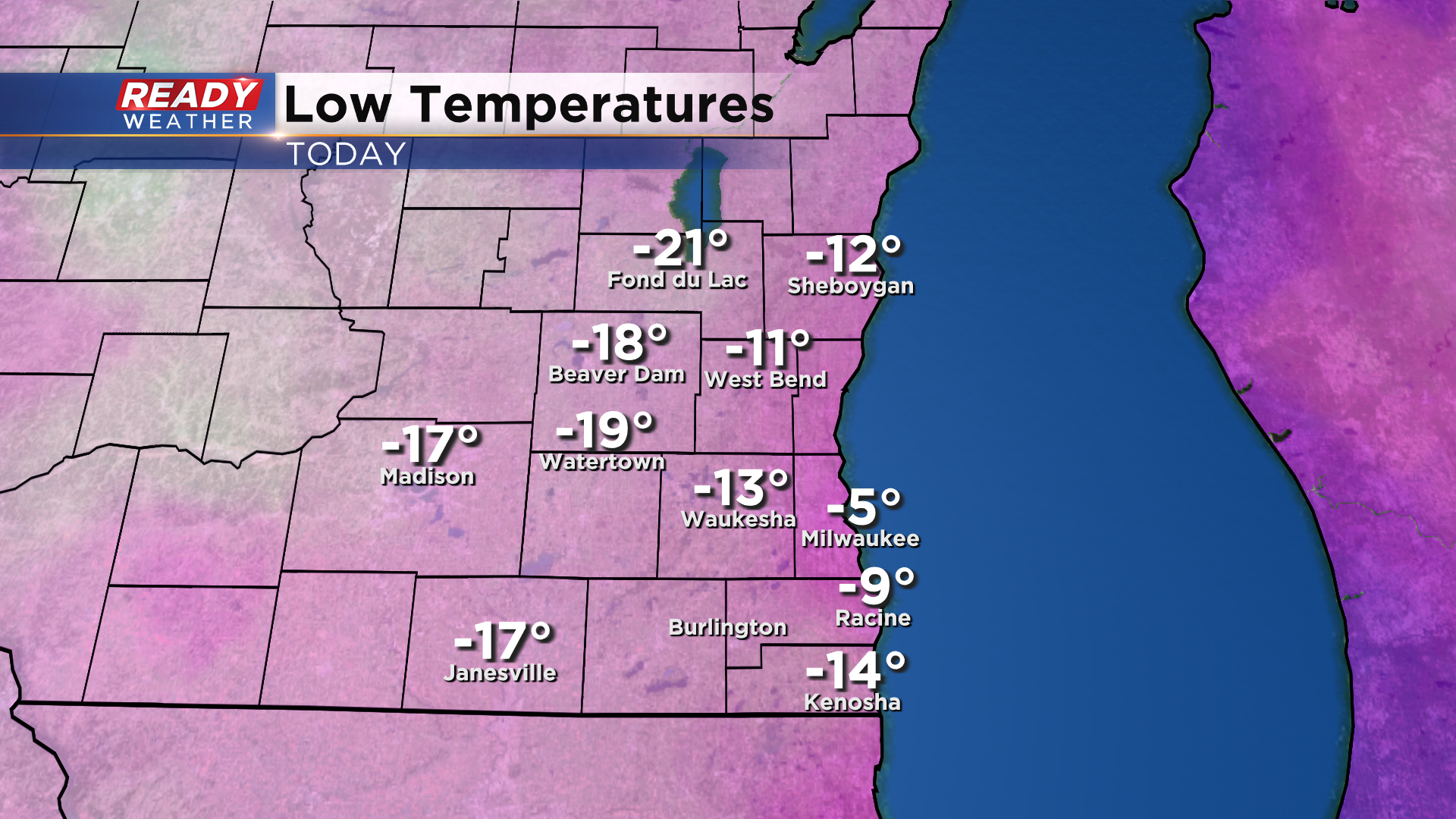
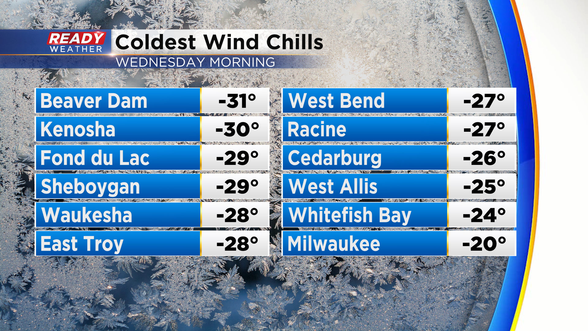
Factor in a bit of a breeze, and wind chills dropped between -20° and -30° this morning.
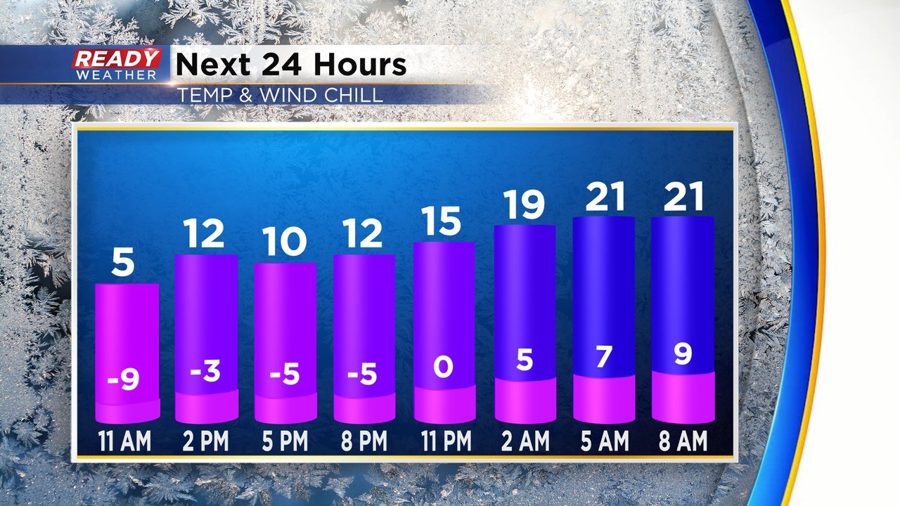
Wind chills will stay below zero all day today, but will improve later tonight as temperatures slowly rise all night thanks to a breezy southwest wind.
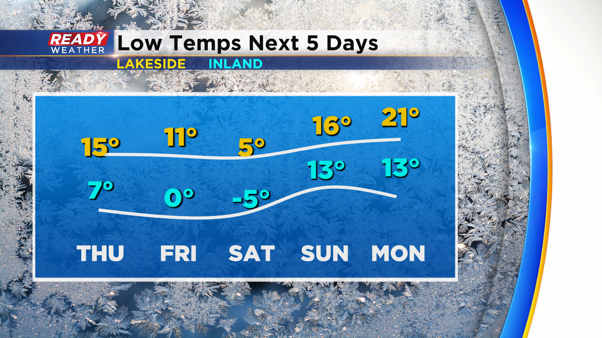
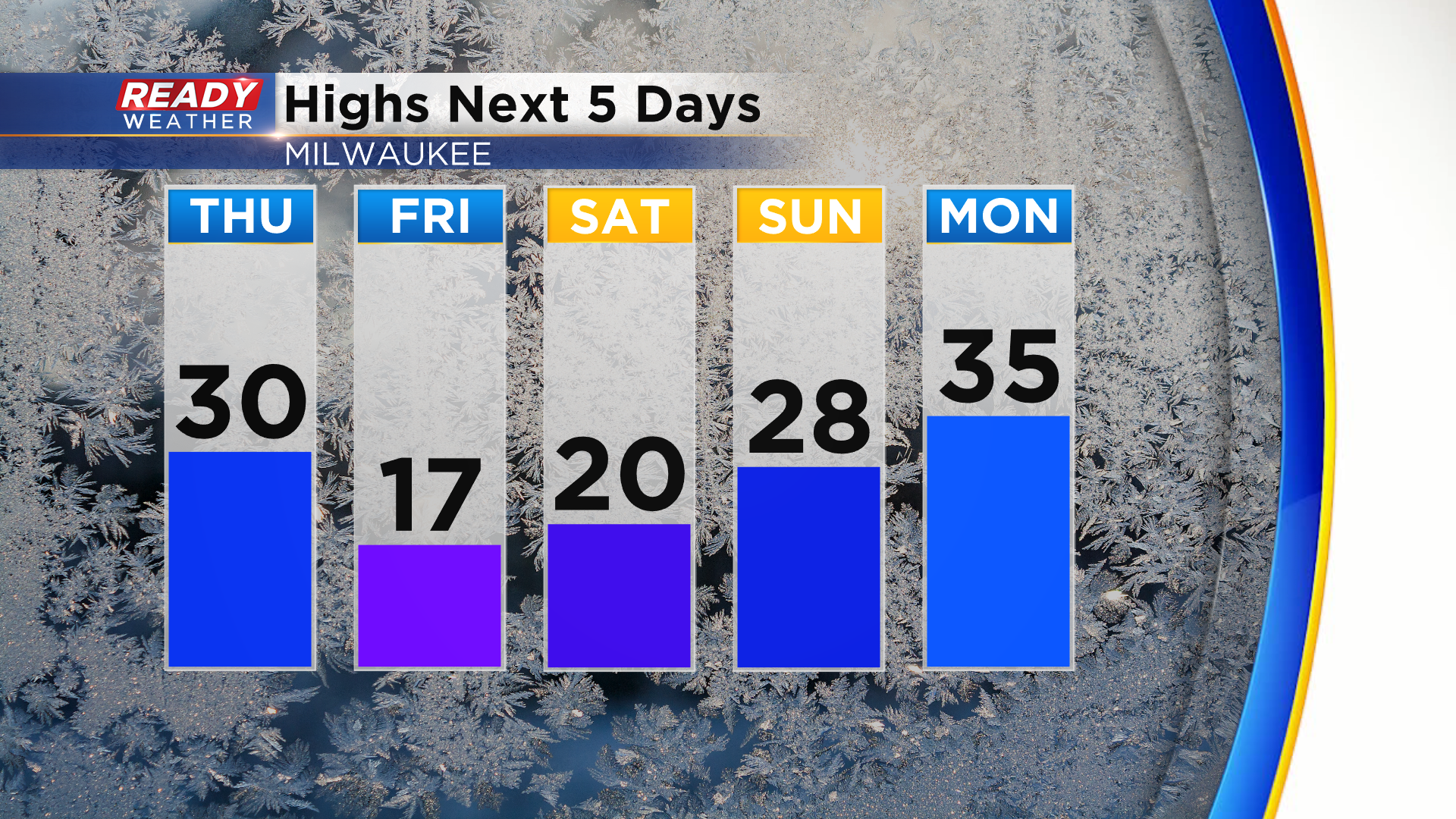
That southwest wind will boost temps into the upper 20s to around 30° on Thursday before a cold front moves through in the afternoon. That will bring another shot of cold air and bitter cold wind chills Friday morning into Saturday morning. Lows will drop into the single digits both mornings, likely below zero away from the lake.
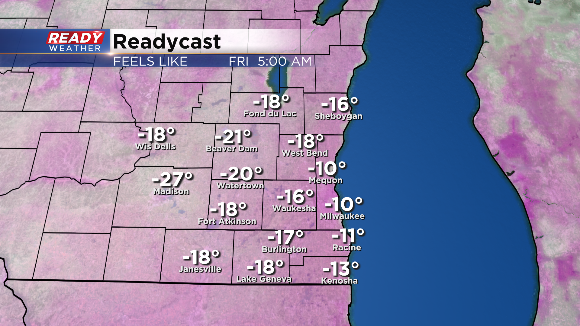
Factor in a northerly wind around 10-15 mph Friday morning, and wind chills will drop between -10° and -20° as you head out the door to work or school once again.
Thankfully, there is some warmer and more tolerable weather on the horizon! After a chilly day Friday and Saturday, temps rebound back into the upper 20s Sunday and warm into the mid 30s by early next week!
Besides a few flurries with the cold front on Thursday and a small chance for lake effect snow showers on Friday, mainly dry weather is expected into early next week. Download the CBS 58 Ready Weather app to get any wind chill alerts sent directly to your phone.
