Hit or miss showers expected throughout the day Sunday
10:20 pm Update:
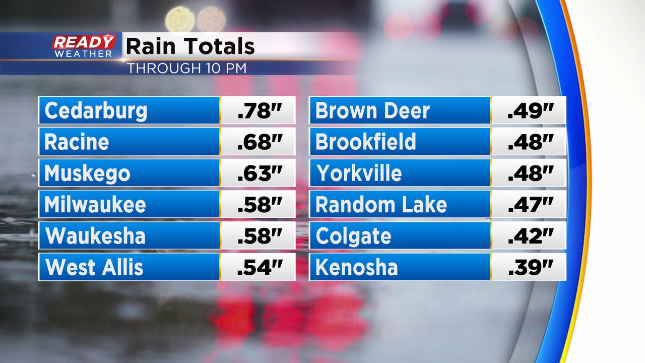
Most of southeast Wisconsin has picked up .25-.50" of rain as of 10 pm, but a few spots are approaching .75"!
Steady rain continues for a majority of the area, but we're already seeing a break in the action near Racine and Kenosha.
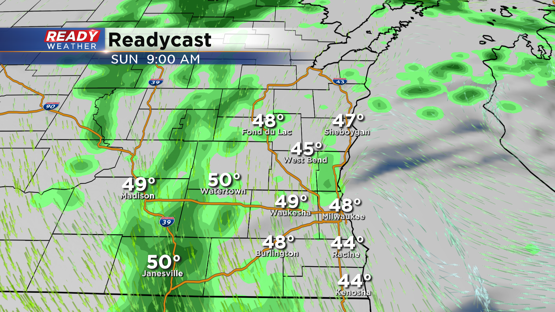
Showers will become spotty late tonight and will be hit or miss on Sunday. There could be a decent amount of dry time mid to late morning before more spotty showers pop up in the afternoon. Areas of dense fog may develop overnight as well, especially in far SE Wisconsin.
-----------------------------------------------------------------------------------------------------------------
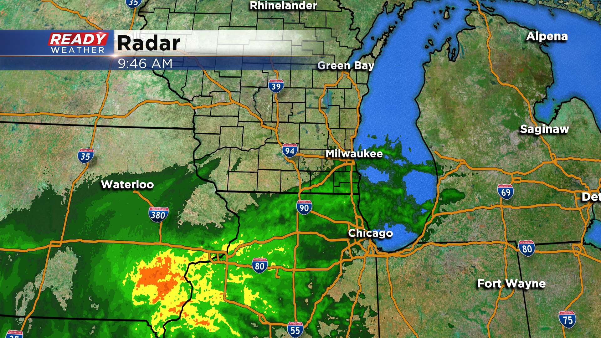
It was nice to have a brief break in the rain Friday evening into early this morning, but showers are already pushing into southeastern Wisconsin and will continue to overspread the area heading into the afternoon.
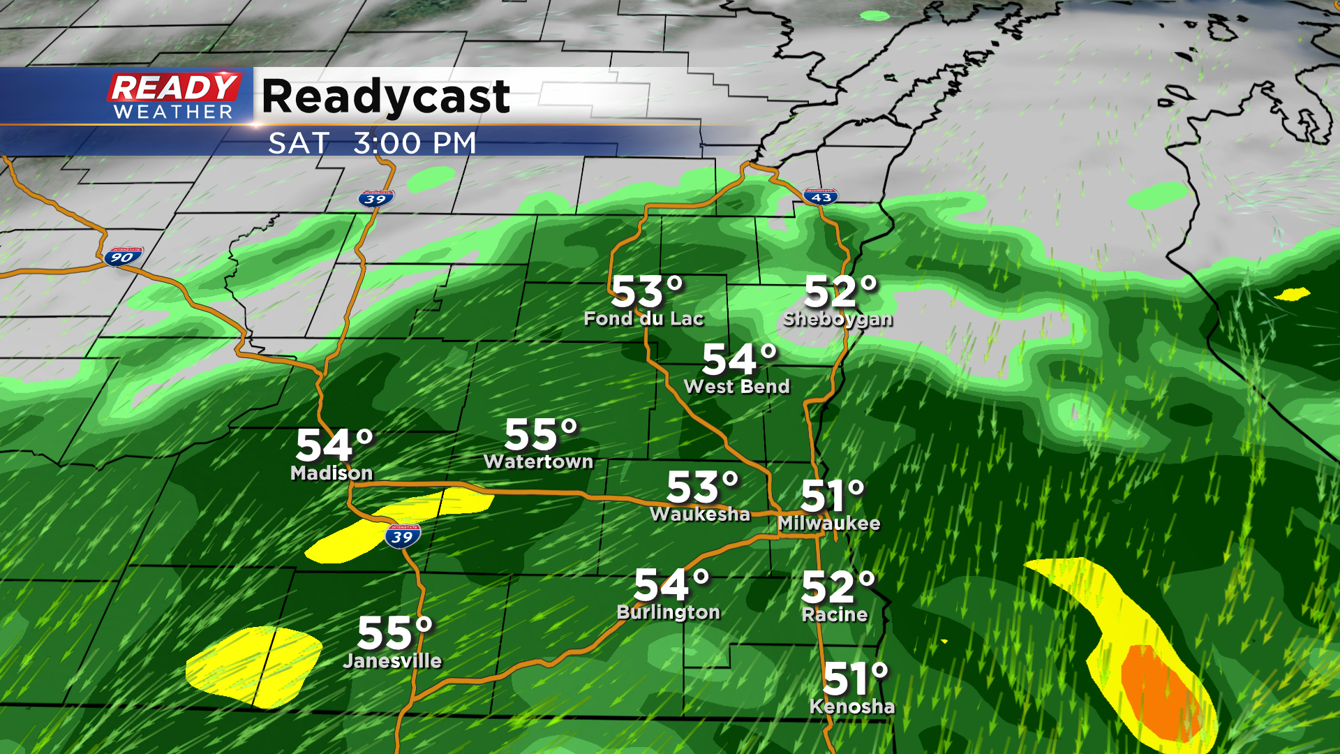
Rain will the fairly widespread through the afternoon and could become fairly moderate at times late afternoon into the evening.
A few rumbles of thunder are possible as well this evening, and any embedded, weak storm could produce locally heavy rainfall.
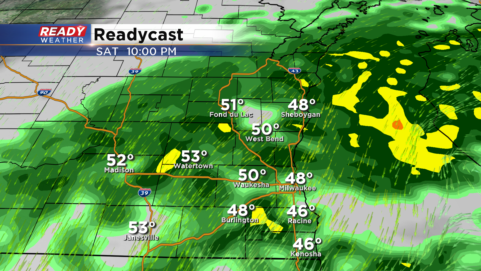
Showers and drizzle will continue through the night, but will become more spotty in nature by Sunday morning. Some spots near the lake may even seen a brief dry period in the morning, but a concentrated band of rain is expected in our western counties and closer to south central WI.
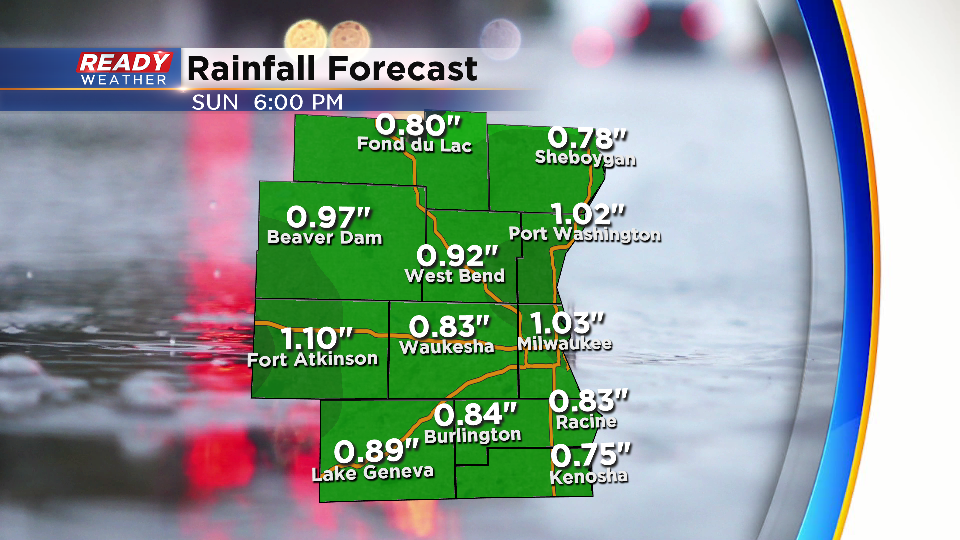
Most of the area will pick up between .75-1.25" of rain this weekend, but higher amounts are possible in any spot that sees prolonged periods of heavier rain.
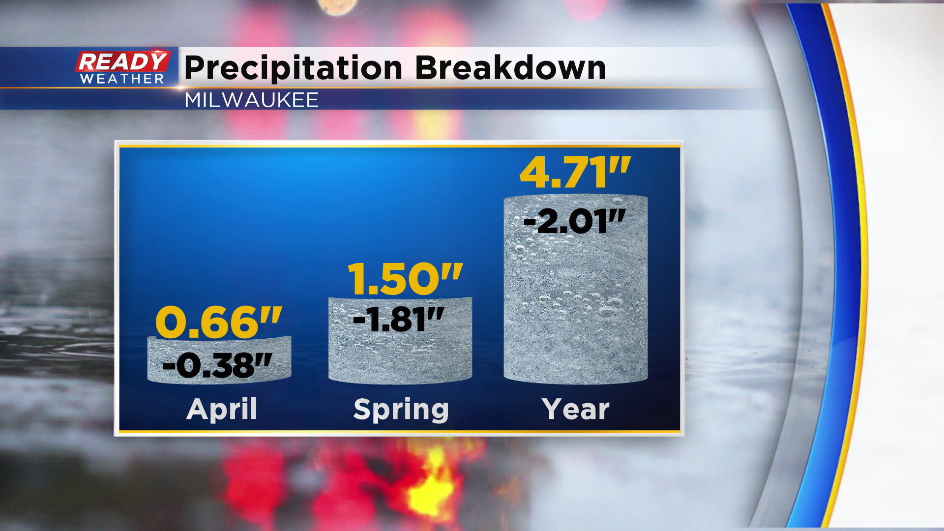
Although we've had showers or storms nearly every day this week, we're still sitting at a rainfall deficit. Milwaukee is running just under 2 inches below normal since March 1st, so this added rainfall isn't expected to cause any flooding.
More spotty showers are possible on Monday. Download the CBS 58 Ready Weather App to track the rain through the weekend.


