


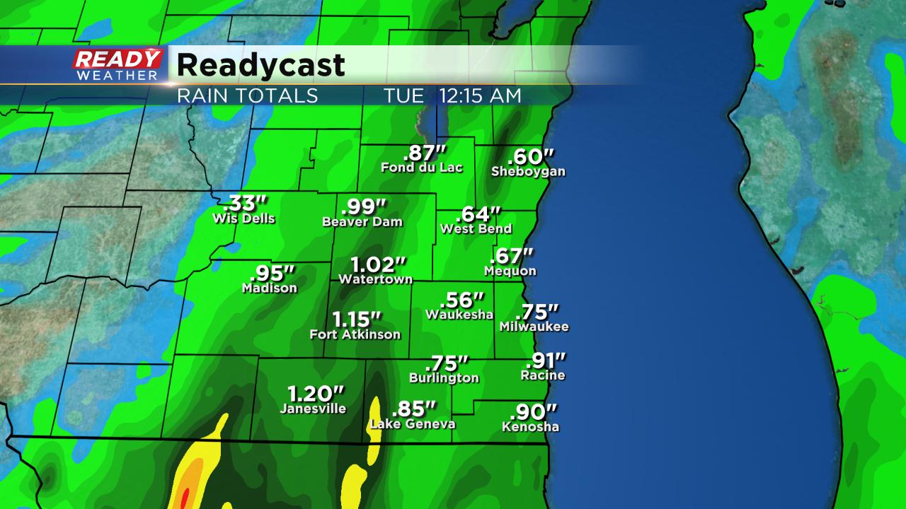
The heaviest of the rain is moving north but has already dumped over 1" in spots. Expect another half inch in some communities the rest of the day but most of the rain will become more scattered and light.

------
Posted: 7:43 a.m. August 26, 2019
Scattered rain started moving into southeast Wisconsin Sunday night and continued through the overnight into Monday morning. Most of the activity has been light and scattered but as of 8 a.m. is started to get a little heavier. The best chance for some pockets of heavy rain is mid to late morning. A few dry hours may be possible Monday afternoon before more scattered showers and a few storms develop. Overall rain totals look soaking, but it's a beneficial rain that we really needed.
The chance for severe weather is very low but a few stronger storms aren't out of the question. Heavy rain is the main risk and all of southeast Wisconsin is under the marginal risk for severe weather.

After likely rain on Monday a few lingering showers are possible Tuesday. Wednesday kicks off another dry stretch of weather.

Download the CBS 58 Ready Weather app to track the rain throughout the day.