Soaking rain expected Tuesday with more showers Wednesday


Noon Update: Rain continues in some areas this afternoon and after a soaking this morning, totals are really adding up. Check it out!

A few isolated communities on Monday, especially along and south of I-94, saw some downpours that resulted in rain totals from 0.10-0.30" but most of southeast Wisconsin didn't get much.

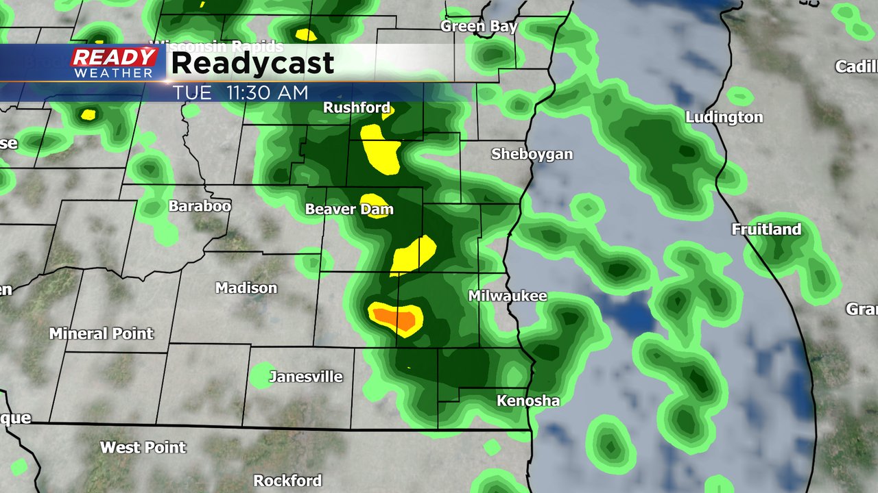
Another round of rain is on the way Tuesday. Some downpours, good steady rain, and isolated storms have already rolled into some parts of southeast Wisconsin with rain totals just since midnight getting close to an over a full inch of rain. The morning commute will likely be wet and soggy and slow. Send the kids to school with rain boots, umbrellas and rain jackets especially if they are waiting at the bus stop.
Here's a current radar image that will update with time:

More showers and storms are expected throughout the day on Tuesday but there will be some dry time as well especially during the later afternoon and evening hours.
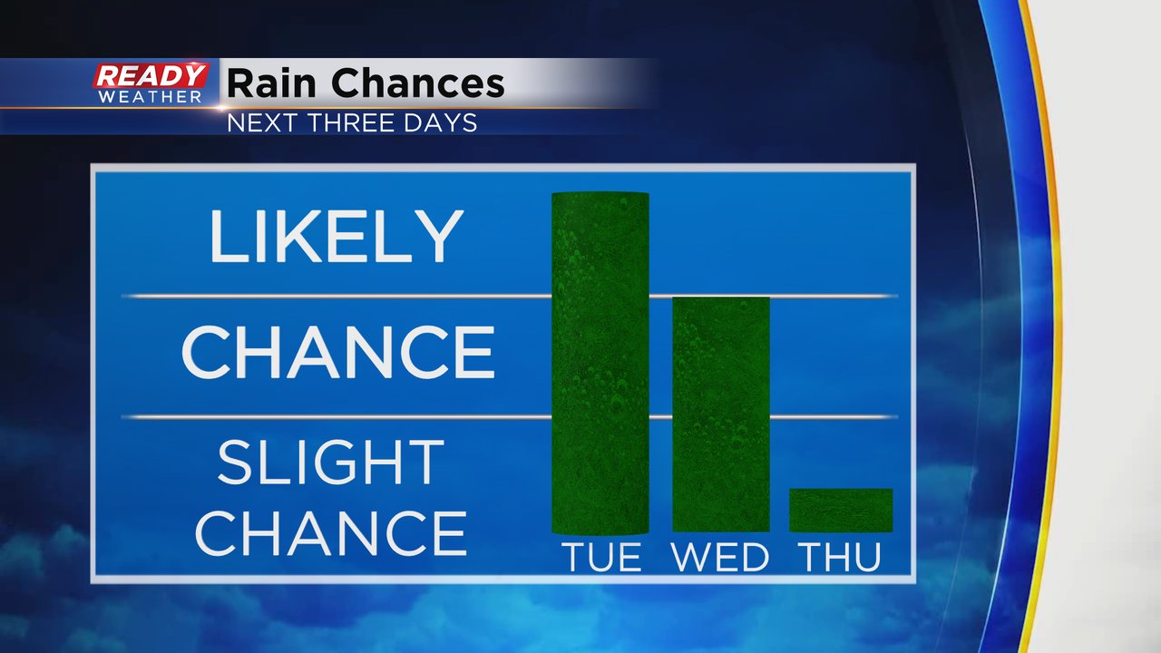
Rain chances will continue Tuesday night and throughout the day on Wednesday. Thursday finally starts to dry out and the forecast for the upcoming weekend which signifies the end of September and beginning of October stays dry.
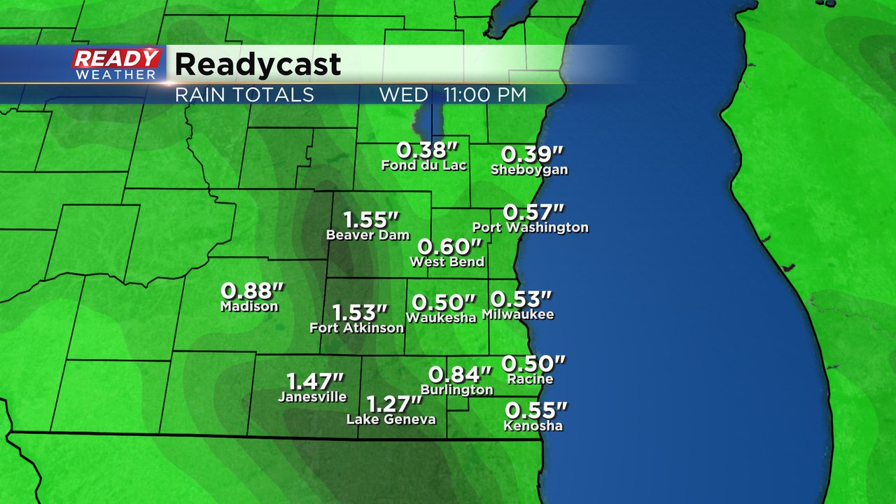
Rain totals are still on track for a good soaking rain for the majority of our local area with 0.50-1.50" of rain for most of southeast Wisconsin but communities that see thunderstorms or good downpours could get up to or over 2".
Download the CBS 58 Ready Weather app to track the rain for Tuesday and Wednesday.