


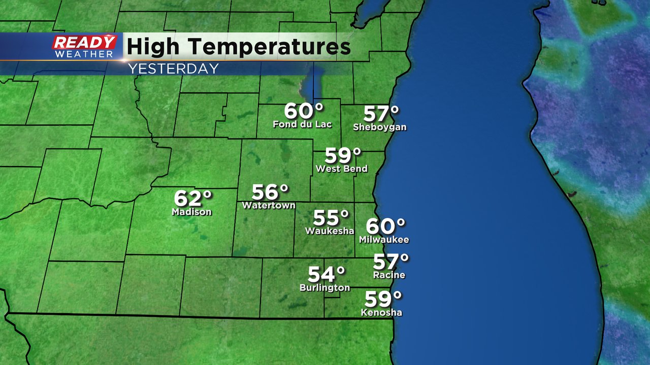
Milwaukee officially hit 60* on Monday and more 60s are possible Tuesday and Wednesday. It took almost all day long but both Milwaukee and Fond du Lac hit a high of 60* on Monday. The rest of southeast Wisconsin saw highs in the middle to upper 50s.
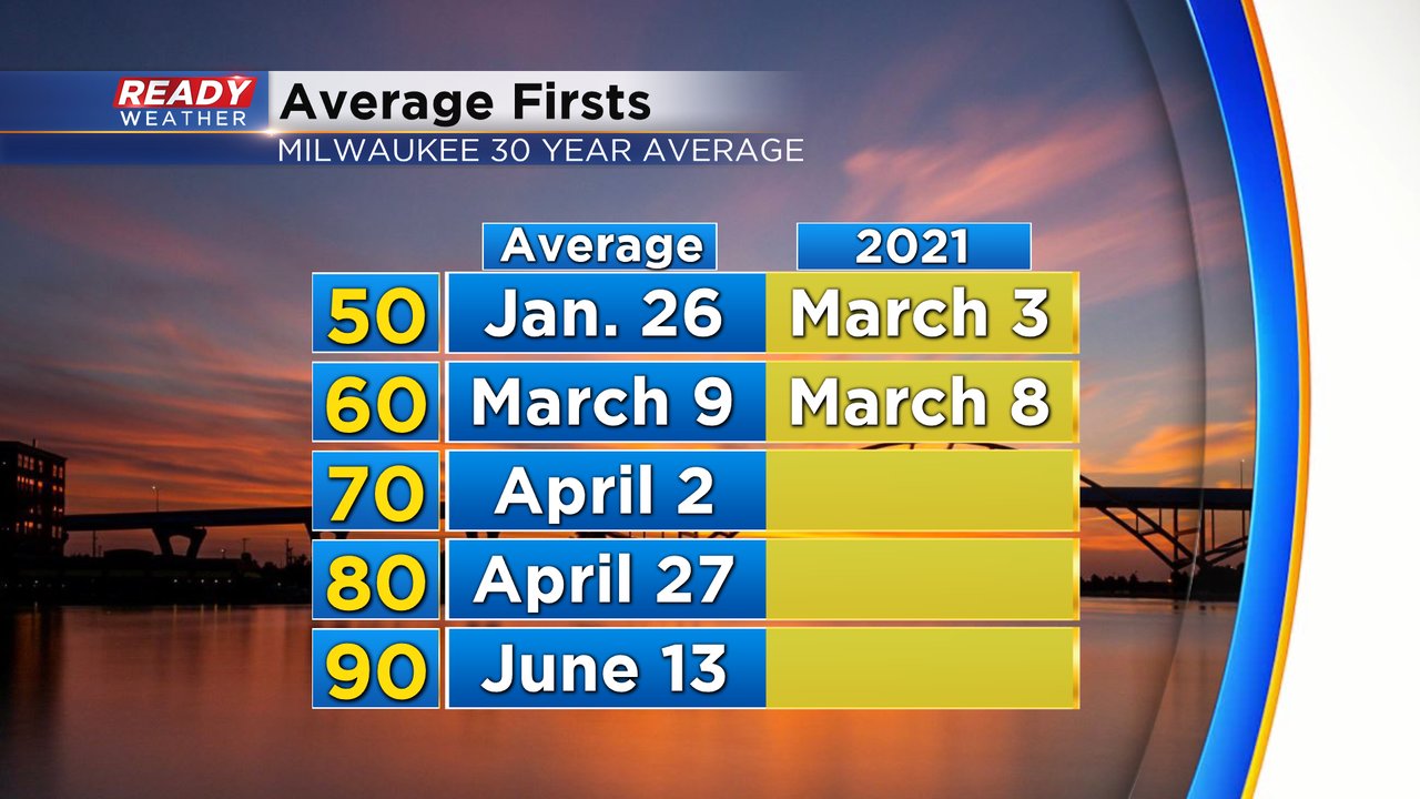
The first 60 in Milwaukee comes almost exactly at average - just one day before the average of March 9. Now we move on to our first 70s which on average arrives at the beginning of April.
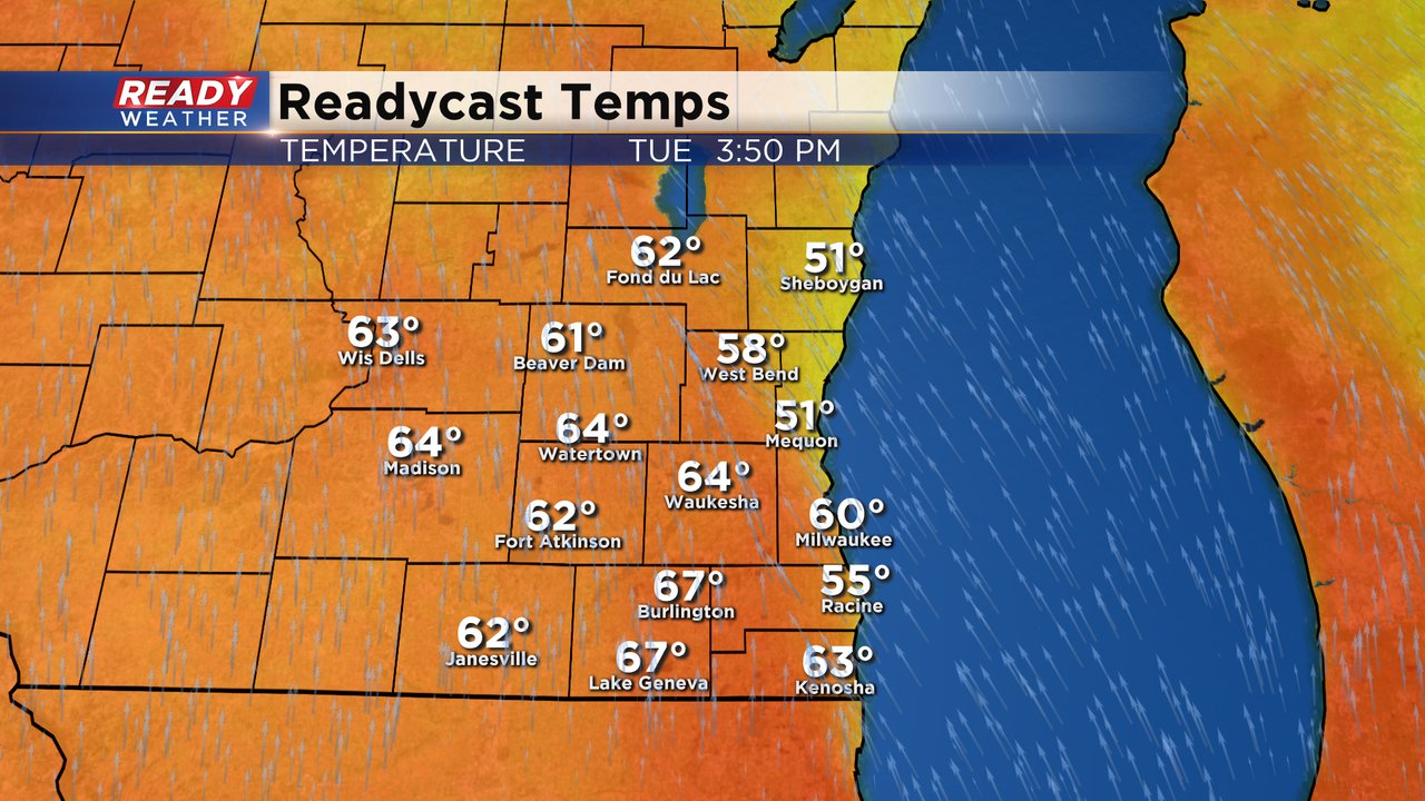
Tuesday has another chance to hit 60* but this time inland spots might actually get a little warmer. We will have a windy SE wind that will bring in a lake breeze that could keep some lakeside spots in the 50s. Inland locations will have a better chance to get into the low 60s for highs on Tuesday.
Wednesday could actually be warmer but it comes with scattered rain showers. Highs on Wednesday will likely reach into the 60s once again. The record for Tuesday is 67* and Wednesday is 68* so while we will be relatively close we aren't quite on record watch just yet. Temperatures will fall for the end of the week and by the weekend highs will stay around 40 which is closer to average.

With all the mild air the last couple of weeks we've melted a good amount of snow. As of Monday afternoon the official snow depth in Milwaukee is 0" for the first time since the end of December (69 days to be exact). With warmer air continuing for a few more days and rain on the way for Wednesday into Thursday the shaded areas of snow and larger snow piles will continue to melt fast.

Download the CBS 58 Ready Weather app to track the warm temps and return of rain.