Snow chances increasing for late Friday into Saturday
We are just under three days out from our next significant winter weather maker for the weekend. In fact, this system is our most impressive winter weather maker since November!
The track of the low is still uncertain, and that means clear cut snowfall accumulations haven't been determined yet. The models are consistent with bringing snow across the area late Friday into Saturday, but accumulation differences do exist.
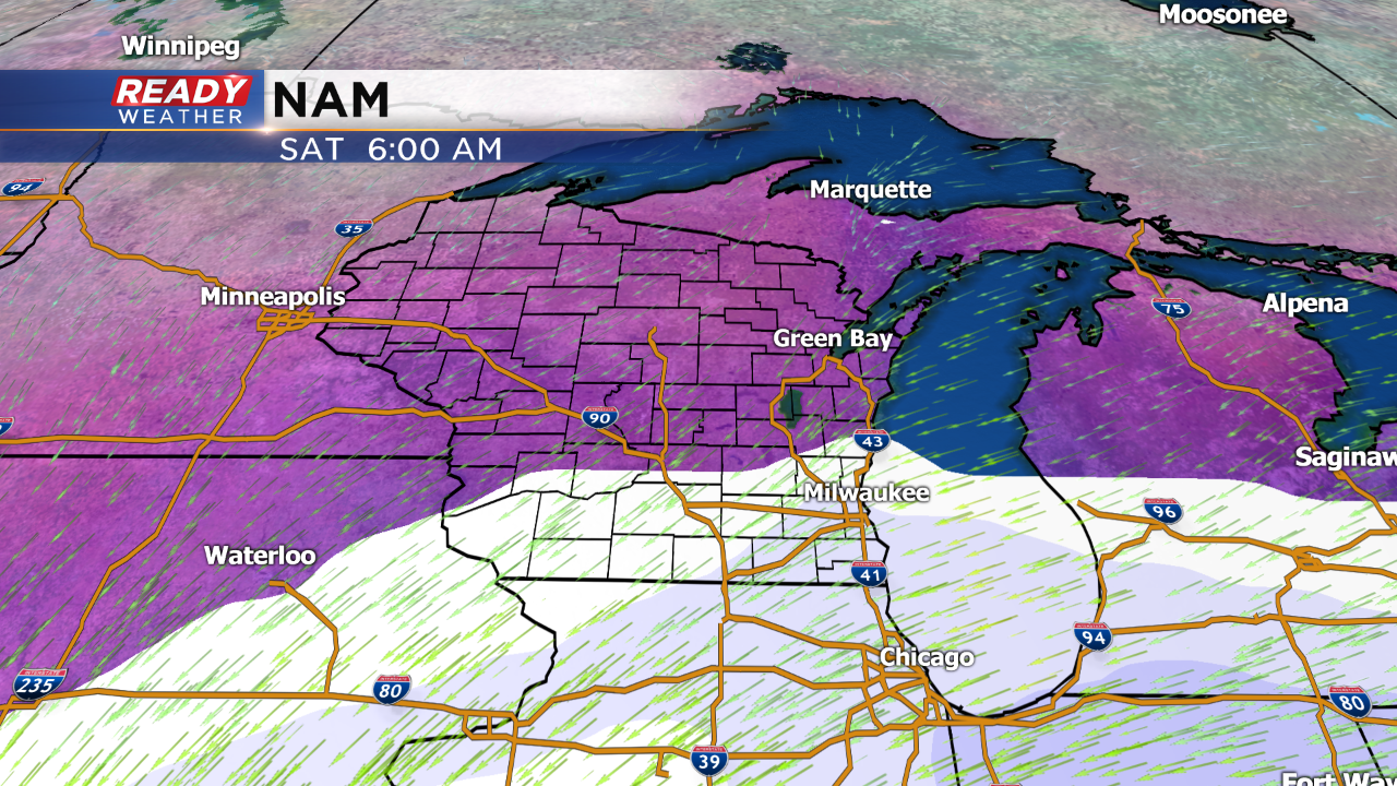
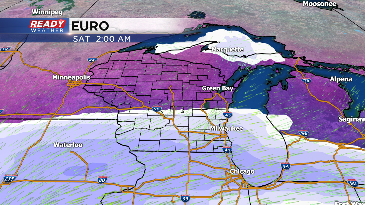
Both the NAM and the EURO have similar placement of the snow. Lowest totals would be across Sheboygan and Fond du Lac counties for this event. Overall these models were putting down 2" to 4" of snow with locally higher totals along the border.
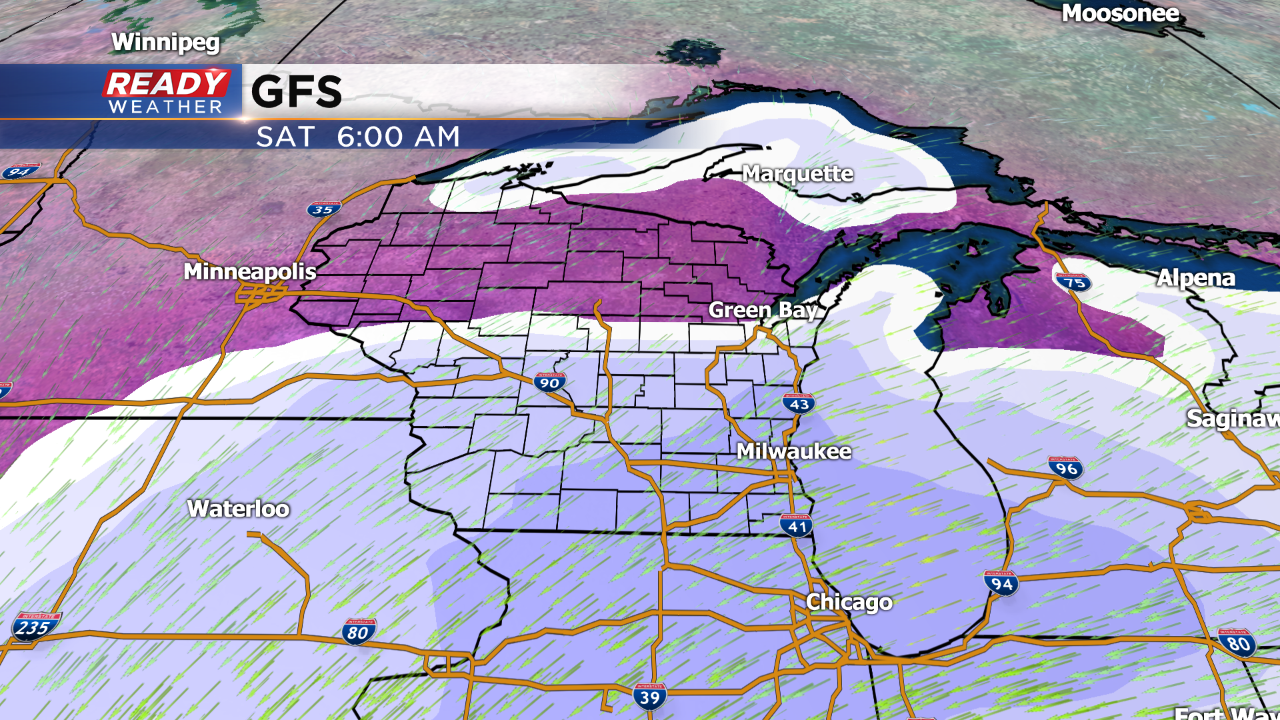
The GFS is further north with the snow. Accumulations were more like 3" to 6" with locally higher totals along the border.
The other issue will be a lake effect band or some lake enhancement during the day Saturday. Where that band sets up will impact totals!
Overall there isn't a major difference at this point. The cold will pour in Saturday night into Sunday. Roads will likely be slick for Saturday!
We will continue to update you on this event!
