


A cold front approaching the area Sunday morning will keep skies on the cloudy side to start the day, and by mid to late morning there will be a chance for a few rain and snow showers. These will be quick moving and out of the area by early afternoon.
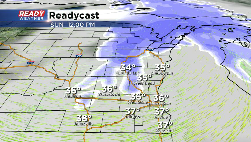
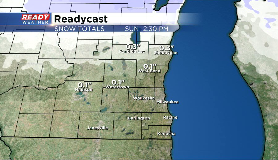
The best chance for any snow showers and minor accumulation will be in Fond du Lac and Sheboygan counties where a dusting or so is possible. The snow that does fall will be a wet snow, so any accumulation that does occur will primarily be on the grass and turn slushy on the roads as temperatures will be rising through the mid 30s into the upper 30s during this time.
The main impact will be reduced visibilities and a few slippery spots on roads. However, the farther south you go, the smaller the chance for this brief rain/snow mix.
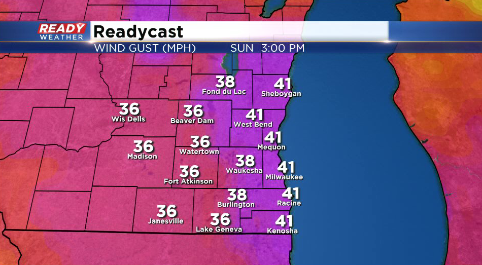
Winds will be a bit breezy during the morning hours ahead of the cold front, but they’ll really pick up during the afternoon behind the front. Wind gusts between 20-25 mph are expected through morning, with gusts up to 40-45 mph possible during the afternoon.
This wind will be ushering in drier air, so expect gradually decreasing clouds during the second half of the day. Winds will still be a bit gusty through Sunday night and Monday, but more sunshine is expected to start the new work week.