Showers to storms to snow: Soggy weather starts Tuesday evening


Tuesday is starting out dry with a nice sunrise but the next round of rain is approaching. As the wind ramps up the rain showers will get closer likely arriving after 5 PM Tuesday evening. There may be a touch of sleet or mix right when the showers start but most of the precipitation will just be rain Tuesday evening.

A few pockets of heavy rain as well as isolated thunderstorms will be possible off and on from Tuesday night throughout all of Wednesday. The wind will stay strong as well with a SE wind gusting above 30 mph at times.
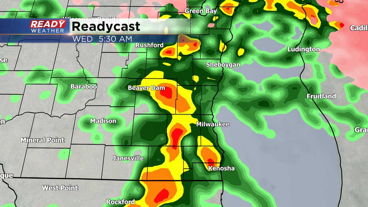
Any thunderstorms that do develop will likely inflate our rain totals. Another really good soaking rain is likely for all of southeast Wisconsin. At least 0.75" of rain is likely for everyone with most seeing under 1.50" but with any storms that happen we could see rain totals get close to or even above 2".

The soaking rain comes to an end Wednesday night. By Thursday morning the rain showers have switched to snow showers. A bit of slushy snow accumulation is possible during the day on Thursday that could be a bit more than what we saw last week.

Download the CBS 58 Ready Weather app to track the rain, storms and snow.