Showers and storms continue through the weekend with isolated severe chances


Thursday was the warmest day of 2019 with a high of 77°, but then the bottom dropped out and we woke up to temperatures in the upper 40s.
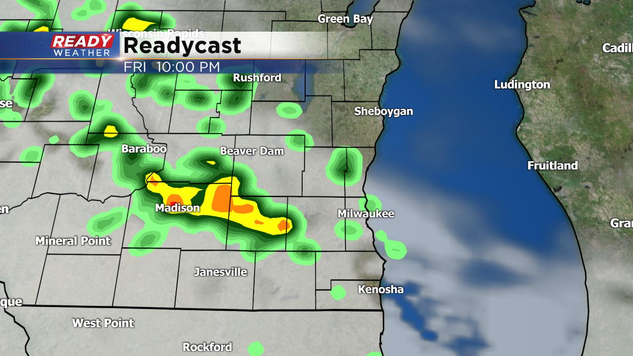
Expect the cooler temperatures to stick around all day Friday with little warming and highs around 50°. Thursday stayed mostly dry but more scattered showers and an isolated storm are possible Friday, especially in the afternoon and evening.
If you are planning on going to the Deer District to watch the Bucks game make sure to grab the jacket with temperatures dropping into the low 40s feeling like the 30s with wind chill. The umbrella may also be needed with rain chances increasing throughout the game.

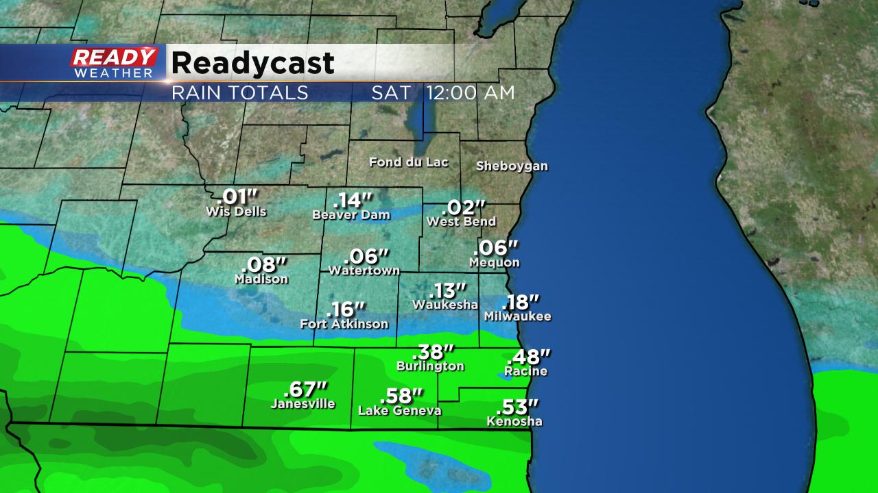
Up to a half inch of rain is expected by the end of Friday with another round of scattered showers and storms on tap for Saturday bringing an additional half inch.
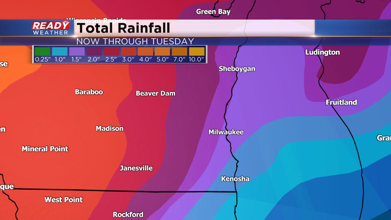
Heavy rain is looking likely with a chance for severe weather on Sunday. We finally dry out Monday with rain returning Tuesday. By the end of Tuesday some of our western communities could pick up a total of 3" of rain. All of that rain could cause area rivers and streams to rise causing flooding.
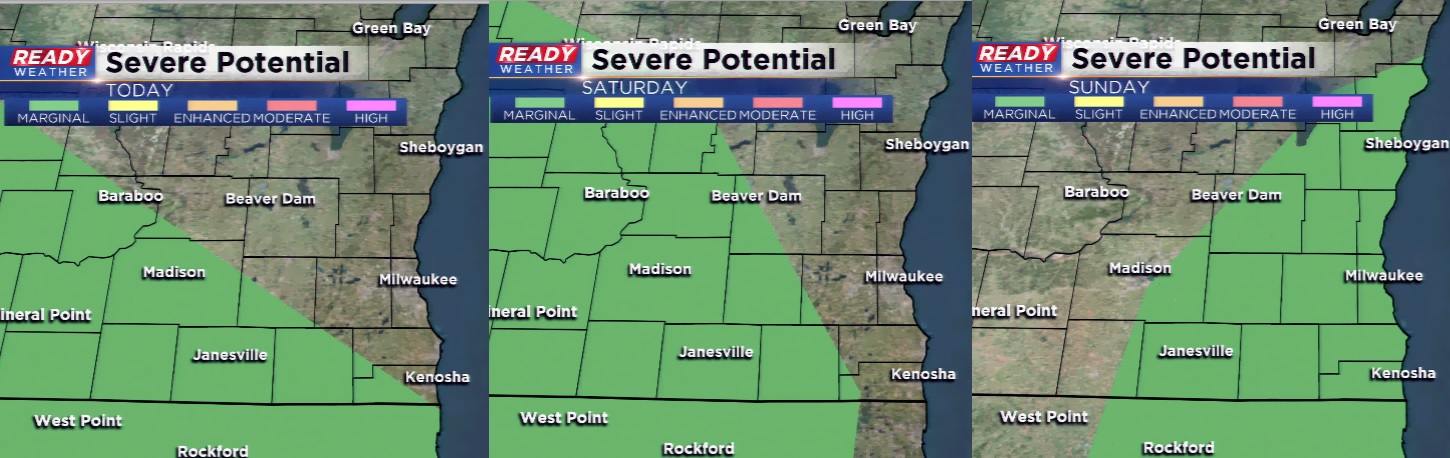
Each day's rain chance the next three days will also bring a low chance for strong to severe storms. At least part of southeast Wisconsin is in the "marginal" risk for severe weather Friday, Saturday and Sunday. The best chance for stronger storms looks to be Sunday, but we will have to watch the location of a warm front closely on Saturday too.
Download the CBS 58 Ready Weather app to track any showers and storms that do develop. The app will also give you notifications if warnings are issued.