Severe weather threat later today and tonight
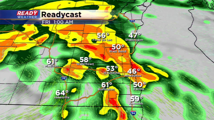
Morning update: Morning showers and storms have moved out over Lake Michigan. The cloud deck will eventually scour out and should allow for some partial clearing. If this happens, storms could fire later this afternoon. If the clouds stay pesky, storms could back off until later tonight and early tomorrow around the upper-level disturbance. This could be enough to produce stronger storms with strong winds and hail. Highs still could get close to 80 degrees.
For some parts of Wisconsin and the viewing area, it was an active morning with showers and storms blossoming off a strong low level jet and surface front. Rainfall totals will exceed an inch to the north, and was more scattered for the viewing area.
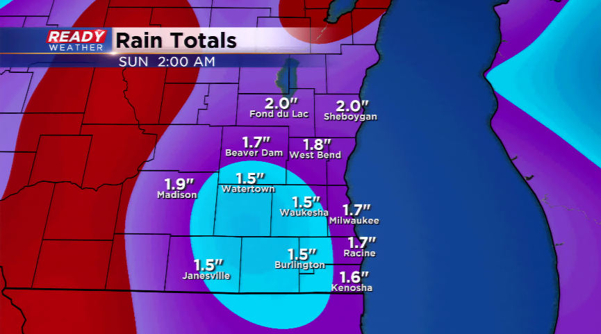
With the unseasonably warm air expected, two more rounds of showers and storms are likely the next two days.
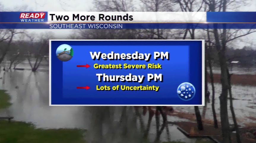
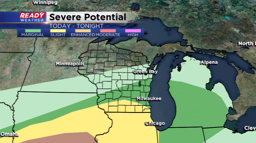
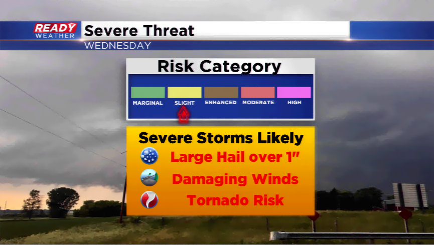
There will be a lull in the action this morning aka recovery time! This will rebuild instability in the atmosphere with daytime heating and could lead to more showers and storms. All eyes will be on a wave of energy for late this evening and overnight that will trigger showers and storms. The best dynamics are along the border of WI/IL and south of the border, but a few of these storms could become strong to severe. The SPC has put parts of the viewing area under a "slight" risk of severe weather while the rest are under a marginal risk. The main risks appear to be high winds, large hail, and heavy rainfall.

A secondary round for Thursday is possible, although better dynamics are further south. Rain will still be likely with showers and storms for the afternoon and evening. If the warm front moves far enough north, it could be an explosive day. Again, for now we are keeping the best ingredients south.
Make sure you have ways of getting weather information the next few days. We will have the latest information on the CBS58 Ready Weather Blog.
