Several chances for snow this week


Get ready for a very active week ahead! Take a look at the picture above. The wave train will be running full steam across the Midwest through the weekend. The jetstream overhead will provide several disturbances aloft to create several chances for snow.
Light snow is possible tonight; however, better chances for snow will arrive Tuesday into Wednesday, Thursday,and another oen Friday into Saturday.
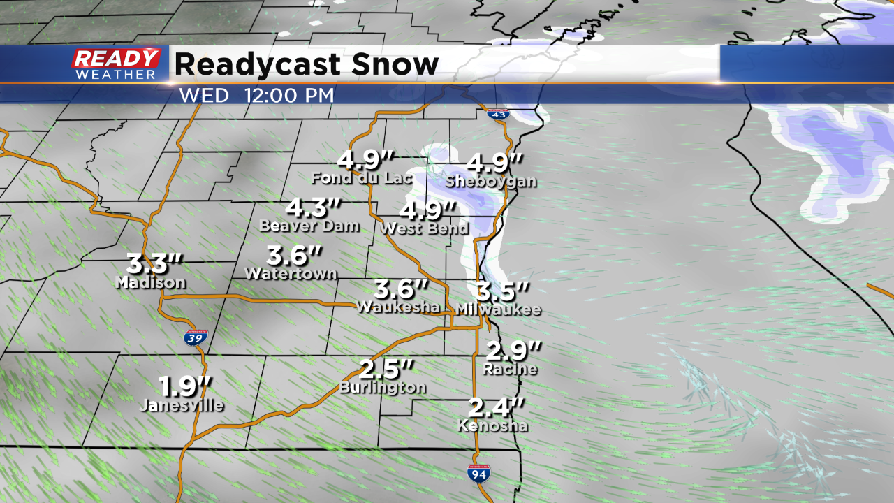
I want to focus on our next substantial chance for snow Tuesday evening into Wednesday morning. Temperatures in the 20s will allow the snow to quickly accumulate on the roads. The Tuesday evening commute and the Wednesday morning commute will likely be impacted.
Most of the area will pick up between 2" to 4" of snow. Slightly higher totals are possible across our northern counties and possibly along the lakefront. Thankfully wind won't be an issue with this system; however, some light mix could arrive as the system departs Wednesday afternoon.