


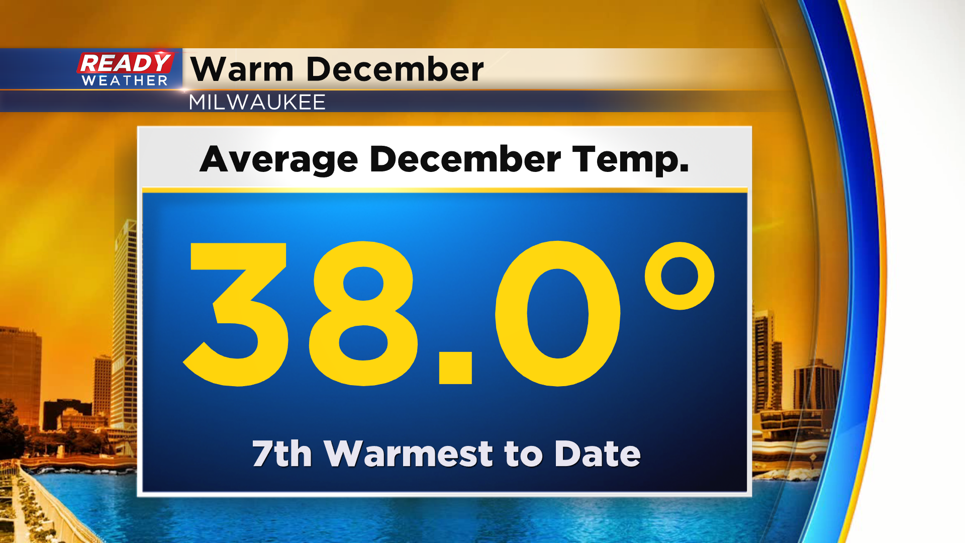
It's been a rather wild week of weather with above normal temps and strong winds across southeast Wisconsin. Temps have been above normal for the last week, and after two days in the upper 60s our average December temperature is now 7th warmest to date at 38.0°.
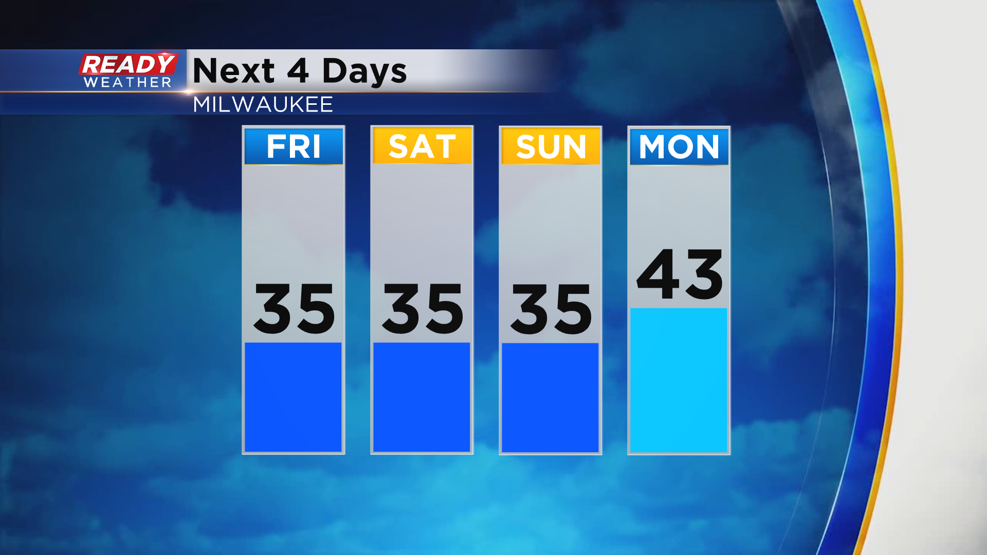
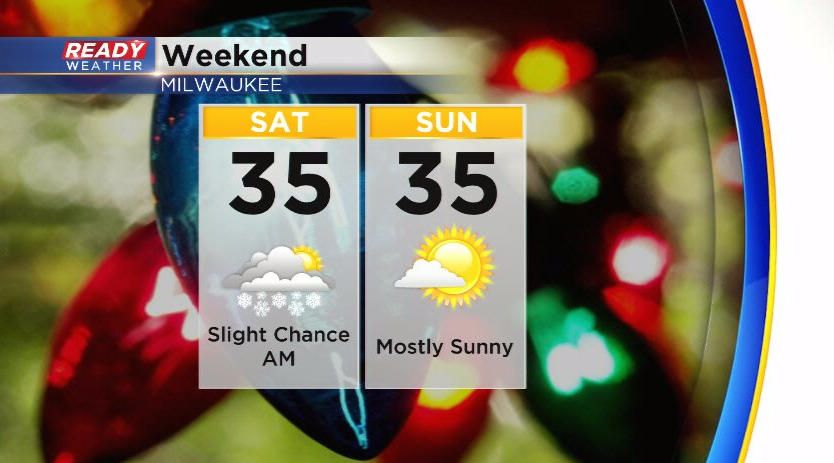
After that warm stretch of weather, temps are getting back to normal across southeast Wisconsin. Temps will top out in the mid 30s today and throughout the weekend with a brief warmup expected Monday.
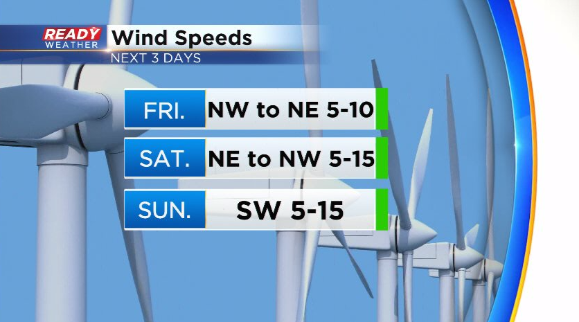
Good news is the wind will remain light for the next several days, primarily between 5-15 mph, so there won't be any concerns for your holiday decorations!
Dry weather is expected throughout today, but there is a small chance for flurries or a brief snow showers overnight into Saturday morning.
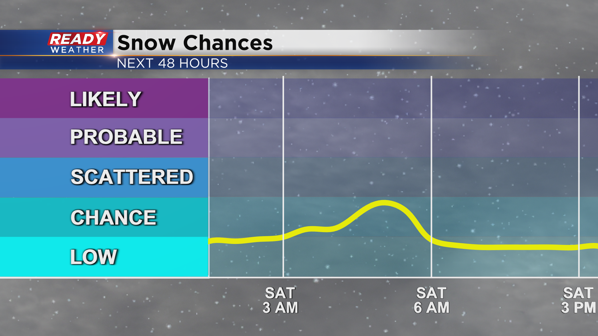
These flurries will have to fight through quite a bit of dry air, so only a light coating of snow will be possible in spots. Best chance would be in far SE WI and lakeside thanks to a brief window for light lake effect. Clouds gradually decrease Saturday afternoon and evening with more sunshine on tap for Sunday.
Download the CBS 58 Ready Weather App to see the full forecast.