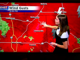
Scattered strong storms, possibly severe, into this evening
Update as of Early Saturday Evening:
This day has turned out to be a little more active than anticipated. We had a Severe Thunderstorm Warning for Milwaukee County during the lunch hour. There were sporadic reports of trees down, especially around Franklin and Bay View. Then, we had a Tornado Warning for parts of Washington County around dinner time. The storm in question was Doppler radar-indicated, not spotter indicated.
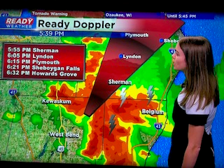
Nonetheless, it's vital you take cover when a Tornado Warning is issued. Seek shelter in an interior room of your home, preferably in the basement. Also, protect your head from flying debris. The chance for storms will continue mainly this evening. However, once the sun sets, most of the energy from the atmosphere will dissipate. This means the chance for severe weather really dwindles. But keep it tuned here to CBS 58 on air and online for more details.
______________________________________________________________________________________________________________
We're starting off the day quiet and mild with temperatures already in the mid to upper 70s as of 9 am.
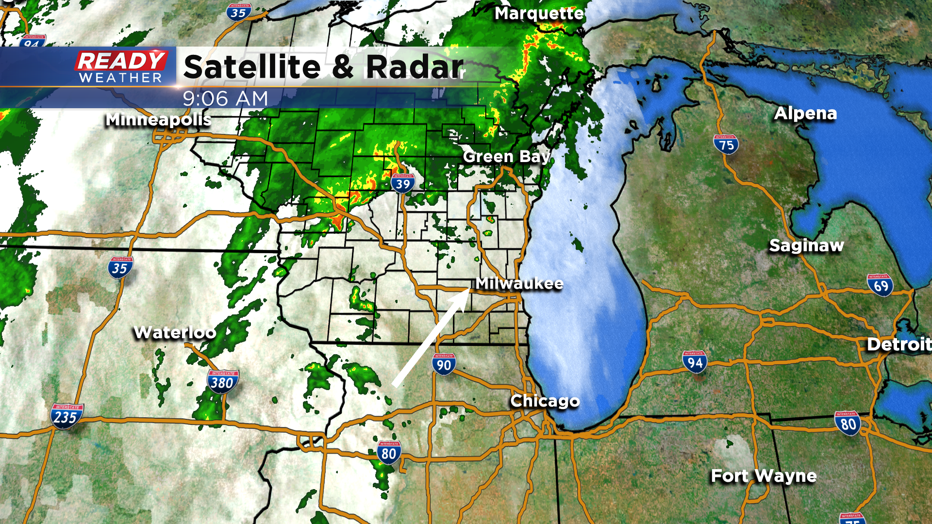
While some parts of southeast Wisconsin will see some sunshine briefly this morning, scattered thunderstorms will be developing by late this morning and continue throughout the afternoon.
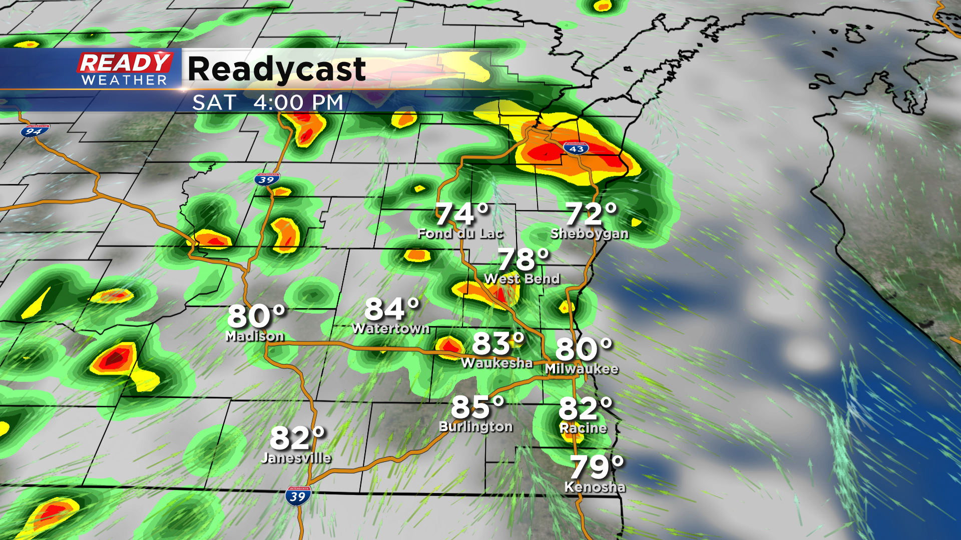
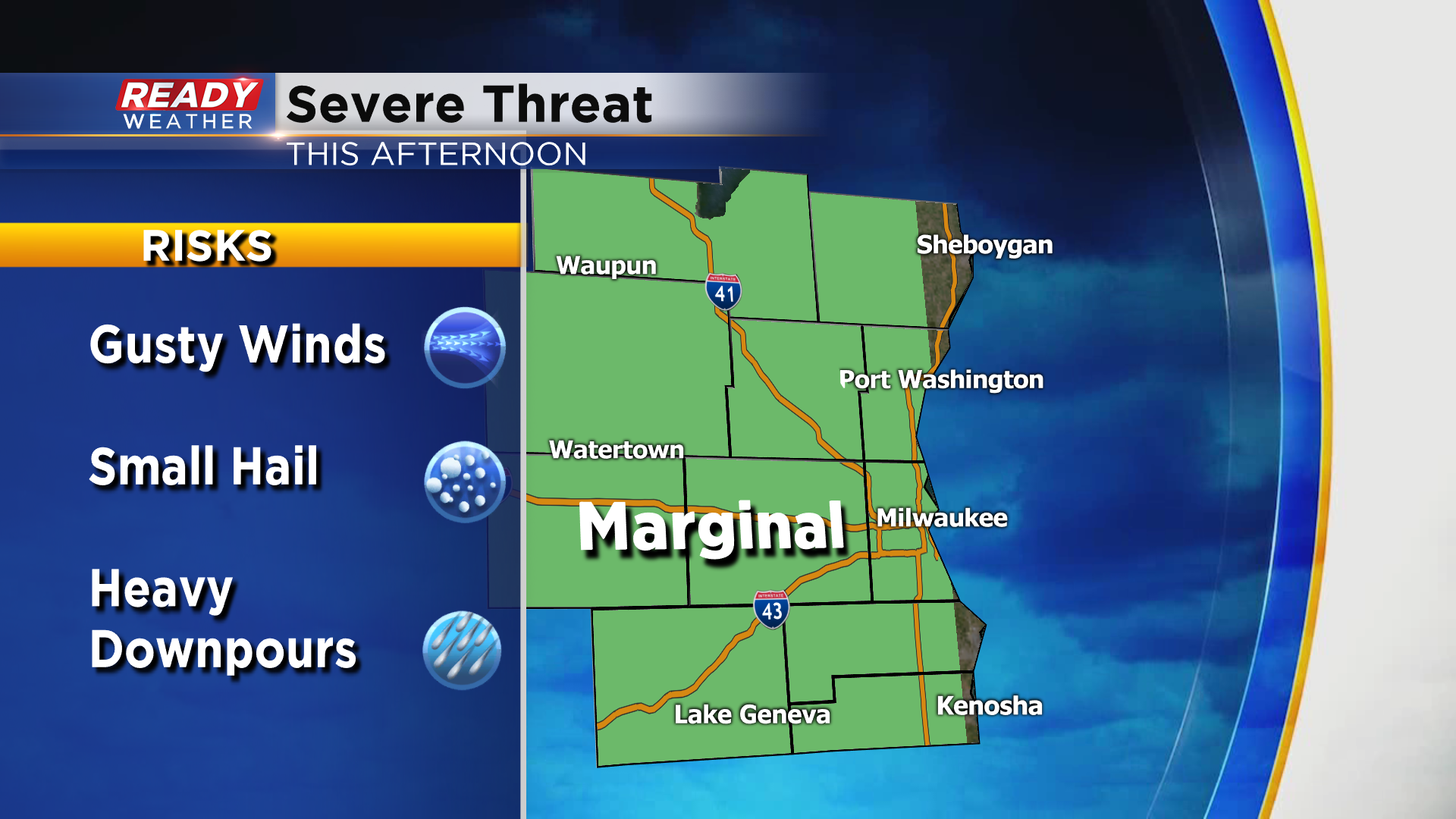
Any storms that develop will produce moderate to heavy downpours for a period of time. We are not expecting widespread severe weather, but a few stronger storms are possible with gusty winds being the primary threat. Due to this gusty wind threat, most of the area is under a level 1 of 5 Marginal Risk for severe storms this afternoon.
Storms will dissipate this evening after sunset.
Download the CBS 58 Ready Weather App to track any pop up storms, and to get severe thunderstorm warnings sent to your phone.
