Scattered storms and rapid cool down follow another hot day


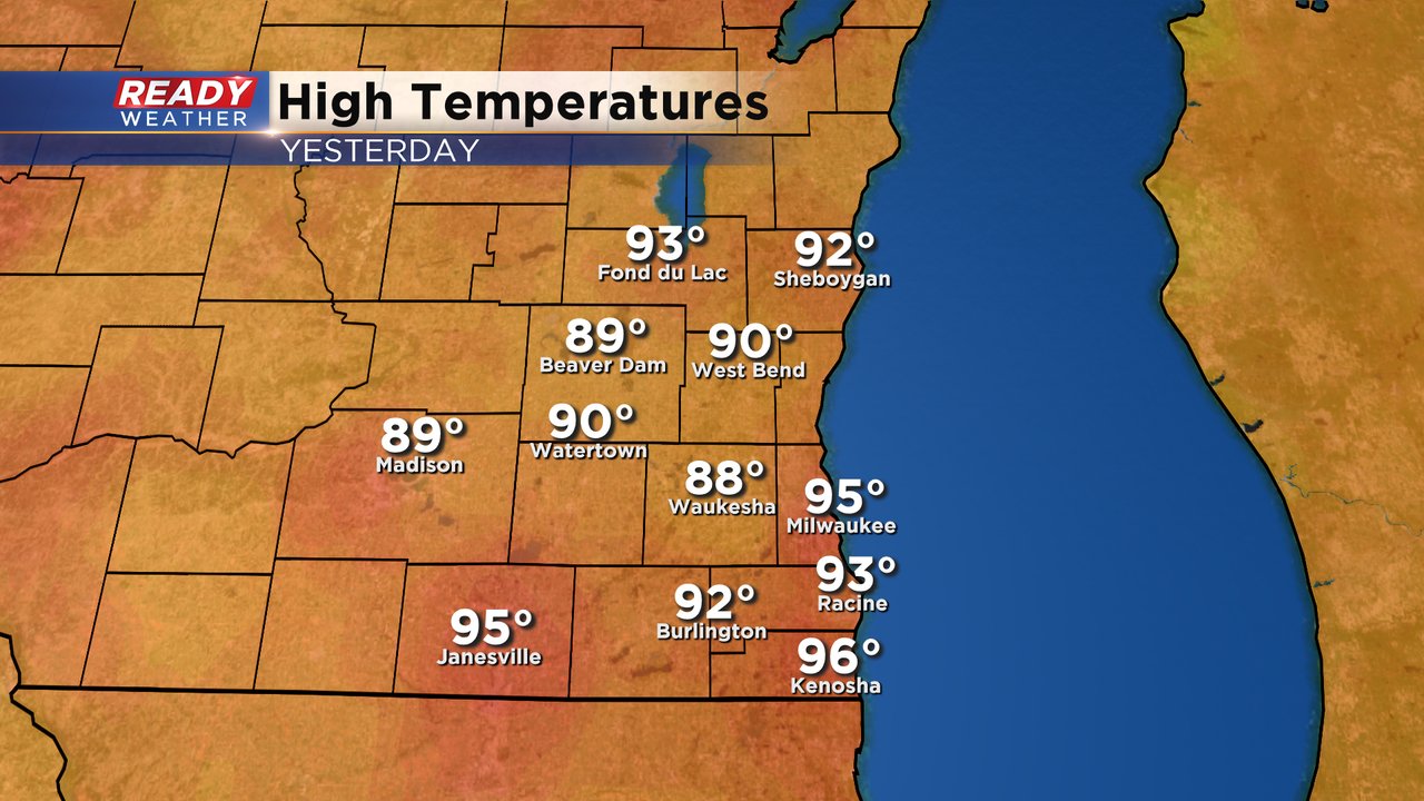
Monday was the hottest day of the year so far in many locations. Milwaukee hit 95* for the first time this year which is the warmest since we hit 95* at the end of July in 2020. We haven't been warmer than 95* in almost 9 years! The last time we hit 96* or warmer was in July of 2012! As of Monday we have hit the 90s eight times so far this and the average is nine.
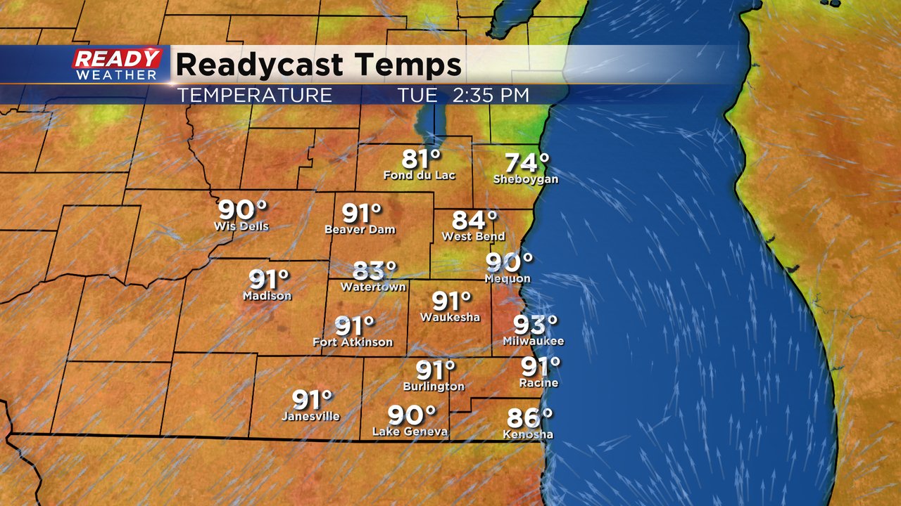
We likely get our ninth day in the 90s Tuesday with highs once again expected to reach into the low 90s for most of southeast Wisconsin. But look at Sheboygan on the graphic below. A cold front lake breeze will likely kick in during the afternoon dropping temps into the 70s.
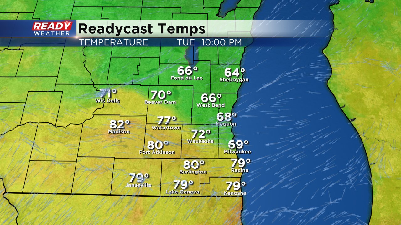
That lake breeze cold front will likely get through the Milwaukee area later this evening dropping temps into the 60s by 10 PM. The rest of southeast Wisconsin will get into the 60s by the time we reach Wednesday morning.
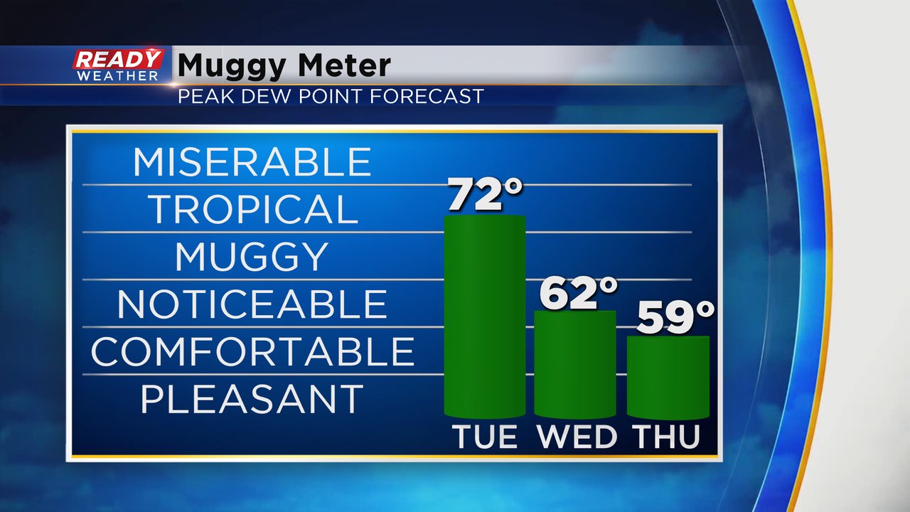
In addition to another hot day the humidity will stay high. Dew points will stay in the low 70s Tuesday but then we drop to barely noticeable humidity on Wednesday and by Thursday it feels pretty comfortable.
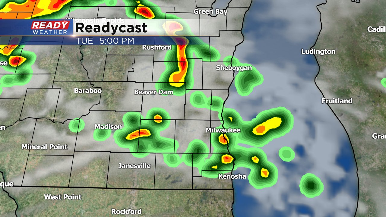
The chance for showers and storms Tuesday afternoon/evening is starting to increase. A few storms could form as early as 2 PM and then last through the rest of the afternoon and evening. Although the activity will be scattered meaning some of you could stay dry or get long dry breaks, others could get heavy downpours or even a stronger storm with small hail and gusty wind. Scattered showers and storms will last through most of Wednesday.
Storms will be possible during Bucks Finals Game 1. Hard to pinpoint exactly where the storms are possible but I do think someone in our area will have rain during the game. Download the CBS 58 Ready Weather app to track the rain to see how it impacts your Tuesday plans.