


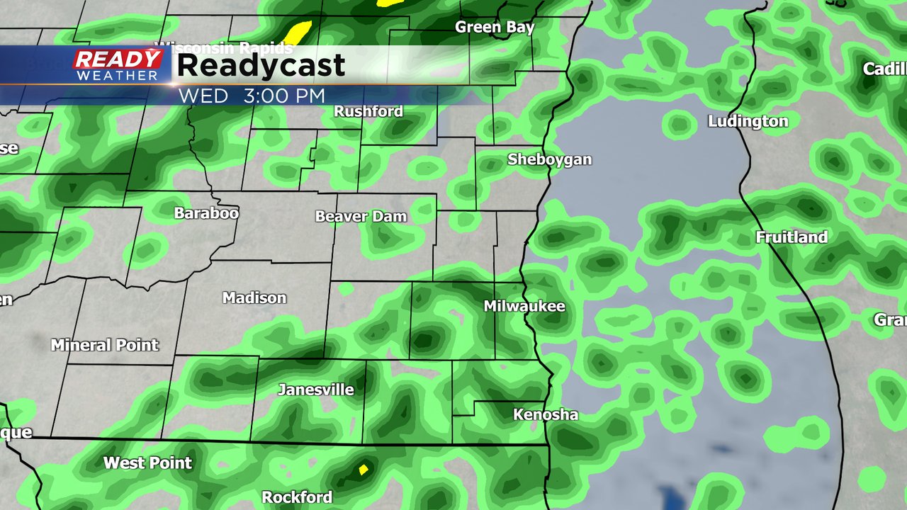
The rain is back. Before Wednesday we had not seen much accumulating rain in southeast Wisconsin so far this November. An area of steady and heavy rain has already rolled through Wednesday morning.
Here's a radar image that will update with time:

The steady rain is now moving north and eventually out of our local viewing area but that won't end our rain chance. Scattered showers will be expected through the rest of the day through the early evening before drying out tonight.
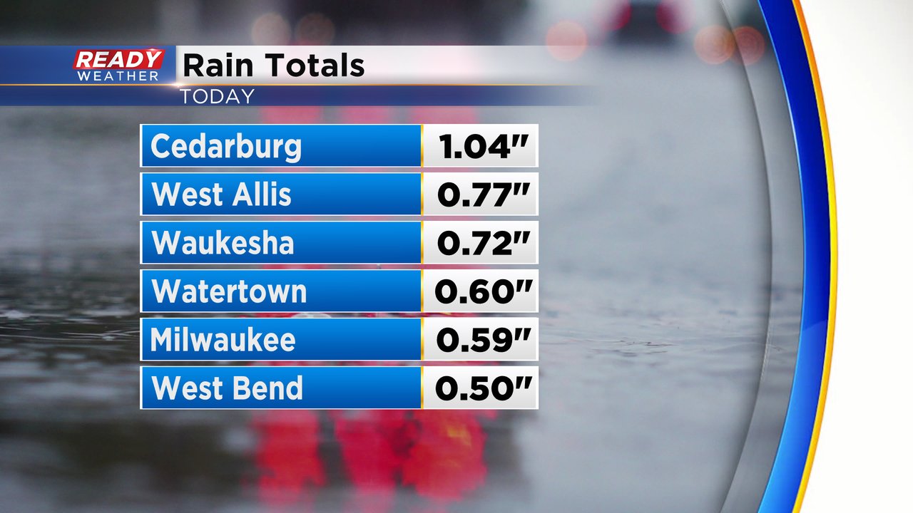
Through 6 AM rain totals have already reached 1" in Cedarburg and other communities are not far behind.
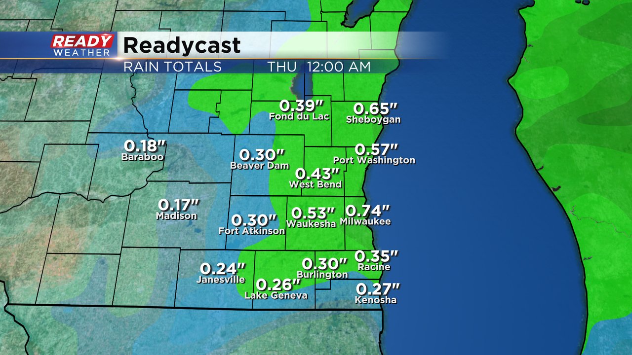
Most of southeast Wisconsin will see 0.25-0.75" of rain by the end of Wednesday but some isolated locations, like we've already seen, could definitely reach the 1" mark.
Download the CBS 58 Ready Weather app to track Wednesday's rain and see if we have any more chances.