Say it ain't so. More April snow on Saturday.
Posted: Apr 26, 2019 5:37 AM CDT

-
4:18

Shoveling and heart health: Who’s at risk and what to look...
-
1:54

Kewaskum’s Jordan Stolz returns home after historic Winter...
-
1:29

Snow covers roads as Milwaukee’s DPW crews battle high winds
-
2:44

The Gathering returns to Potawatomi Casino Hotel March 21
-
2:21

Thousands of We Energies customers remain without power after...
-
2:56

Travelers to and from Milwaukee face cancellations and delays...
-
4:10

Winter Weather Advisory until 9 pm.
-
4:25

ABCDog Walkers+ talks about dog walking and training
-
4:26

GMAR chair discusses home sales, condo buying during housing...
-
2:50

West Bend snow removal crews prepare for significant snow
-
0:14

Entire pier seen floating down Milwaukee River raises questions
-
1:47

Students across Wisconsin compete in 8th annual underwater robot...

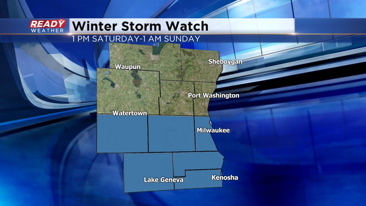
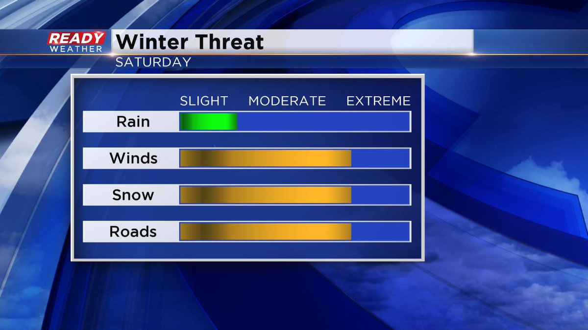
Milwaukee (CBS 58)--Where's your snow brush? You better find it for Saturday afternoon and night. The storm is playing out like we thought yesterday. It might begin as a little wintry mix and then quickly change over to a heavy, wet snowfall, accumulating quickly. A Winter Storm Watch is now in place, mainly along and south of I-94. 3-6" amounts are likely. To the north, the snowfall accumulation cuts off quickly, say around Highway 23.
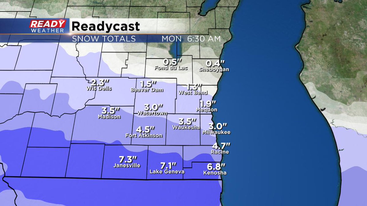
The snow stops into early Sunday. Then we sit and wait for more rain showers for much of next week. Temperatures will start in the 40s and then end up near 60 later in the week. Just a reminder, May starts on Wednesday.
Sign up for the CBS 58 Newsletter