Rising and falling temps become the focus as rain chances dissipate


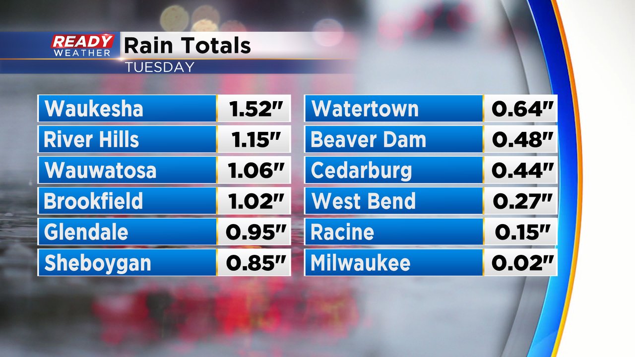
Rain has been the focus of the forecast over the last two weeks as we finally saw some decent rain after a few very dry months. Another soaking rain fell for some of the area getting around or over an inch of rain but others, especially south of downtown Milwaukee didn't get much. The new drought update will come out Thursday morning and we could see some improvement in our area.
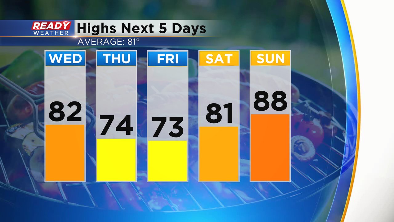
There's only an isolated chance for a shower or storm on Wednesday with best chances near the IL border in the afternoon. Our focus will now shift towards quickly changing temps and humidity. Highs on Wednesday stay close to average in the low 80s. Thursday and Friday will be a bit cooler in the 70s but we warm right back up. On Saturday highs are back into the low 80s with near 90* expected for July 4th and 5th.
Expect another humid day Wednesday with dew points staying in the upper 60s. We get more comfy for Thursday and Friday but humidity will likely rise going into the holiday weekend. The next chance for storms is Tuesday.

Download the CBS 58 Ready Weather app to track the temps for the upcoming holiday weekend.