Recapping the rain and snow totals from Thursday as we look to a sunny weekend


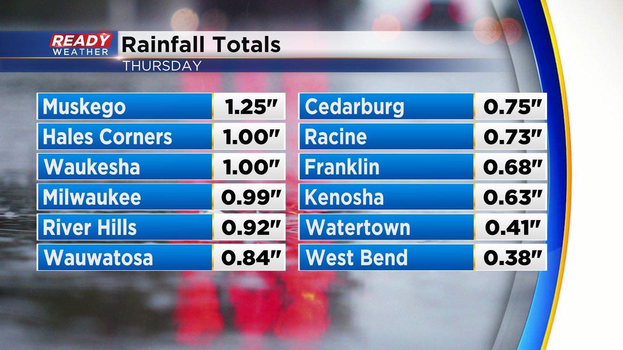
The sloppy, wet, snowy weather from Thursday is long gone. We saw some good, heavy bands of snow during the morning and afternoon. Thundersnow was even reported in some North Shore communities! Before the snow rolled in we had a good soaking rain with some areas along I-94 seeing either side of 1" of new rainfall. North of I-94 saw less rain.
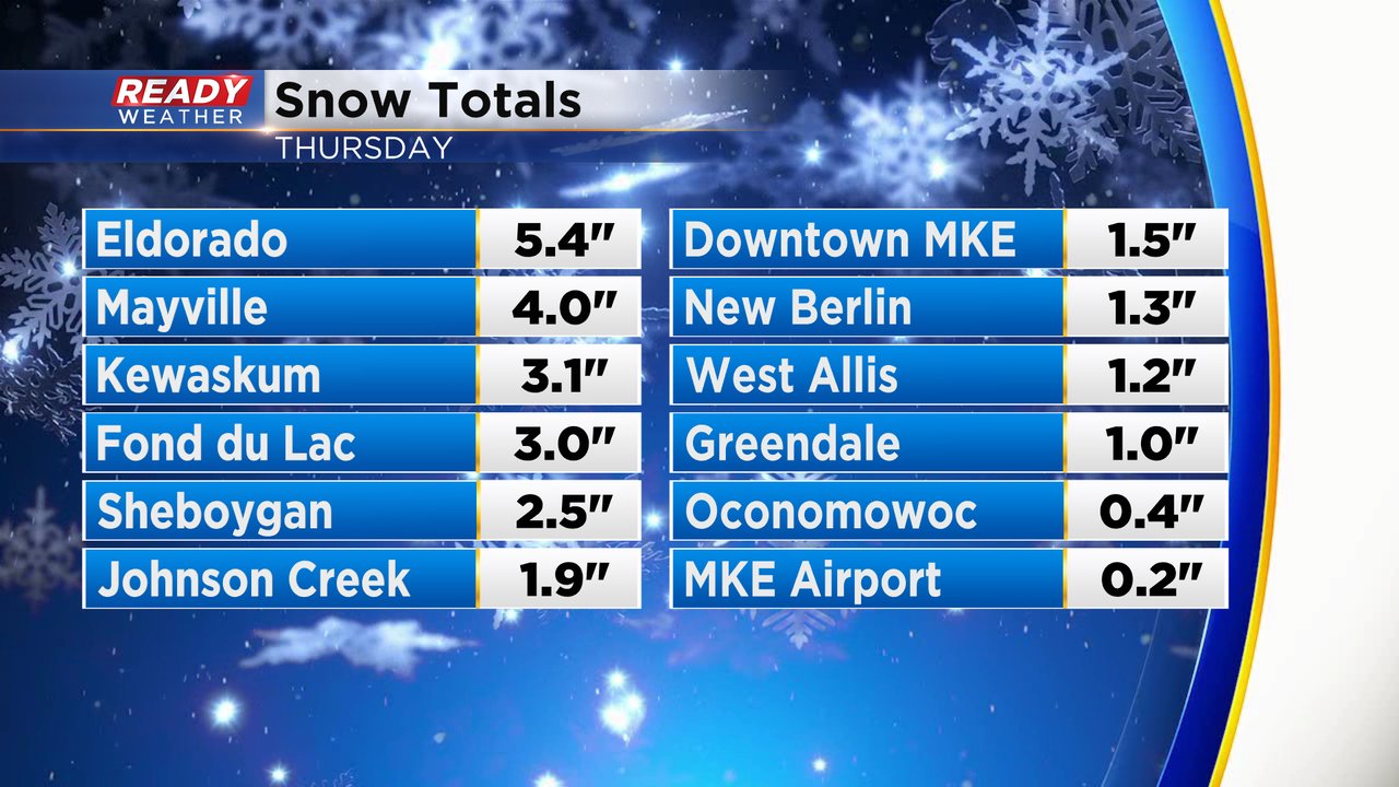
Snow totals were concentrated in Dodge and Fond du Lac Counties with 2-5" of snow there. With some of the heavier bands of snow we did see totals briefly surpass 1" in Milwaukee County before melting quickly. Milwaukee officially only saw 0.2" of snow at the airport.
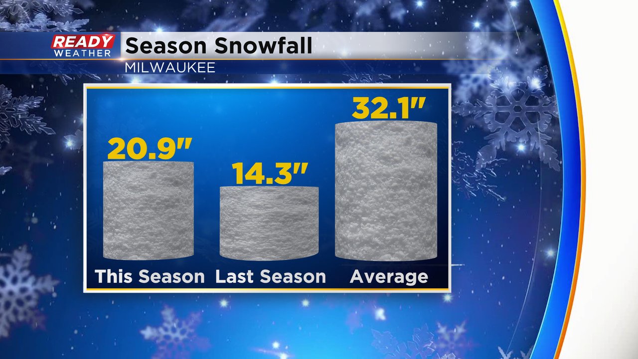
The light snow at the airport did not make any dent in the snow deficit for the season. We will need a few more good storms to make up that deficit which now sits at over 11" with 20.9" of snow so far this season.
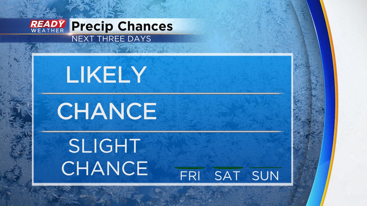
Our next snow (or rain) chance won't come anytime soon with 0% chance for any rain or snow over the weekend. The end of next week looks to get wet again.
Download the CBS 58 Ready Weather app to track the weekend sunshine.