Rapid temp drop arrives Friday; freeze warnings issued


Winter is coming! A freeze watch has been issued for all of our counties for Friday morning from 2 a.m. to 9 a.m. These are the spots where temps are most likely to get below-freezing. The rest of southeast Wisconsin will see lows between 32-35° so it is advised that everyone cover or take inside plants you don't want to freeze.
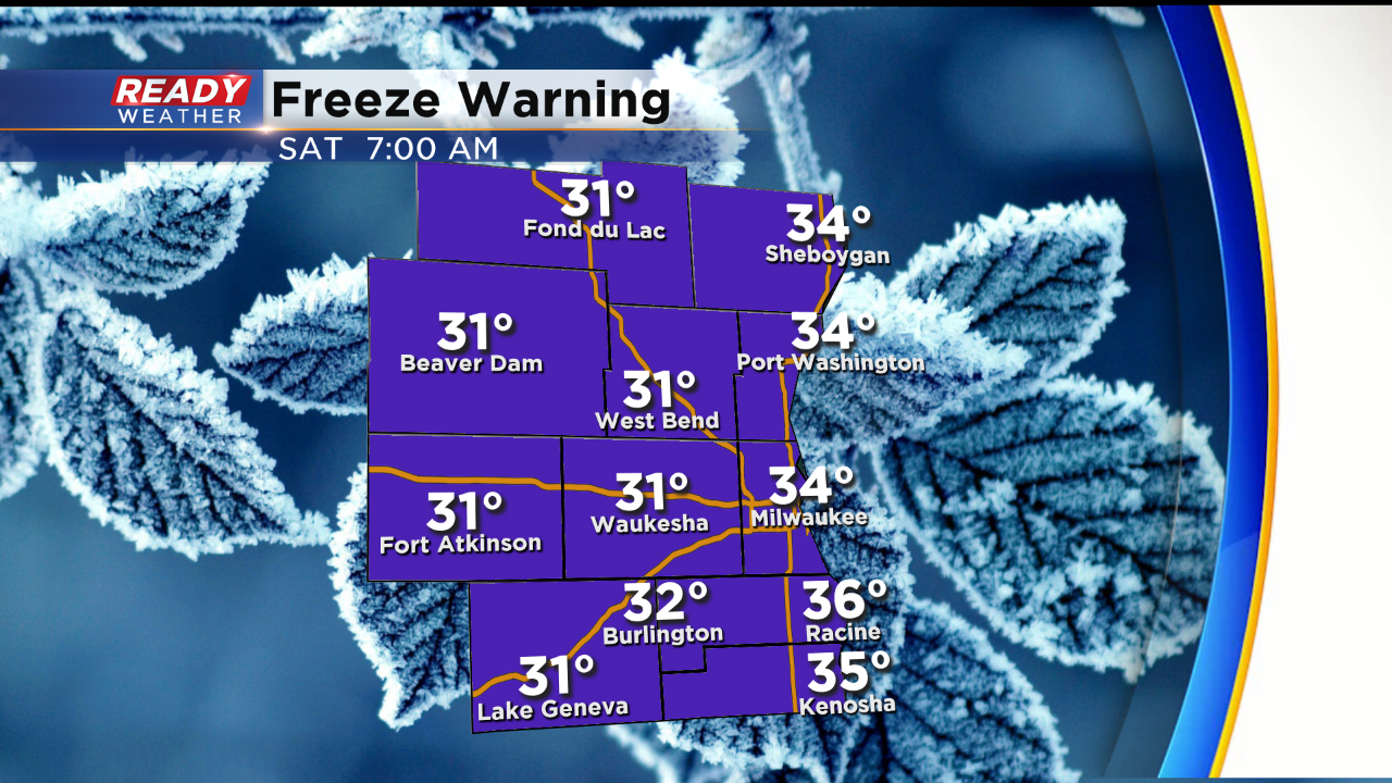
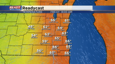
Temperatures start out mild Friday morning in the 60s but then drop pretty quickly this afternoon through the 50s and 40s. By Saturday morning lows will be in the 30s everywhere.
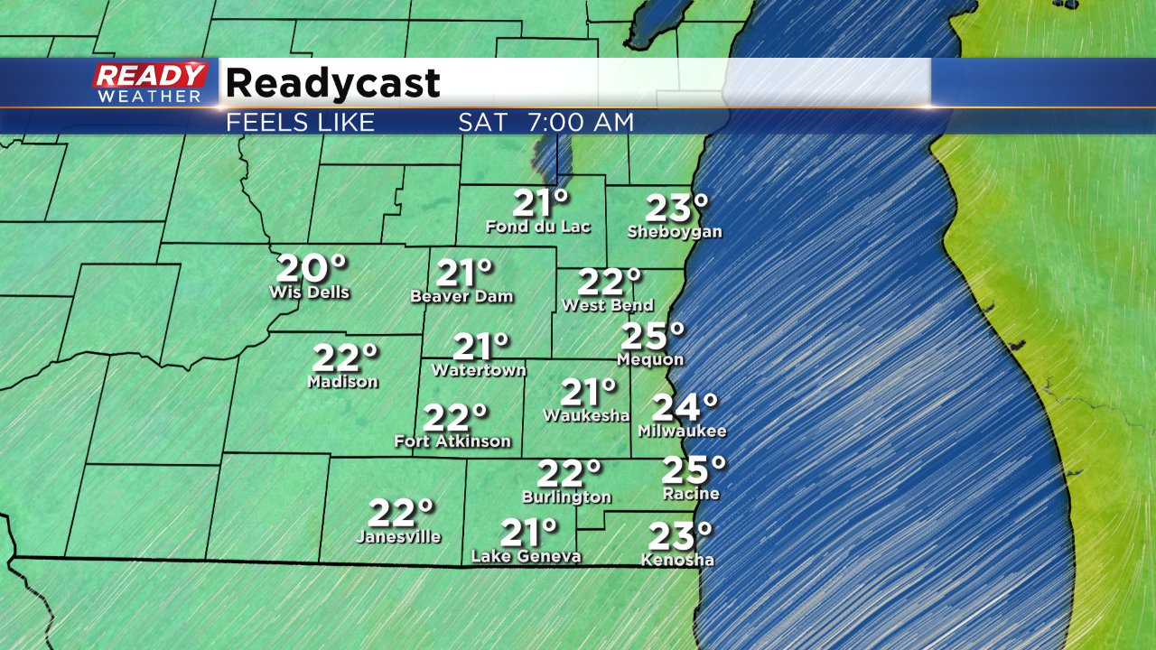
The wind is also going to pick up with gusts as high as 30 or 35 mph Friday afternoon and most of Saturday. That wind combined with the chill will push wind chills into the 20s for Saturday morning and it won't feel much better than the 30s all day.
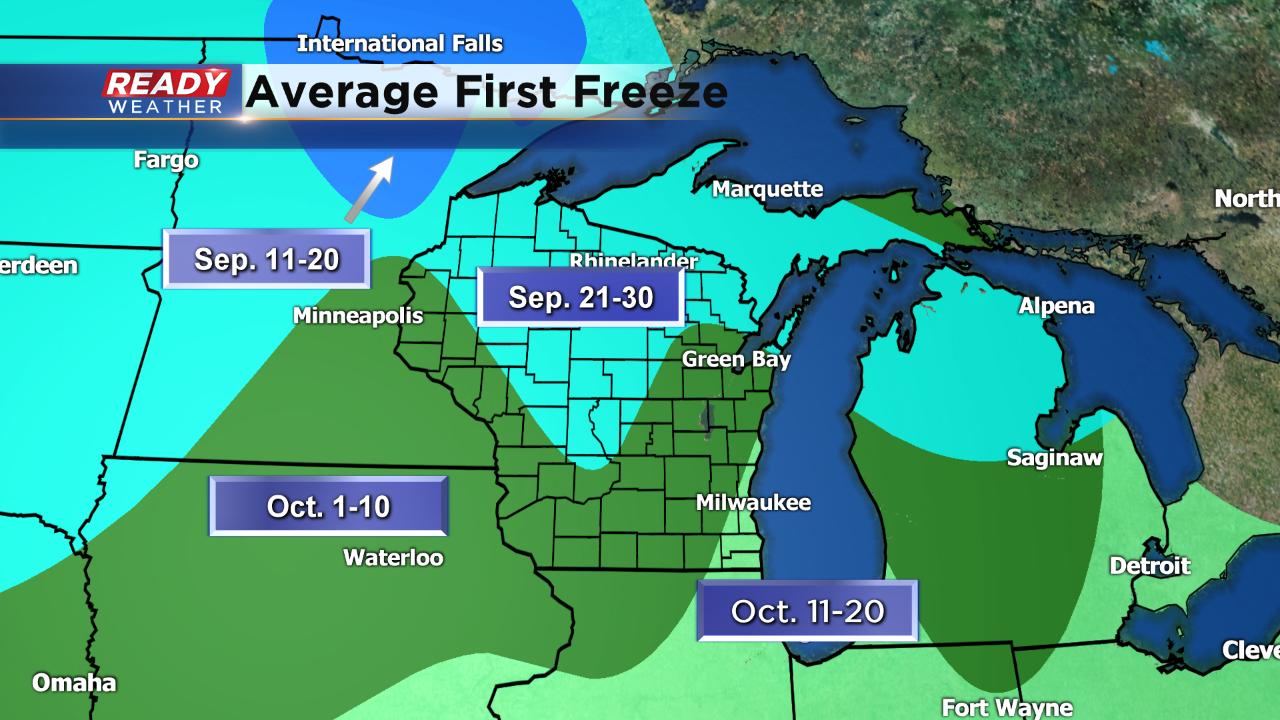
This is right around average for the our first freeze. Officially, it's happening a few days late in those western counties but this is right on track with our climatological average.
Saturday morning does look to be the coldest temps get over the next couple of days. Monday morning is our next best chance at a frost or freeze. Download the CBS 58 Ready Weather app to see when the temp drops where you live in our hour-by-hour forecast.