Rapid snowmelt as snowfall stays well below-average this winter


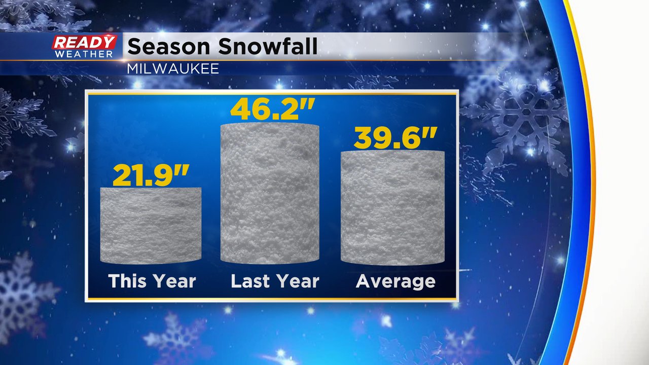
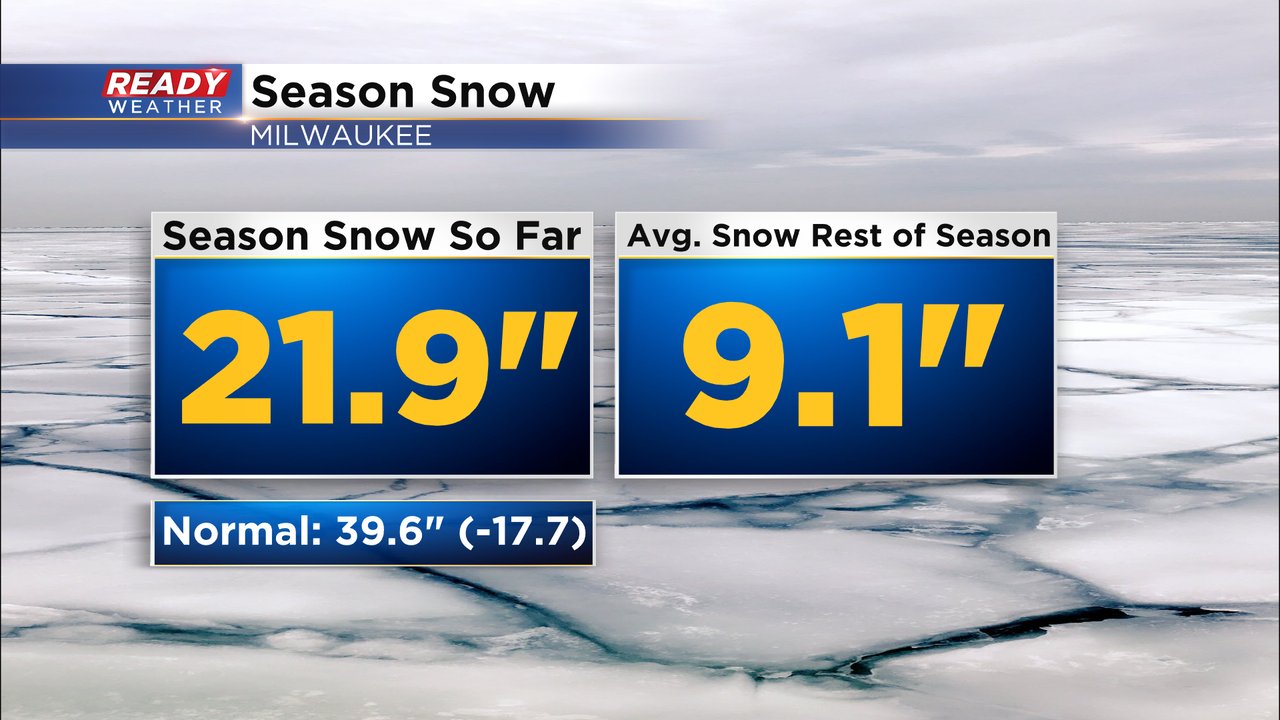
We got our biggest snowfall of the season in southeast Wisconsin to end last week, but after lots of weekend sunshine and temperatures well above 32* we've seen a lot of melting. As of Monday, we are sitting at just under 22" of snowfall for the season which is nearly 18" below the average of 39.6" and well below the 46"+ of snow we had at this point last season.
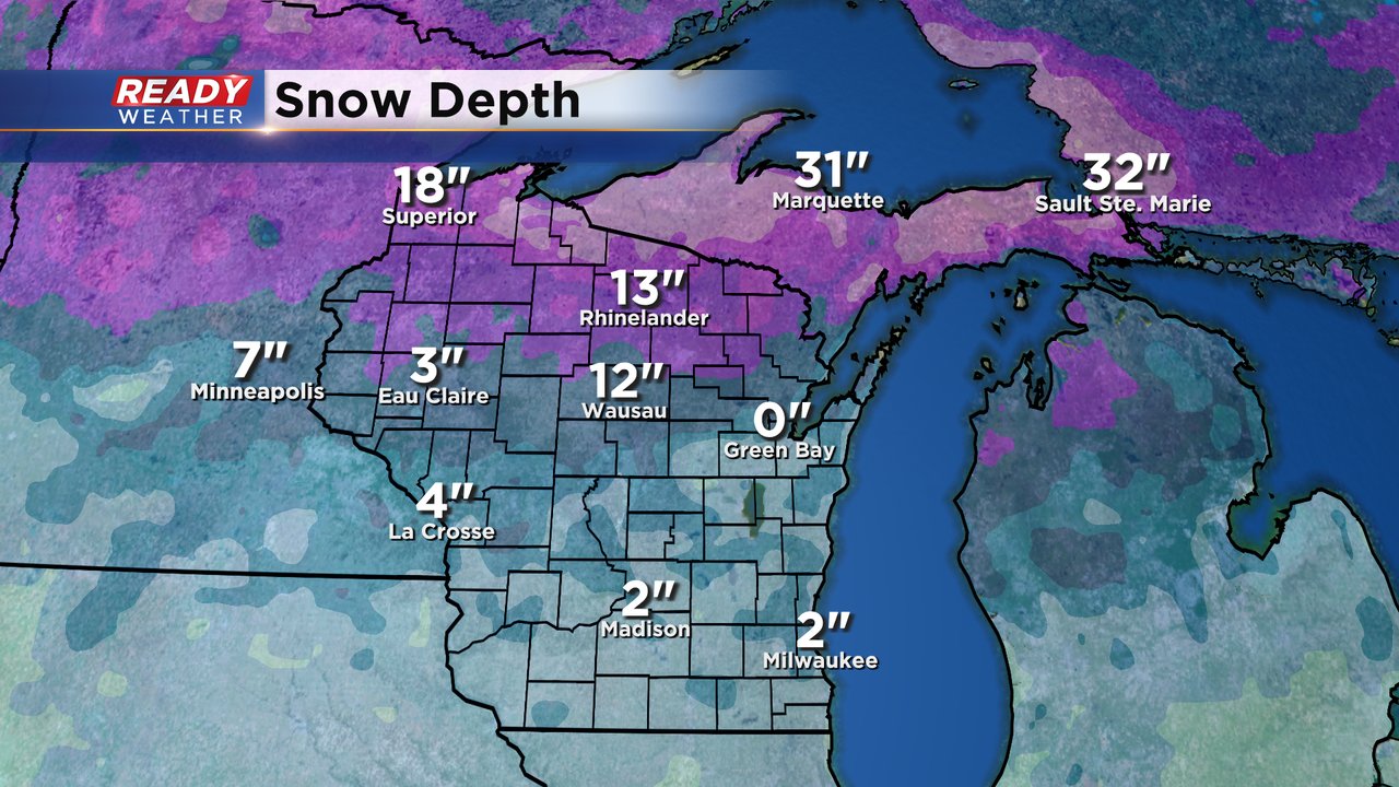
We tried to make some of that snow deficit up at the end of last week but most the snow has melted. By the end of the weekend the snow depth in Milwaukee was only 2" after seeing over 5" at the end of last week. Green Bay doesn't have anything on the ground officially. With a full week of high temperatures above 32* and some sunshine we could see the rest of this snow melt by the end of the week.
Even if we were to see average snowfall the rest of winter we would only get about 30" of snow for the season which would still be well below-average. Of course we could see above-average snowfall in March and April which would help but it's going to take some big storms for us to see average snowfall for the season.
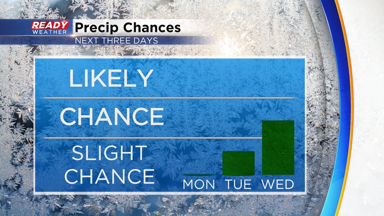
A few snowflakes aren't completely out of the question this week but even light snow accumulation looks very unlikely. A few flurries and sprinkles are possible on Tuesday. There's a better chance for some light wintry mix on Wednesday. A bigger storm system is possible to start the weekend but it looks like mostly rain right now.
Download the CBS 58 Ready Weather app to track the light mix chances.